
A series of EarthScope Regional Interpretative Workshops for teachers and interpreters took place between 2008 and 2014. Enjoy the general resources and ideas of activities that came out of these workshops.
In 2018, 2019 and 2010 three new Workshops were offered in Alaska (ANGLE).
Introduction to Earthscope (low-res pdf)- Sarah Robinson
Place-Based Earth Science Teaching (low-res pdf) -Steve Semken
Getting to know EarthScope Plate Boundary Observatory & UNAVCO (low-res pdf) (powerpoint) - Shelley Olds
Measuring plate motion with GPS (pdf) (powerpoint) (For the full activity online click here) - Shelley Olds
Southern California Earthquake Center (SCEC) Resources (low-res pdf) (powerpoint) - Bob de Groot
SCEC ShakeOut (low-res pdf) (powerpoint) -Bob de Groot
IRIS Education and Public Outreach Resources (low-res pdf) (powerpoint) (movies and animations) -John Taber
Making Waves (low-res pdf) (powerpoint) (movies and animations) -John Taber
Earthquake Machine and Induced Intra-Plate Earthquakes (low-res pdf) (powerpoint) -John Taber
IRIS Earthquake Browser (low-res pdf) (powerpoint) -John Taber
videos
Plate Tectonics Map Order Form
Putting Down Roots in Earthquake Country (So Cal 2011)
ShakeOut Drill Broadcast (mp3)
ShakeOut San Andreas Fault Simulation (.mov)
Staying Safe Where the Earth Shakes, Stadewide Edition
Sense of Place or the importance of place-based education part 1 & part 2 (you can also read a short article about this subject here)
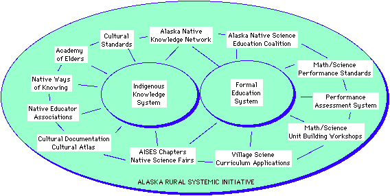
For the benefit of teachers working in predominantly Native American schools in Minnesota and the Midwest, the EarthScope Program offered a 2 ½-day professional-development workshop in Midwest-based, cross-cultural Earth science at the Palace Casino Hotel located on the lands of the Leech Lake Band of Ojibwe in Cass Lake, Minnesota. This workshop had a place-based emphasis in order to enhance a teachers’ senses of place and present methods and content that are especially relevant to Native American students and communities in the Midwest. During the NSEW, participating teachers worked together with prominent geoscientists, educators, and cultural experts to interpret the stories of the magnificent geological landscapes, resources, and occasional natural hazards of the Midwest. Teachers learned how to apply basic Earth science principles, Midwest-based content, and new findings from the EarthScope Program to update and enrich their own curricula and activities for their students—and obtained continuing-education credit hours!
Materials and Resources from the Workshop
Some useful links
American Indian Science and Engineering Society
g i d a k i i m a n a a n i w i g a m i g
IRIS (Incorporated Research Institutions for Seismology)
National Association of Geoscience Teachers
National Earth Science Teachers Association
SCEC (Southern California Earthquake Center)
Society for Advancement of Chicanos and Native Americans in Science
Steve Semken’s publications page
2015 Leech Lake Reservation Field Guide and Journal (PDF)
Resources from Lisa Lone Fight
Migration: A Way of life for the Innu
Using Google Maps with Indigenous Students
Field Trip Guide
Howard Mooers - Field Trip Guide (pdf) (powerpoint)
Group Presentations
Group 1 - Shared Phenology (low-res pdf) (powerpoint)
Group 2 - Seafloor Spreading (low-res pdf) (powerpoint)
Group 3 - Minnesota Lakes and Native Uses (low-res pdf) (powerpoint)
Group 4 - Map Modeling Activity (low-res pdf) (powerpoint)
Note that group presentation activities show ideas for classroom activities and lessons that have not yet been tested in the classroom.
-
-
Participants and facilitators at the Mississippi River for the Midwest Native Science Educators Workshop! Sunday August 2, 2015
This workshop, seventh in a series of workshops for park rangers, museum educators, and other interpretive professionals sponsored by the EarthScope National Office (ESNO), was motivated by the progress of EarthScope instrumentation into the Eastern United States and by the M5.8 central Virginia (Mineral) earthquake in the summer of 2011.
The central Appalachian Mountain belt and environs are the legacy of a billion-year history of plate-tectonic events including one of the greatest mountain-building events in the geologic history of North America. Today these beautiful mountains are the locations of many of the best-known and most-visited National, State, and regional Parks in the nation. The M5.8 Mineral earthquake in central Virginia in 2011 serves as a reminder that the region is still geologically dynamic, and brought renewed attention to the scientific and societal implications of geological research in the eastern United States.
This workshop, hosted by James Madison University (JMU) and organized by ESNO, featured presentations and collaborations by EarthScope geoscientists and interpretive professionals to better present the geological stories of the Central Appalachian Region to the public, teachers, and students. Workshop participants learned about the EarthScope program and the geological evolution of the Appalachians, learned how to use basic geological information and scientific results from EarthScope and other sources, and developed and presented actual interpretive programs. The workshop also included a geological field trip to the Valley and Ridge to Blue Ridge Province Transition, and a presentation at JMU by EarthScope Speaker Meghan Miller.
Regional Tectonics and Geology of the Appalachians presentation (4 parts)
14-15-16 March 2015
Workshop Facilitator Biographies
Select Presentations from Workshop
Semken: Introduction to EarthScope
Semken: Geology of the Southwest
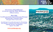
Olds: Getting to Know EarthScope Plate Boundary Observatory & UNAVCO
Olds: Visualizing relationships with data: Volcanoes, Earthquakes, and Plate Tectonics
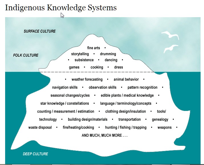
Lone Fight: Re-centering the Teaching and Learning of Earth Science Within an Indigenous Context
About the Workshop
What? For the benefit of teachers working in predominantly Native American schools in Arizona and the Southwest, the EarthScope Program (https://www.earthscope.org) will offer a 2 ½-day professional-development workshop in Southwest-based Earth science at Arizona State University. This workshop had a place-based emphasis striving to enrich teachers’ senses of place and present methods and content that are especially relevant to Native American students and communities in the Southwest. During the NSEW, participating teachers worked together with prominent geoscientists, educators, and cultural experts to interpret the stories of the magnificent geological landscapes, resources, and occasional natural hazards of Arizona and the Southwest. Teachers learned how to apply basic Earth science principles, Southwest-based content, and new findings from the EarthScope Program to update and enrich their own curricula and activities for their students—and obtained continuing-education credit too!
Who applied? We were especially looking for teachers who teach Earth Science or Environmental Science at the middle or high school levels (grades 6-12) at schools with majority Native American student populations. All science teachers could apply, but those who teach Earth Science or Environmental Science had priority.
Sponsors: The NSEW was sponsored and hosted by the EarthScope National Office (ESNO) at Arizona State University (www.earthscope.org/about_us/esno_staff) under a grant from the National Science Foundation (www.nsf.gov).
This three-day workshop happened in Anchorage, Alaska, in April 2014. that features presentations by prominent geoscientists and interpretive professionals to help convey the story of the magnificent landscapes, geology, and natural hazards of the Alaska-Yukon region. Participants will learn how to use basic geology, EarthScope data, and scientific results. Participants will develop and present actual interpretive programs and exhibits during the workshop. Access to digitally-archived and real-time, web-accessible geophysical data will provide a key source of information for such programs.
The workshop is sponsored by the EarthScope National Office (ESNO) at Arizona State University and funded by the National Science Foundation. The host for the EarthScope Alaska-Yukon Regional Workshop for Interpretive Professionals is the Alaska Science Center in Anchorage.
Enjoy these videos of Group presentation activities (9 video clips)
Note that group presentation activities show ideas for classroom activities and lessons that have not yet been tested in the classroom.
Earthquake-Tsunami-Volcano Science & Preparedness
May 29 - June 1, 2018
Anchorage School District Education Center, 5530 E Northern Lights Blvd, Anchorage AK 99504
This 4-day professional development workshop brought together K-12 educators, parks & museum interpreters, and emergency management and health & safety educators. Participants learned the basic science of earthquakes, tsunamis, volcanoes, EarthScope, preparedness, and other research efforts to monitor the Earth in Alaska. They explored the topics in a hands-on learning environment and a field trip. Participants received an educator kit containing high quality physical and digital resources to support the transfer of teaching activities to classrooms, interpretive sites, and other learning venues. on the last workshop day, participants developed action plans for conducting collaborative science and engaging our communities on the mitigation of coastal geologic hazards.
Educational Material are available through SERC website : https://serc.carleton.edu/ANGLE/educational_materials/index.html
The western United States is a prime target area for EarthScope to investigate processes that result in elevated topography, earthquakes, and volcanism. Interpretive professionals in the Colorado Plateau and Rio Grande Rift region have a unique opportunity to engage the public on the relevance of EarthScope discoveries as they are being made. This three-day workshop combined presentations by EarthScope scientists with interpretive methods to convey the story of how continental rifting and other processes result in the region's breathtaking landscape and geological hazards.
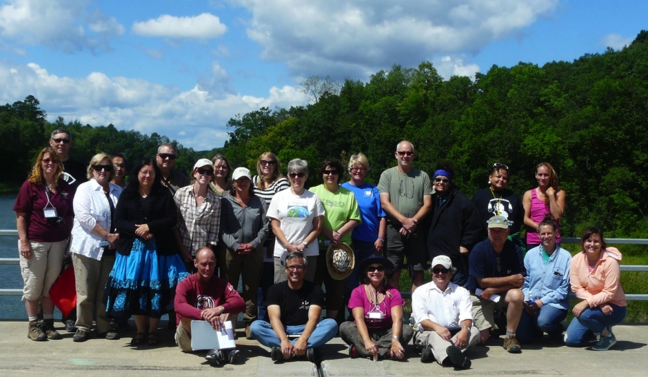
The workshop was held October 26-28, 2009 at the New Mexico Museum of Natural History and Science in Albuquerque. This was the fourth in a series of workshops for park rangers and museum educators sponsored by the EarthScope National Office. Participants learned how to use EarthScope data and science results, and developed and presented interpretive programs on the evolving landscape and its connections to aspects of the natural and cultural history of the Colorado Plateau-Rio Grande Rift region.
Organizations represented included the National Park Service, U. S. Forest Service, Bureau of Land Management, Nature Conservancy, New Mexico Department of Cultural Affairs, New Mexico State Parks, Texas State Parks, Southern California Earthquake Center, San Bernardino County Museum, Red River Community House, Four Corners School of Outdoor Education, Smithsonian Institution, Chinle Unified School District, New Mexico Museum of Natural History and Science, Public Lands Intepretive Association, Asombro Institute for Science Education, Rough Rock Community School, Arizona State University, Edinboro University of Pennsylvania, and Lafayette College.
The workshop featured presentations by scientists and interpretive specialists to convey the story of how continental rifting and other processes result in the region's breathtaking landscape and geological hazards. Instructors were from Arizona State University, New Mexico Tech, University of New Mexico, New Mexico Museum of Natural History and Science, University of Colorado, Grand Canyon National Park, Oregon State University, IRIS, and UNAVCO. Details and Agenda [PDF]
Participants and scientists worked in teams to develop and present interpretive programs aimed at audiences and settings encountered by interpreters in parks and museums. Five programs revolved around the following themes.
1. The Rio Grande Rift and its waters have provided a spiritual and physical passageway for many cultures.
2. The Rio Grande Rift Valley is a dynamic environment for water, volcanoes, peoples and scientific exploration.
3. The Albuquerque volcanic field and the Rio Grand Rift are evidence of past processes within the Earth which continue to shape the landscape.
4. Four sacred mountains mark the boundaries of Dine bikejah (Navajo homeland). Each mountain was formed at a different time by a unique set of geologic processes that illustrate the major warp in which mountains are formed. This geographic area represents ke′ (kinship), a sacred living landscape to the Navajo people.
5. EarthScope scientific instruments have helped us to better understand the evolution of the New Mexico landscape, including opening of the Rio Grande Rift.
Workshop Presentations
-
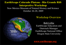 EarthScope Colorado Plateau - Rio Grande Rift Workshop Overview
B. Lillie (Oregon State Universioty/ES National Office)PDF Version [9.8 MB] -
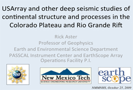 USArray and other deep seismic studies of continental structure and processes in the Colorado Plateau and Rio Grande Rift
R. Aster (PASSCAL) -
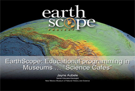 EarthScope: Educational programming in Museums..."Science Cafes"
J. Aubele (New Mexico Museum of Natural History and Science)PDF Version [4.6 MB] -
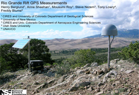 Rio Grande Rift GPS Measurements
H. Berglund (CIRES/University of Colorado)PDF Version [7.7 MB] -
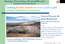 Linking Earth’s mantle to water quality and unique microbial ecosystems
L. Crossey (University of New Mexico)PDF Version [2.1 MB] -
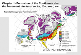 Tectonic evolution of the western US- a brief discussion
K. Karlstrom (University of New Mexico)PDF Version [3.5 MB] -
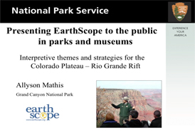 Interpretive themes and strategies for the Colorado Plateau – Rio Grande Rift
A. Mathis (Grand Canyon National Park)PDF Version [2.4 MB] -
 Incorporated Research Institutions for Seismology
P. McQuillan (IRIS)PDF Version [1 MB] -
 Active Earth Display Cascadia and Basin and Range Content Modules
P. McQuillan (IRIS)PDF Version [1.6 MB] -
 Which Way are We Going? Online Mapping Tools to Help People Visualize Plate Motions with GPS Data
S. Olds (UNAVCO)PDF Version [3 MB] -
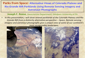 Alternative Views of Colorado Plateau and Rio Grande Rift Parklands Using Remote Sensing Imagery and Astronaut Photographs
J. Reese (Edinboro University of PA)PDF Version [4.3 MB] -
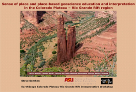 Sense of place and place-based geoscience education and interpretation in the Colorado Plateau – Río Grande Rift region
S. Semken (Arizona State University)PDF Version [1.1 MB]
The southern Appalachian Mountain belt, Piedmont, and Coastal Plain are the legacy of a billion-year history of plate-tectonic and surficial processes, including one of the greatest mountain-building events in the geologic history of North America. Plate tectonics are also responsible for great earthquakes in the past such as the 1886 Charleston earthquake. This area has many beautiful national and local parks and museums that draw on the rich natural landscapes of the region. The Central Virginia earthquake in 2011 serves as a reminder that the eastern margin of North America is still geologically dynamic, and brought renewed attention to the scientific and societal implications of geological research in the eastern United States.
EarthScope presented a three-day (beginning at noon on Monday and ending Wednesday afternoon) workshop that featured presentations by prominent geoscientists and interpretive professionals to help convey the story of the magnificent landscapes, geological stories, and natural hazards of the Southeastern region. Participants learned how to use basic geologic and EarthScope information and scientific results, and developed and presented actual interpretive programs and exhibits during the workshop. Access to digitally-archived and real-time, web-accessible geophysical data will provide a key source of information for such programs. The workshop included a half-day field trip.
The workshop was sponsored by the EarthScope National Office (ESNO) at Arizona State University (www.earthscope.org/about_us/esno_staff) and funded by the National Science Foundation . The host for the Southeastern Regional Workshop is the Department of Geology and Environmental Geosciences at the College of Charleston (geology.cofc.edu)
The goal of the workshop is to help interpreters create opportunities for the public to form their own intellectual and emotional connections to the dynamic landscape of the greater Appalachian, Piedmont, and Coastal Plain provinces of the southeastern U.S. Interpretive professionals from the National Park Service, U. S. Forest Service, Bureau of Land Management, state and regional parks, state geological surveys, community museums, and other individuals who engage the public on geological processes in the southern Appalachian region of South Carolina, North Carolina, Virginia, West Virginia, Georgia, Tennessee, and Kentucky are encouraged to apply. Participants do not have to be geologists or geophysicists, but they should have some knowledge of Earth science and experience incorporating geological information into interpretive programs or exhibits. We also welcome applications from K-12 Earth science teachers who interact with interpretive specialists in parks or museums, as well as from college faculty teaching geology field camps or informal education programs in the region.
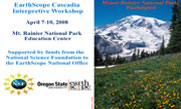
Mt.Rainier National Park Education Center, Tahoma Woods, WA; April 7-10 2008
The workshop brought together individuals from the scientific and informal educational communities to learn about EarthScope and develop interpretive programs to engage park and museum visitors on how advanced geophysical instrumentation enhances our understanding of landscape formation and geological hazards in the Pacific Northwest. There were 28 participants representing parks, museums, and other informal education centers in Oregon, Washington, California, Idaho, British Columbia, and Alaska.
Summary: EarthScope Cascadia Interpretive Workshop
The EarthScope National Office (ESNO) sponsored an inaugural workshop for interpretive professionals on April 7-10 at the Mt. Rainier National Park Education Center in Tahoma Woods, Washington.The workshop brought together individuals from the scientific and informal educational communities to learn about EarthScope and develop interpretive programs to engage park and museum visitors on how advanced geophysical instrumentation enhances our understanding of landscape formation and geological hazards in the Pacific Northwest. There were 28 participants representing parks, museums, and other informal education centers in Oregon, Washington, California, Idaho, British Columbia, and Alaska. Organizations included the National Park Service; U. S. Forest Service; state parks of Oregon, Washington, and California; state geological surveys of Washington and Oregon; the Pacific Geoscience Center of the Geological Survey of Canada; Oregon Paleo Lands Institute; OSU Hatfield Marine Science Center; Oregon Shakes; Olympic Park Institute; Mt. St. Helens Institute; and Orting High School.
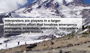
The three-day workshop combined presentations by EarthScope scientists with interpretive methods to convey the story of the ongoing deformation of the edge of the North American continent. Participants learned how to use EarthScope data and science results, and developed and presented interpretive programs on the evolving landscape and earthquake, tsunami, and volcanic hazards of the Pacific Northwest. One of the fundamental aspects of EarthScope is the integration of many types of observations to study the structure and evolution of the continent. Two challenges facing the EarthScope community include providing the public with access to timely EarthScope science and presenting complex data and related principles in language and formats accessible to varied audiences. The workshop showed how incorporating EarthScope data and scientific results into interpretive programs and exhibits enhances the "sense of place" represented by the dynamic landscape of the Pacific Northwest.
Instructors for the workshop included scientists from the University of Washington, Central Washington University, the University of Portland, Oregon State University, UNAVCO, the Incorporated Research Institutions for Seismology, and the USGS Cascades Volcano Observatory. Workshop participants are being encouraged to participate in the 2009 EarthScope National Meeting so that they can learn more about EarthScope and showcase how they are using EarthScope in their interpretive programs and exhibits.
The EarthScope National Office is working with IRIS and UNAVCO to develop a Cascadia Subduction Zone module for the IRIS Active Earth interpretive computer kiosk. Proposals were submitted by some of the organizations represented at the workshop and, as a result, kiosks will be placed at Redwood National and State Parks, the Oregon Whale Watching Center, and Oregon Paleolands Institute. A second EarthScope interpretive workshop on October 19-22, 2008 in Reno, Nevada focused on the Basin and Range Province. Future workshops are planned during the next three years for the San Andreas Fault, Colorado Plateau – Rio Grande Rift, Yellowstone Hotspot, and Rocky Mountains. There are plans to build on the momentum of the EarthScope Cascadia Interpretive Workshop by organizing workshops to focus on more detailed content and interpretive strategies for the staffs at specific parks and museums. The EarthScope National Office is also collaborating with IRIS, UNAVCO, and some of the organizations participating in the Cascadia workshop to develop training aimed in the other direction. That is, EarthScope scientists will be taught interpretive methods so that they can present EarthScope science results more effectively to a variety of audiences. The first such workshop for scientists is planned for the 2009 EarthScope National Meeting in Boise.
Workshop Presentations
-
Cascadia Interpretive [PDF]
Bob Lillie, Oregon State University -
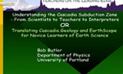
Translating Cascadia Geology [PDF]
Bob Butler, University of Portland -
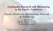
Earthquake Research and Monitoring [PDF]
Steve Malone, University of Washington -
Living with a Volcano in your Backyard [PDF]
Carolyn Deidger, USGS -
Overview of EarthScope [PDF]
Bob Lillie, Oregon State University -
EarthScope Cascadia Interpretive Workshop [PDF]
Susan Eriksson, UNAVCO -
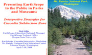
Interpretive Strategies for Cascadia Subduction Zone [PDF]
Bob Lillie, Oregon State University -
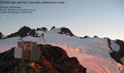
EarthScope and the Cascadia Subduction Zone [PDF]
Tim Melbourne, Central Washington University
Reno, NV; October 19-22 2008
The workshop showed how incorporating EarthScope data and scientific results into interpretive programs and exhibits can enhance the "sense of place" represented by the dynamic landscape of the Basin and Range Province. It brought together individuals from the scientific and informal educational communities to learn about EarthScope and develop interpretive programs to engage park and museum visitors on how geophysical monitoring helps us appreciate landscape formation and geological hazards in the region.
Participants learned how to use EarthScope data and science results, and developed and presented interpretive programs on the evolving landscape and its connections to aspects of the natural and cultural history of the Great Basin. Organizations represented included the National Park Service; U. S. Forest Service; Bureau of Land Management, state parks of California and Nevada; state geological surveys of Nevada and Montana; Oregon Paleo Lands Institute; Southern California Earthquake Center; Nevada State Museum; Central Modoc River Center; WonderVisions; Malheur Field Station; Fleischmann Planetarium and Science Center; Eastern Sierra Nevada Institute for Collaborative Education; National Science Foundation; and the Red Rock Canyon Interpretive Association.
The workshop featured presentations by scientists and interpretive specialists that help to convey the story of continental rifting and its broader meanings. Instructors were from the University of Nevada-Reno, California Institute of Technology, Oregon State University, and Grand Canyon National Park. There were also talks by staff from UNAVCO, the Incorporated Research Institutions for Seismology, and the National Park Service Intermountain Region. Participants and scientists worked in teams to develop and present examples of interpretive programs during the workshop. Each program focused on a specific theme devised by the group, and it was aimed at a particular audience and setting encountered by interpreters in parks and museums.
1. "The mysterious and spectacular forces uplifting the Basin and Range Province and Colorado Plateau are being explored by EarthScope." The FBI (Forces Beyond Imagination) group performed this skit. The narrator asks questions like "Why are there fossils at 9700 feet elevation in the region?" Three scientists offer their competing viewpoints; which one is correct? EarthScope data will tell...
2. "The beauty and extremes of Basin and Range topography across central Nevada was created by tens of millions of years of repeated movements on faults." This program has one ranger using volunteers to show how Basin and Range extension works, and how EarthScope GPS instruments measure the relative movements of mountain ranges.
3. "Through the juxtaposition of the extremely low Death Valley and the lofty Mt. Whitney, the dynamic nature of plate tectonics manifests itself in extremes, inspiring and puzzling scientists, artists, and athletes." The "Sierra Nevada Extremists" performed the program. It involves a narrated slide show that could be used as a standalone audiovisual display, or as an evening program.
4. "EarthScope is like a stethoscope to monitor the health of the High Lave Plains." This program modeled a presentation to a 6th grade class prior to a 3-day field trip. "Troubadours" performed a skit investigating a sick Newberry volcano that is monitored by scientific instruments.
5. "The tectonic landscape of the Basin and Range Province has served as a stage of cultural evolution from prehistoric times to present." This "Cultural and Tectonic Crossroads" program pretends to coincide with the opening of a new visitor center funded by a $100-million, no-strings attached grant from a private foundation. It unveils a 4-dimensional exhibit showing changing landscape with time and bringing in the human component and history via Native American and other story telling.
Redlands, California; April 19-22, 2009
Southern California's San Andreas Fault is a prime target area to investigate plate-tectonic processes that result in earthquakes and the dramatic topography along an active plate boundary. The workshop brought together individuals from the scientific and informal educational communities to learn how incorporating seismic, GPS, LiDAR, and borehole observations into interpretive programs and exhibits can enhance the "sense of place" represented by the dynamic landscape of western California.
Southern California's San Andreas Fault is a prime target area to investigate plate-tectonic processes that result in earthquakes and the dramatic topography that forms along an actively deforming plate boundary. The workshop brought together individuals from the scientific and informal educational communities to learn about geophysical monitoring in the region. It showed how incorporating seismic, GPS, LiDAR, and borehole observations into interpretive programs and exhibits can enhance the "sense of place" represented by the dynamic landscape of western California.
The workshop was held on April 19-22, 2009 at the San Bernardino County Museum in Redlands, California. It was co-sponsored by the Southern California Earthquake Center (SCEC). This was the third in a series of workshops for park rangers and museum educators sponsored by the EarthScope National Office. Participants learned how to use SCEC and EarthScope data and science results, and developed and presented interpretive programs on the evolving landscape and its connections to aspects of the natural and cultural history of the San Andreas region. Organizations represented included the National Park Service, U. S. Forest Service, Bureau of Land Management, U. S. Geological Survey, California State Parks, North High School, Rodriguez High School, Sequoia Natural History Association, InterpTrain, San Bernardino County Museum, Midpeninsula Open Space District, Edinboro University of Pennsylvania, and Arizona State University.
The workshop featured presentations by scientists and interpretive specialists that help to convey the story of transform plate boundary processes and their broader meanings. Instructors were from the U.S. Geological Survey, Arizona State University, Utah State University, California State University-San Bernardino, Incorporated Research Institutions for Seismology, UNAVCO, San Bernardino County Museum, Southern California Earthquake Center, and Oregon State University.
Participants and scientists worked in teams to develop and present interpretive programs aimed at audiences and settings encountered by interpreters in parks and museums. Five programs revolved around the following themes.
1. "The San Andreas Fault is the common thread that connects the world by telling the story of transplanted people and landscapes." (Presented by "A Family Divided").
2. "You may not know it, you may not see it, you may not feel it, but the Earth is moving underneath your feet." (Presented by "Default Gang").
3. "The landscape out the window is a product of ever moving plates, and society exists at the consent of geology." (Presented by "The Dumb Schists").
4. "Before you prepare for an earthquake, know what you're preparing for." (Presented by "The Whats" or "The Seven Steps").
5. "Changing landscapes dictate life in Borrego." (Presented by "Voices of Borrego" or "LuAnne and the Tectonics").
More EarthScope Interpretative Workshops are being presented over a three-year period. The Cascadia Subduction Zone Workshop was held in spring, 2008 at Mt. Rainier National Park. A fall, 2008 workshop at the University of Nevada-Reno focused on continental rifting in the Basin and Range Province. The fall, 2009 workshop highlighted the Colorado Plateau and Rio Grande Rift, and future workshops will focus on the Yellowstone and Rocky Mountain regions.
Teton Science School, Jackson, Wyoming; September 9-12, 2010
The workshop brought together scientists and informal educators to learn about EarthScope and similar efforts to study the dynamic landscape of the greater Yellowstone region. They developed interpretive programs focused on how society benefits from ongoing seismic, GPS, and other studies, and how such monitoring helps us appreciate the regions scenery as well as earthquake and volcanic hazards.
The greater Yellowstone region is a prime target area for EarthScope to investigate plate-tectonic processes that result in earthquakes, volcanism, and the dramatic topography that forms along an active hotspot track and continental rift zone. This was the fifth in a series of workshops for park rangers and museum educators sponsored by the EarthScope National Office. Participants learned how to use EarthScope data and science results, and developed and presented interpretive programs on the evolving landscape and its connections to aspects of the natural and cultural history of the Yellowstone-Snake River Plain-Teton region.
Organizations represented included the National Park Service, U. S. Forest Service, Bureau of Land Management, Temple University, Idaho Environmental Education Association, South Australia Department of Environment and Heritage, Jackson Hole Community School, Exum Mountain Guides, Sacajawea Center, University of Nebraska State Museum, Wyoming Geological Survey, UNAVCO, Denver Museum of Nature and Science, Geologists of Jackson Hole, and Lawrence Hall of Science.
The workshop featured presentations by scientists and interpretive specialists to convey the story of how hotspot activity other geological processes result in the region's breathtaking landscape and geological hazards. Instructors were from the University of Utah, Yellowstone National Park, Craters of the Moon National Monument and Preserve, Grand Teton National Park, Carnegie Institution, Idaho National Laboratory, Utah State University, Oregon State University, IRIS, and UNAVCO.
Participants and scientists worked in teams to develop and present interpretive programs aimed at audiences engaged by interpreters in parks and museums. Five programs revolved around the following themes.
1. "History repeats itself at Hegben Lake."
2. "The effects of supervolcanoes are widespread as evidenced by ash in Nebraska."
3. "The seismic activity that created the beauty of the Tetons also has the potential for death and destruction."
4. "Scientific instruments tell us about the activity of our dynamic Earth."
5. "Modern technology provides a portal into the ancient Yellowstone that lies beneath our feet."
Fogelman Executive Conference Center, Memphis, Tennessee; March 17-20, 2011
The workshop brought together scientists and informal educators to learn about EarthScope and other geophysical studies that record Earth movements and image the deep structure of the continent. The workshop coincided with the 200th Anniversary of large earthquakes that struck near New Madrid, Missouri, as well as arrival of the USArray of seismometers in the central United States. This was the sixth in a series of workshops for park rangers and museum educators sponsored by the EarthScope National Office.
Summary: EarthScope New Madrid–Central U.S. Interpretive Workshop
Fogelman Executive Conference Center, Memphis, Tennessee, March 17-20, 2011
The central U.S. region is a prime target area to investigate intra-continental earthquakes as well as the deep structure and tectonic evolution of the North America continent. The workshop featured presentations by prominent scientists and interpretive professionals to help convey the story of the landscape and geological hazards of the Central United States. Participants learned how to use basic geologic information and EarthScope science results, and developed and presented actual interpretive programs during the workshop.
Organizations represented included: Newburg Children's Museum; The Museum of Discovery; Longway Planetarium; Reelfoot Lake Research and Teaching Center; Baylor University; Sesser-Valier School; Maine East High School; Adventure Science Center and Sudekum Planetarium; Pink Palace Museum; Reelfoot Lake State Park; Tennessee Emergency Management Agency; Starved Rock State Park; Sharpe Planetarium; Signature Design; Bootheel Youth Museum; Public Lands Interpretive Association; Paris Landing State Park; Crowley's Ridge State Park; Chapman University; Michigan Tech University; Friends of Crab Orchard Public Library; and Norris Dam State Park.
Instructors were from the University of Memphis, Illinois State University, the Southern California Earthquake Center, Oregon State University, IRIS, and UNAVCO.


