
Articles
2019
Derek Schutt
2019-07-11
Wait, I could do geophysics—physics and math—and go outside?! That's the perfect combination.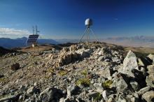
Exploring a Changing Continent Using a Plate Boundary Observatory
2019-02-14
Geodesy is the science of measuring the size, shape, and gravity field of Earth, and how these change with time.
Fifteen Years of Earth Science Exploration
2019-02-14
The EarthScope National Office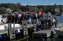
Reflections on the Accomplishments of EarthScope’s USArray
2019-02-14
The USArray has operated for over 15 years as a community science facility designed to address EarthScope’s goal of understanding the structure and evolution of the North American continent.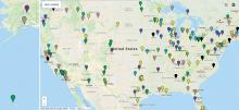
Education Corner: Final inSights Issue
2019-02-14
Sharing Science through the EarthScope Speaker Series and Save the Date for the EarthScope Legacy Education and Outreach Virtual Workshop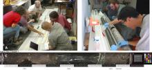
San Andreas Fault Observatory at Depth
2019-02-14
The Gold Standard for Scientific Drilling Through an Active, Continental Transform Fault
EarthScope Announcements
2019-02-13
inSights Final Issue February 20192018

New EarthScope Video!
2018-12-12
15 Years of Geoscience Discovery and Education in North America
EarthScope Top 10 Discoveries
2018-12-07
,
Redrawing the Map of the Midcontinent Rift
2018-09-04
EarthScope data is changing our views of this billion-year-old feature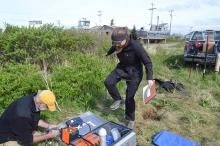
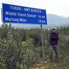
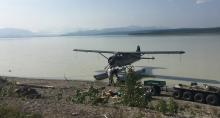
Alaska Amphibious Experiment Crosses the Shoreline
2018-08-31
New ocean-bottom seismometers complement the Transportable Array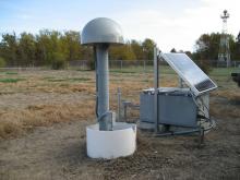
PBO Station Highlight: A Puzzle in the Midcontinent
2018-08-31
What causes earthquakes in the interior of North America, far from plate boundaries?
Education Corner: 2018 ANGLE Teacher Workshop
2018-08-29
This issue features the first ANGLE educator workshop, which focused on giving educators tools for teaching about Alaska geoscience and community resiliency to tsunami and earthquake hazards.
EarthScope Announcements
2018-08-29
inSights Summer 2018
Rhiannon Vieceli
2018-07-10
Humans of EarthScope: “I like making interpretations about the earth, which is the common denominator for everyone.”
Media Advisory
2018-05-24
Science Educators Gather in Anchorage to Learn about Teaching and Preparing for Earthquakes, Tsunamis, and Volcanoes in Alaska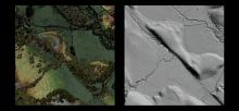
EarthScope’s Laser Vision: Sharing Lidar Data
2018-05-07
High-resolution images reveal fault movement—before and after quakes—to experts and students
EarthScope Announcements
2018-05-04
inSights Spring 2018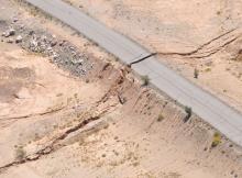
PBO Station Highlight: P496 Is Only One Piece of the Story
2018-05-04
PBO station P496 not only shook during the 7.2 El Mayor–Cucapah earthquake in northwestern Mexico, but moved permanently as a result of it.
Education Corner
2018-05-01
We explore the senses in this issue, from visual resources for current events-based lessons, to mapping with lasers, to learning about seismic waves through sound. Bonus materials: What wildlife sets off seismic sensors?
Emily Hopper
2018-03-06
Humans of EarthScope: "The stuff we’re researching is fundamental to how the whole planet functions."
Open SESAME
2018-01-29
EarthScope seismic research inspires landowners and students in Georgia
EarthScope Announcements
2018-01-29
inSights Winter 2017-18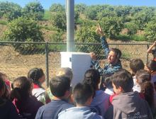
PBO Station Highlight
2018-01-29
Station OVLS introduces students to plate movement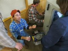
Inter-Agency Collaborations Take Center Stage at EarthScope Transportable Array Meeting in Alaska
2018-01-28
New Alaska data reaches beyond earthquakes
Rob Hawman
2018-01-24
I got into geology originally because I was always fascinated by the history of the earth.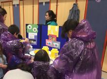
Education Corner
2018-01-24
Science Fair season is coming soon, giving students a chance to explore hands-on science. (Photo by Molly Tedesche)
In every inSights issue, we feature a few of the dozens of
2017
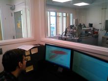
A Writing Intern in the Field
2017-10-11
As the science writing intern for the EarthScope National Office, field work is not generally a part of my job.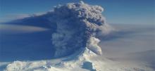
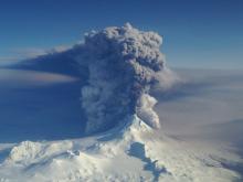
The Quiet After the Storm
2017-07-26
How EarthScope’s infrasound and seismic capabilities monitor evolving volcanic eruptions
EarthScope's Final National Meeting
2017-06-16
A culmination of 15 years of expansive geoscience research
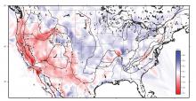
Earthquakes on a Passive Margin
2017-05-05
How EarthScope data help reveal the roots of anomalous seismic zones in the southeastern U.S.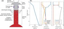
Probing volcanic systems with Bayesian inversion using physics-based models
2017-04-24
Science Nugget - By Paul Segall (Stanford University), Ying-Qi Wong (Stanford University), Kyle Anderson (U.S.G.S.) - NSF # EAR 1358607 | 2014-2017
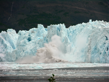
Calving Season
2017-04-03
How EarthScope seismometers help track glacier breakdown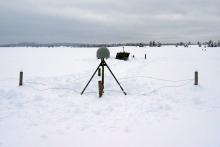
Improving Snow-Depth Forecasting with EarthScope’s Plate Boundary Observatory
2017-02-01
by Gail McCormick - Winter 2017
Volcano study examines relationship between seismic signals, sound waves
2017-01-23
By Sue Mitchell - University of Alaska Fairbanks Press Release - January 17, 2017 (http://news.uaf.edu/hearing-a-volcanic-plume/)
A study of relationships between seismic signals and sound
2016
Good Times, Better Ages
2016-10-11
How the EarthScope AGeS program evolved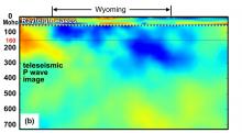
Recent Craton Growth by Under-accreting an Ocean Plateau Beneath Wyoming
2016-09-20
Science Nugget - By Eugene Humphreys (University of Oregon Eugene) and Robert van der Hilst (MIT) - NSF # EAR 952194 | 2010-2012
Seismic tomography images high-velocity…
Uppermost mantle seismic velocity structure beneath USArray
2016-09-19
Science Nugget - By Jeanine Buehler (University of California San Diego) and Peter Shearer (University of California San Diego) - NSF EAR # 1358510 | 2014
We…
2015
The Cascadia Initiative: A Sea Change in Seismolog
2015-11-19
By Cascadia Initiative Expedition Team (CIET)[http://cascadia.uoregon.edu] - Winter 2015
The increasing public awareness that the
Alaska Bound
2015-09-22
Transportable Array migrates northward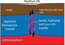
Underground Clues Help Explain an Old Earthquake Mystery
2015-09-19
By Adam Mann - Fall 2015
In 1811 and 1812, the New Madrid earthquakes destroyed homes and buildings through northeast Arkansas and the Missouri Bootheel. According to…

A Coast-to-Coast View of the Mantle Beneath the United States
2015-04-01
By Brandon Schmandt, University of New Mexico and Fan-Chi Lin, University of Utah - Spring 2015
One of the major observational components of the EarthScope program is the…
2014
The EarthScope Decade Symposium
2014-10-14
Celebrating Ten Years of Geoscience Accomplishments
Workshop Report: Modern and Ancient Basement Arches and the Connection to Flat Slab Subduction
2014-09-22
By Megan Anderson (CC), Kate Miller (TAMU), Susan Beck (UA), and Margarete Jadamec (UH) - Fall 2014
The structural dissimilarity between basement-involved arches and thin…
Transportable Array Contributes to the Central and Eastern US Network
2014-03-22
By Perle Dorr, IRIS - Spring 2014
The National Science Foundation is funding the creation of a Central and Eastern US Network (CEUSN) for the purpose of obtaining long-…
Earthquakes and Human Activities Addressing Public Concerns
2014-03-22
North Texas Earthquake Study Group, Southern Methodist University - Spring 2014
There is currently public, scientific, and policy concern regarding the recent increased…
New Flexible Array Video Series
2014-01-01
By ESNO - Winter 2014
Geology might not be the first thing that comes to mind if you heard the names SESAME, CAFÉ, SUGAR, and OIINK, but these are just a few examples of…
2013
Hitting Hot Water with PBO Borehole Strainmeters in the Yellowstone Caldera
2013-12-22
By Glen Mattioli and David Mencin - Winter 2014
Data from the Yellowstone Gladwin Tensor strainmeter (GTSM) network are improving the understanding of the structure of…
USArray Looks Back as it Looks Ahead
2013-09-22
By IRIS - Fall 2013
Ten years ago, the construction of USArray observatories officially began. This followed numerous community meetings, countless hours of meticulous…
Monitoring Surface Deformation at Long Valley Caldera, California
2013-09-22
By Kang Hyeun Ji - Fall 2013
Continuous monitoring of volcanic activity provides a way to detect changes from usual activity, provide warning impending eruptions, and…
SPREE: A Seismic Study of Continental Modification
2013-06-22
Trevor Bollmann, Emily Wolin, Suzan van der Lee, and the SPREE Team - Summer 2013
Northwestern University, Washington University in St. Louis, the University of Minnesota…
USArray - Alaska Deployment Planning
2013-06-22
Terry Pavlis, UTEP - Spring 2013
On February 19 and 20 approximately 50 geoscientists met at the Pacific Geoscience Center in Sydney, British Columbia, to discuss…
USArray Infrasound Data Products at IRIS
2013-06-22
By Manochehr Bahavar and Chad Trabant - Summer 2013
Diverse natural and man-made acoustic sources such as large explosions, rocket launches, and meteorites can act as…
Deformation of the Wasatch Fault System
2013-03-22
Plate Boundary Observatory Data
Chelyabinsk Meteor lit up the Transportable Array
2013-03-22
By Catherine D. de Groot-Hedlin and Michael Hedlin - Spring 2013
The large meteorite that entered Earth's atmosphere above Chelyabinsk, Russia last month drew attention…
Chlorite-Smectite Clay Minerals and Fault Behavior
2013-01-01
Evidence from the San Andreas Fault Observatory at Depth (SAFOD)2012
Understanding Continental Evolution using Data from the Transportable Array
2012-09-22
By Dr.Hersh Gilbert - Fall 2012
Do high mountains possess thick roots of low-density crust that keep them a"oat in the denser mantle, or do zones of low-density mantle…
Mineral, VA Earthquake Demonstrates the Passive Aggressive Margin of Eastern North America
2012-03-22
By Meghan Berg - Spring 2012
On August 23, 2011, the Mw 5.8 Mineral, Virginia, earthquake rocked the east coast of the U.S. While moderate in comparison to recent mega-…


