
by Atleigh Forden - Spring 2017
The center of the North American tectonic plate is a hotspot of earthquakes, and scientists are hard pressed to explain why. A recent study using EarthScope data has started to shed some light on the mystery.
When we think of earthquakes in the U.S., California’s San Andreas fault comes to mind. Where the Pacific plate grinds past North America, rocks rub past each other and energy is released in ground-shaking earthquakes of significant magnitude. On the west coast, earthquakes happen commonly near plate boundaries, but plate boundaries are not the exclusive sites of seismic activity.
One of North America’s most active seismic zones away from any plate boundary is the New Madrid Seismic Zone. It lies within the stable continental interior—within the boundaries of Missouri, Arkansas, Kentucky and Tennessee—and its position, a thousand miles from the closest tectonic margin, has long puzzled Earth scientists. Since 1974, seismometers have recorded 4,000 earthquakes in the region, enough to prompt the Federal Emergency Management Agency to help develop catastrophic earthquake disaster response plans in these parts.
EarthScope’s Transportable Array (TA) has provided researchers a comprehensive means to study these areas.
A team of scientists studying the anomalously active seismic zone has suggested that inherited faults from ancient tectonic episodes are the sites of unusual levels of seismicity. The southeastern U.S. was built over multiple episodes of tectonic accretion and rifting, but the area has not been near a plate boundary since 180 million years ago, when Pangea broke apart and the Atlantic Ocean began to form.
“In Earth science we have a saying, ‘Once a fault always a fault’,” says Cemal Biryol, lead author on the study and a postdoctoral researcher at University of North Carolina, Chapel Hill.
These structures can be reactivated, and have been deemed “inherited” structures. “An old fault is still a weakness,” Biryol points out, even if there is no currently active plate margin in the region. “It is acceptable that earthquakes can occur along these belts due to these inherited faults.”
Imaging under the crust
Biryol set out to image the deep roots of these inherited structures in the upper mantle, which lie anywhere from around 100 up to 650 kilometers (60 to 400 miles) beneath the southeastern U.S.. A notable example is under the New Madrid region, which has experienced earthquakes up to magnitude 7.5. His team used the TA’s network of seismometers to capture speed variations of P waves and construct images of the underbelly of the plate and into the mantle of the earthquake-prone regions. The technique, known as tomography, is widely employed in seismology for imaging inside Earth in a manner that has been compared with medical CT scanning.
%20copy.jpg)
Map: Locations of EarthScope’s seismic stations in the southeastern U.S. that were used in the analysis (marked with stars), along with all earthquakes recorded in the region between 1900 and 2015 (marked by yellow dots).
Seismometers record not only seismic activity in the immediate vicinity of an earthquake, they also capture waves emanating from earthquakes all over the world. Biryol employed the P waves from these distant earthquakes, as recorded by the TA receivers, to map out the variations in temperature, density, and composition that influence P-wave velocities. His team was searching for plate-thickness variations across the region that would mark possible scars of inherited faults, but to their surprise, they also found some anomalous structures that extend down from the sole of the plate in the vicinity of the earthquake-prone regions.
Lithospheric weak spots
Tectonic plates are composed of lithosphere, a pairing of brittle crust—where earthquakes happen—and an underlayer of the rigid uppermost mantle. The lithosphere rides above a hotter, gooey layer of the mantle called the asthenosphere. Biryol’s tomographic imaging yielded distinct locations beneath almost all of the seismic zones in the region where the lithosphere was thinner than in surrounding regions. These thin regions are the true zones of weakness, and they are caused by a kind of sloughing process at the base of the North American plate.
_0.png)
Image: A slice at 130 km depth through the eastern U.S. Each color represents how much P waves slow down (red) or speed up (blue) relative to their average speed (green) at this depth. Red/slow typically indicates weak regions, and blue/fast typically indicates strong regions. The ovals mark seismically active zones (compare to the map above) that have weaker/thinner mantle as indicated by slower P-waves.
Lithosphere is thicker in the older, central parts of plates, and it becomes thinner near the plate boundaries. In some cases, this is paired with an increased contrast in density at the base of the plate, so that eventually this base—similar to the keel of a ship—can begin to pull away from the plate and descend into the underlying hotter, less dense mantle. “This is what we call lithospheric foundering,” Biryol notes. “The mantle part of the lithosphere gradually peels off following gravity-pull forces and creates the thickness variations we see in our images.”
The causes of lithospheric foundering in the region are still under examination, but what Biryol does know is that asthenosphere upwells to fill the void left by foundered lithosphere. Resulting temperature and thickness variations lead to weakening of the remaining lithosphere, allowing any local or regional stress to manifest as earthquakes in the thinned region—all major seismic zones in the study area lie above lithosphere that is significantly thinner than in earthquake-free areas.
Taking steps
Biryol is currently working to produce more detailed images of the mantle structure below each of the areas of thinned lithosphere. He hopes that with a clearer understanding of the structures associated with seismicity in passive-margin zones, there can be better predictions of where large earthquakes might manifest. This is especially important in the southeastern U.S., where earthquake preparedness is not de rigueur the way it is in active margins. Biryol’s hopes that his continued research can complement other studies in the region that aim to mitigate earthquake hazard.
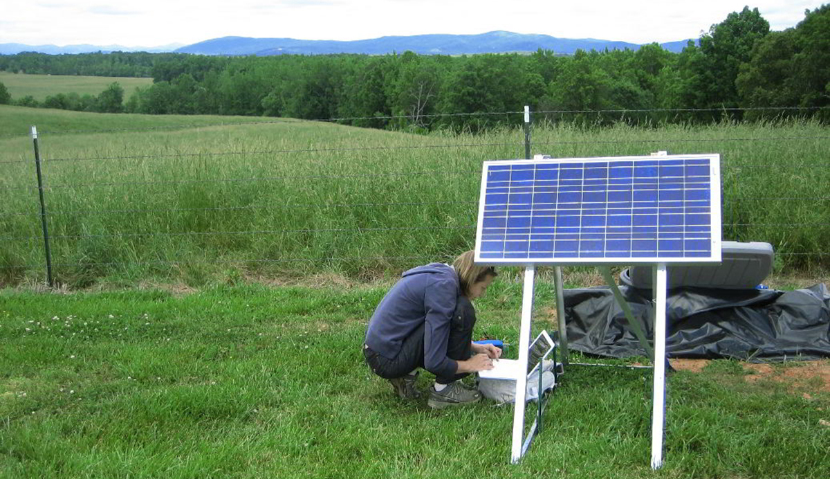
Top Image: Lara Wagner of Carnegie Institution of Washington checks data from station D17 on site in Clarkesville, Georgia.
Collaborators:
Lara S. Wagner --Department of Terrestrial Magnetism, Carnegie Institution of Washington
Karen M. Fischer --Department of Earth, Environmental, and Planetary Sciences, Brown University
Robert B. Hawman --Department of Geology, University of Georgia
NSF-related Funding Sources: EAR-0844186, EAR-0844276, and EAR-0844154
EarthScope Affiliations: IRIS—Transportable Array


