
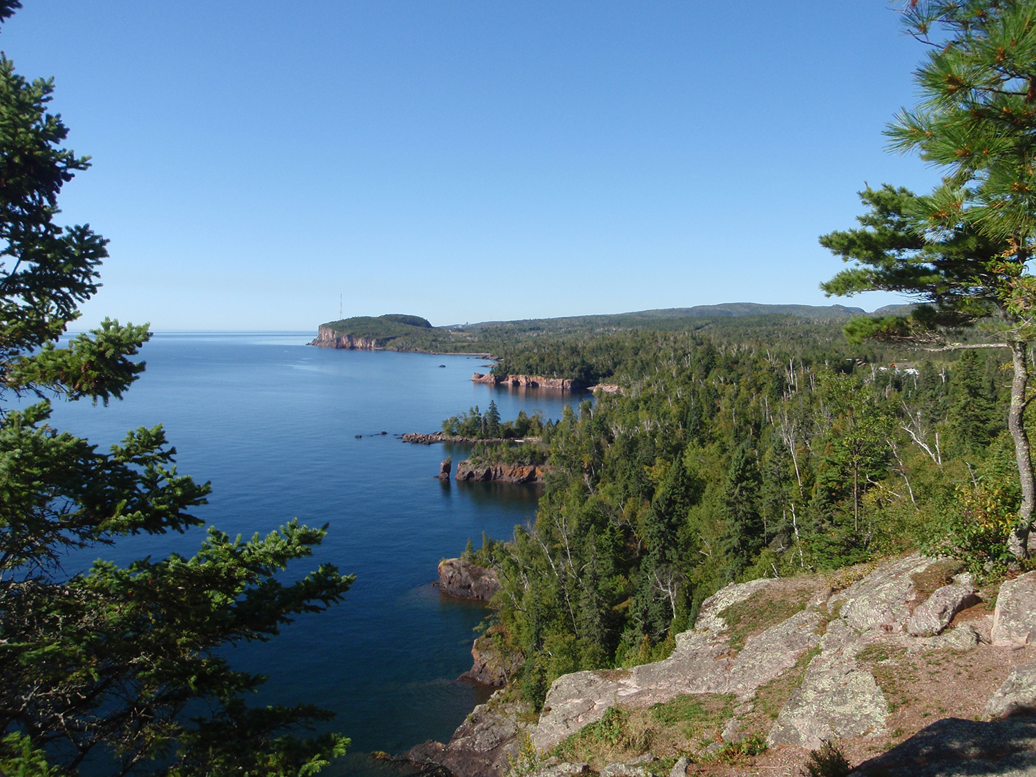
Cliffs of 1.1 billion-year-old Midcontinent Rift volcanic rocks along the shore of Lake Superior in Tetegouche State Park, Minnesota. Photo by Seth Stein.
by Beth Grassi
Ideas about a geological scar in the center of North America called the Midcontinent Rift are in the midst of an overhaul. EarthScope’s Transportable Array (TA) and a Flexible Array project called the Superior Rifting EarthScope Experiment (SPREE) have brought in new data that has some scientists rethinking the map of this feature.
When a tectonic plate stretches to the point of forming a new ocean between continents, the process is called rifting, and can take millions of years. The Midcontinent Rift (MCR) in midwestern Canada and the U.S. stopped short of actually splitting North America, and today offers a snapshot of an ancient stage of the continental rifting process.
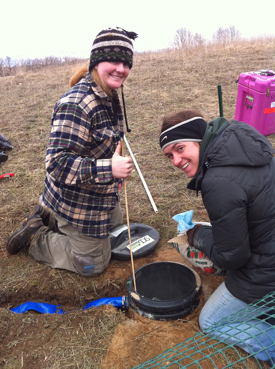
(Photo at left) Northwestern University graduate students Emily Wolin and Jessica Lodewyk install a SPREE seismic station in northern Wisconsin.
The rift halted 1.1 billion years ago, but its formation shaped the continent as we know it today. The northern end of the MCR forms the basin of Lake Superior. The rift then splits into a south-facing U shape, traditionally mapped with the eastern arm reaching southward through Michigan and the western arm through Ontario, Minnesota, Iowa, Nebraska, and Kansas. The new data gathered with the help of EarthScope instruments seems to indicate that both arms extend farther south than previously thought—the western arm down to at least Oklahoma and the eastern arm through Ohio, Kentucky, Tennessee, and Alabama.
“What’s really important is that in the Lake Superior area, the MCR outcrops on the surface, so you can walk around on the rocks,” said Seth Stein, the William Deering professor of Earth and Planetary Sciences at Northwestern University. When asked why he first became interested in studying the MCR, Stein said, “I’ve been at Northwestern for 37 years now. I got in the habit early on of going up to the Lake Superior area because it’s really pretty, just as a recreational area. I like to hike, ski, and kayak there. When EarthScope started, it was fun spending time thinking scientifically about an area that I had only treated as a recreational resource.”
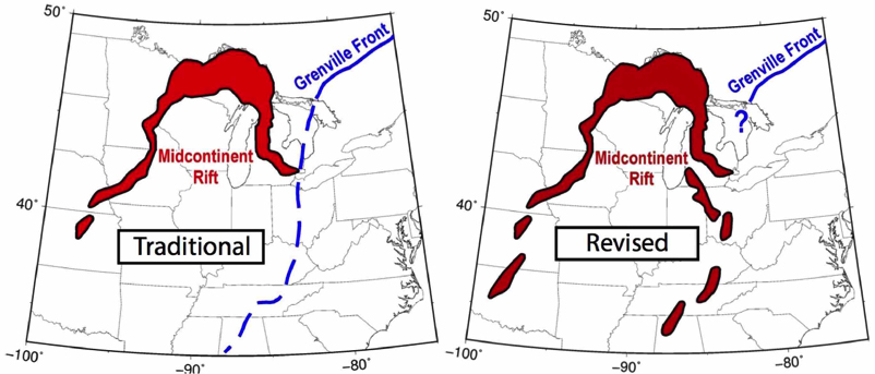
(Left map) Previously imaged geometry of the MCR in which the Grenville Front truncates the east arm and extends southward along subsurface features indicated by gravity and magnetic anomalies. Lake Superior lies at the top of the U-shape. (Right map) Revised geometry in which the previously assumed Front in the central U.S. is the southward continuation of the MCR. (Stein et al., 2018)
In 2009, a group of U.S. and Canadian researchers proposed an EarthScope Flexible Array project to examine the structure of the MCR in Minnesota, Wisconsin, and Ontario. Aside from the Lake Superior area, for most of its length the MCR is underground, buried under sediments, so not easily observed. The Flexible Array offers EarthScope seismic instruments for short-term data collection. Eighty-two SPREE seismometers were in place from 2011 through 2013. Combined with the TA data, scientists at many institutions were able to study the rift in several different ways, using the velocity of seismic waves, gravity fields, and magnetic fields.
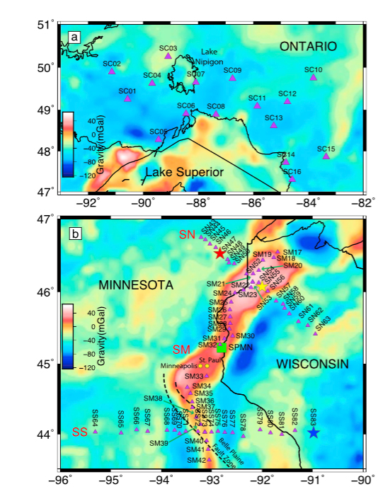
SPREE stations (purple triangles) and Bouguer gravity anomaly defining the Midcontinent Rift. The network is divided into three linear profiles: SS, SM, and SN. (Zhang et al., 2016)
The different methods yielded surprisingly different results. While the MCR is remarkably clear when viewed through certain types of data collected by SPREE and the TA, it is nearly invisible when observed with seismic surface wave velocity, a method known as surface-wave tomography. “When we look at the USArray images of the whole country, we barely see the MCR except for the sediment that’s on top of the igneous rocks. Which I think was really a surprise to everybody,” said Stein.
Seismometers measure the velocity of different types of seismic waves from earthquakes all over the world moving through the ground of the study area. Seismic waves typically move faster through dense rocks, allowing scientists to visualize rock structures underground. Scientists can measure the speed of seismic surface waves (using surface-wave tomography) or examine seismic waves that come from deeper underground using a method called a receiver function, which is more sensitive to rock density as well as seismic-wave velocity, to create images of structures beneath the surface. The TA and SPREE arrays’ inability to “see” the dense rocks through surface-wave tomography is mainly due to another unusual aspect of the MCR—the rift is filled with volcanic rock. Volcanic rock is not common in continental interiors, but it filled the MCR during the rifting process, when deep, hot mantle rocks rose to the surface during the stretching and thinning of Earth’s crust, melting as they decompressed. Usually rifting generates vast lava fields that cover a wide area. In the MCR, however, the lava filled the rift itself, forming a deep, narrow trench of volcanic rock. The conduits of volcanic rock should have been quite distinct in seismic images. But in this region, the seismic wave speed in rocks around the rift is close to the wave speed in the volcanic rocks within the rift, effectively masking the presence of the rift when viewed using surface-wave tomography. However, receiver functions from upcoming seismic waves measured by the TA and SPREE arrays image structures within the MCR.
Viewing the MCR through the spectacles of gravity or magnetic fields produces a very different scene than surface-wave tomography. When measuring gravity, more dense rock gives positive gravity readings (higher than regular gravity), while less dense rock gives negative gravity readings (lower than regular gravity). The volcanic rock filling the MCR is much denser than the surrounding rocks, so the MCR shows up in strong contrast in gravity imaging. Magnetic imaging compares the strengths of magnetic fields of different types of rock. Since the volcanic rock in the MCR is also more magnetic than the surrounding rock, the rift shows up in magnetic imaging as well, although the contrast is not as strong as in the gravity imaging.
What did we learn from the SPREE data? “The SPREE data showed that the structure of the west arm of the MCR looks like the structure of the MCR under Lake Superior, which we know pretty well,” said Stein. Although there are some differences, knowing that the west arm of the rift has similar characteristics to the features in the Lake Superior area helps scientists identify the MCR in other locations.
Another result of the recent research on the MCR is that a contingent of scientists now think the east arm of the MCR extends much farther than previously thought. “People used to think it stopped around the middle of Michigan. We now know it goes all the way down through Ohio and at least as far south as Kentucky, and perhaps somewhat farther south,” said Stein. “What we’ve done is we’ve made the MCR great again, adding maybe a quarter to its length.”
These new insights into the size and dimensions of the MCR means rethinking its relation to another geological feature in eastern North America called the Grenville Front. Carol Stein is a professor at University of Illinois at Chicago—coauthor (and spouse) of Seth Stein. Her past research focused on the thermal evolution of oceanic portions of Earth’s crust and mantle. Some of that research included rifting and hotspots, which is what drew her into the SPREE research.
The Grenville Front is the western edge of deformation in Earth’s crust caused by intermittent continental collisions that took place between about 1.3 billion and 980 million years ago. The Grenville Front formed during pulses of mountain-building, and the MCR formed in between those pulses.
The Grenville Front has long been mapped as extending from where it outcrops in eastern Canada down through Ohio, eastern Kentucky, and Tennessee, wrapping around through Alabama until it resurfaces as an outcrop in Texas. Carol explains that their recent research seems to show that the Grenville Front was misinterpreted in the U.S. from Ohio to Alabama. Instead of the Grenville Front cutting off the MCR in southern Michigan, they think that gravity and magnetic anomalies thought to be the Front are actually the east arm of the MCR, continuing much farther south than previously thought. In a 1982 paper, the gravity highs were referred to as the East Continent Gravity High and interpreted as being due to rifting. “The gravity and magnetic anomalies that are observed along this area from Ohio to Alabama are like what we see in Lake Superior and the west arm, and nothing at all like what is observed for the Grenville Front in Canada,” Carol said. Other evidence comes from drilled wells, which brought up volcanic rock very similar to that found in the MCR outcrop near Lake Superior.
Not everyone is jumping to change established views. “The truth is we need more data,” said G. Randy Keller, professor emeritus of the University of Texas at El Paso. Keller has studied rifts all over the world, including the MCR. “Science doesn’t progress if people don’t come up with new ideas that may or may not please everybody,” Keller said. Although the EarthScope Transportable Array of seismic stations that moved across the entire contiguous U.S. was helpful, the 70–80 km grid was too wide a spacing to detect details of the rift. If anything, it has simply pointed out areas that need further, more focused studies like the SPREE project.
Synthesis Workshop
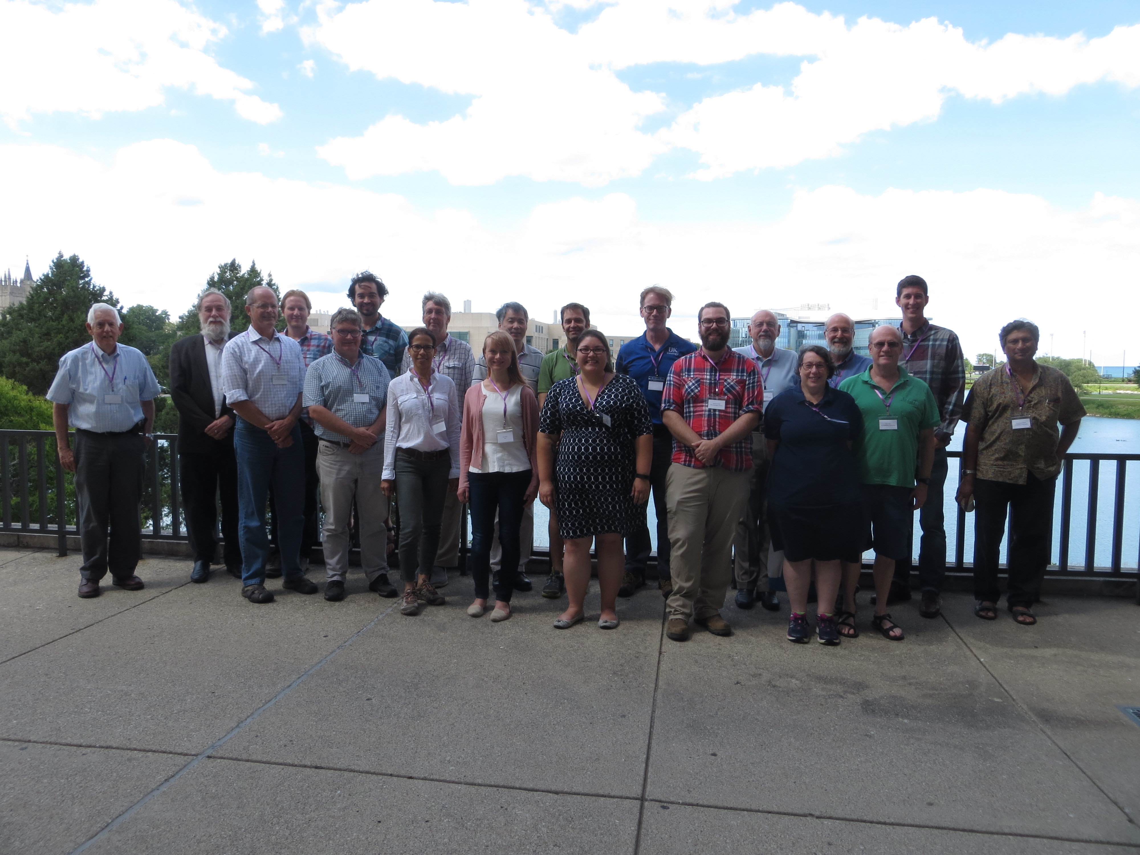
Participants in the EarthScope Synthesis Workshop “Unscrambling the Midcontinent Rift and Grenville Front and Their Implications for the Assembly of Rodinia” enjoy a brief break out in the sunshine. Photo by Beth Grassi.
In July, Northwestern University hosted an EarthScope Synthesis workshop to discuss the current state of research about the MCR and future directions after the EarthScope program ends. Scientists from universities and state geological surveys gathered to pool their research and brainstorm ideas for next steps. Attendees gave presentations on different aspects of the MCR: electromagnetic fields, gravity anomalies, geochemistry, paleogeology, geochronology, comparisons to current rift zones, and seismic structure.
Discussion focused on how to build on EarthScope data, such as brainstorming ideas of how to take a closer look at the interaction of the MCR and the Grenville Front. What sorts of structures exist and where are they? What was the plate geometry when the MCR and Grenville Front formed? Other topics included exploring the MCR deep in the earth. Does it go straight down, or is it angled? Comparing the MCR to other rifts may shed some light as well on why the MCR stopped. What causes the huge volume of magma in the MCR? Was it a plume from deep in the mantle or a shallower source? What new seismic and other experiments could give additional insight?
These and other questions will be discussed at sessions at the upcoming Geological Society of America and American Geophysical Union meetings.
Although many questions remain about the mysterious MCR, EarthScope data has revealed new insights and ideas that are helping decipher this ancient feature.
More Resources
Video: Lake Superior and the Midcontinent Rift: the Billion-Year Story
Park Science journal article: Using Lake Superior Parks to Explain the Midcontinent Rift
EarthScope press release (December 2015) on MCR copper and iron deposits
EarthScope article (2013): SPREE: A Seismic Study of Continental Modification
Nature journal article (2013): North America’s Broken Heart
References
Stein, C.A., Stein, S., Elling, R., Keller, G.R., Kley, J., 2018. Is the “Grenville Front” in the central United States really the Midcontinent Rift? GSA Today 28, 4-10. https://doi.org/10.1130/GSATG357A.1.
Zhang, H., van der Lee, S., Wolin, E., Bollmann, T.A., Revenaugh, J., Wiens, D.A., Frederiksen,
A.W., Darbyshire, F.A., Aleqabi, G.I., Wysession, M.E., Stein, S., and Jurdy, D.M. 2016. Distinct crustal structure of the North American Midcontinent Rift from P wave receiver functions. J. Geophys. Res. Solid Earth, 121, 8136-8153. https://doi.org/10.1002/2016JB013244.


