
Articles
2019
Exploring a Changing Continent Using a Plate Boundary Observatory
2019-02-14
Geodesy is the science of measuring the size, shape, and gravity field of Earth, and how these change with time.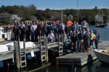
Reflections on the Accomplishments of EarthScope’s USArray
2019-02-14
The USArray has operated for over 15 years as a community science facility designed to address EarthScope’s goal of understanding the structure and evolution of the North American continent.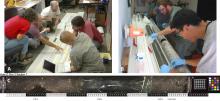
San Andreas Fault Observatory at Depth
2019-02-14
The Gold Standard for Scientific Drilling Through an Active, Continental Transform Fault2018

EarthScope Top 10 Discoveries
2018-12-07
,
Alaska Amphibious Experiment Crosses the Shoreline
2018-08-31
New ocean-bottom seismometers complement the Transportable Array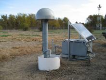
PBO Station Highlight: A Puzzle in the Midcontinent
2018-08-31
What causes earthquakes in the interior of North America, far from plate boundaries?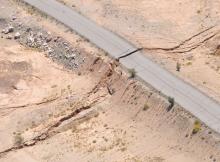
PBO Station Highlight: P496 Is Only One Piece of the Story
2018-05-04
PBO station P496 not only shook during the 7.2 El Mayor–Cucapah earthquake in northwestern Mexico, but moved permanently as a result of it.2017
P472: Engineering for Earthquakes
2017-10-16
PBO Station Highlight October 2017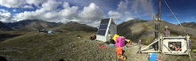
EarthScope's Transportable Array Spans Alaska, the Last Frontier
2017-10-12
Elliot Wilson of Pioneer Earthworks operates the drill at Alaska Transportable Array station D27M. Photo by Max Enders, IRIS.
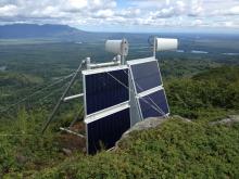
P085: Tiny Motions Matter
2017-07-25
PBO Station Highlight Summer 2017edited.jpg?itok=WcA_Q6ML)
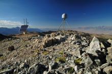
Transportable Array Equips Stations with Infrasound Sensors
2017-07-25
by Andy Frassetto and Kasey Aderhold, IRIS - NSF # SAGE: 1261681, MRI-R2: 0960275 | Summer 2017
Observations of infrasonic signals have…

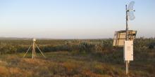
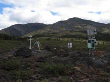
AB50: Quick Responder
2017-05-08
PBO Station Highlight May 2017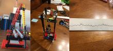
Seismology in the Classroom
2017-05-05
A new online course connects teachers across Alaska to real-time seismic data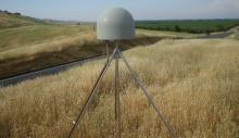
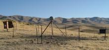
Salt Canyon, California
2017-02-01
PBO Station P208 watches the grass grow...literally
The Alaska Transportable Array Team
2017-02-01
Achieving Success in Challenging Environments2016
Driving the Dempster
2016-10-24
The Transportable Array deploys along a remote Canadian “highway”
IRIS 2016 Workshop
2016-09-01
Highlights Emerging Fields and Technologies in Seismology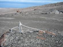
Augustine Island, Alaska
2016-08-10
PBO Station AV03 Takes a Blow
2016 UNAVCO Science Workshop
2016-04-15
New Uses for the Plate Boundary Observatory2015
Supporting Earth Science in the Canadian Sub-Arct
2015-12-01
By Justin Sweet - Winter 2016
Canada’s Yukon and Northwest Territories are not known as hospitable land. This sub-arctic region, home to the Mackenzie Mountains project, presented
Back to Mothership
2015-12-01
How PBO data get from Everywhere to somewhere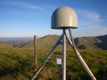
Low-Cost Additions to the Plate Boundary Observatory for Earthquake Early Warning
2015-04-15
By Doerte Mann and Beth Bartel - Spring 2015
One of the major benefits of the Plate Boundary Observatory (PBO) is its contribution to prototype Earthquake Early Warning systems (EEW).
The Legacy of the USArray Transportable Array
2015-04-13
By Andy Frassetto, IRIS - Spring 2015
In the fall of 2003, before EarthScope began, approximately 200 modern broadband seismic stations operated across the contiguous United States,
2014
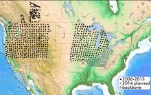
USArray Continues Field Activities in 2014
2014-10-14
By Perle Dorr, IRIS - Summer 2014
Since the completion of the Transportable Array in the Lower 48 during fall 2013, USArray has focused on the creation of the Central and Eastern US

Transportable Array Contributes to the Central and Eastern US Network
2014-03-22
By Perle Dorr, IRIS - Spring 2014
The National Science Foundation is funding the creation of a Central and Eastern US Network (CEUSN) for the purpose of obtaining long-…
Stability of PBO GPS Monument Types
2014-03-22
Project Highlight
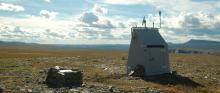
Helicopter Fieldwork in the PBO Alaska Region
2014-02-02
By Ellie Boyce - Summer 2014
With high-elevation GPS stations melting out of the snow and the weather becoming milder, the PBO Alaska region began annual helicopter-based…
2013
USArray Reaches the East Coast
2013-12-22
By Maureen Long and Vadim Levin - Winter 2014
On October 1st 2013 the seismic and magnetotelluric observatory network USArray, which is a key element of the EarthScope…
USArray Looks Back as it Looks Ahead
2013-09-22
By IRIS - Fall 2013
Ten years ago, the construction of USArray observatories officially began. This followed numerous community meetings, countless hours of meticulous…
USArray - Alaska Deployment Planning
2013-06-22
Terry Pavlis, UTEP - Spring 2013
On February 19 and 20 approximately 50 geoscientists met at the Pacific Geoscience Center in Sydney, British Columbia, to discuss…
USArray Infrasound Data Products at IRIS
2013-06-22
By Manochehr Bahavar and Chad Trabant - Summer 2013
Diverse natural and man-made acoustic sources such as large explosions, rocket launches, and meteorites can act as…
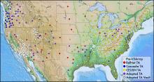
USArray Status
2013-03-22
By Perle Dorr, IRIS
With operating stations blanketing the southeastern states, the Transportable Array is on target to complete its journey across the contiguous US and…
2012
PBO GPS Updates
2012-09-22
By Glen Mattioli, UNAVCO - Fall 2012
Currently, there are 1120 GPS sites and 28 tilt meters, as well as numerous other strainmeters actively measuring deformation. In…
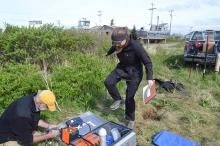
Tales from the Field: PBO Installation in Alaska
2012-03-22
Max Enders - Spring 2012
When UNAVCO set about building the Earthscope Plate Boundary Observatory (PBO) no challenge was nearly as daunting as the prospect of installing…
Spring 2012 Facilities Status
2012-03-22
Spring 2012
USArray Status
The Transportable Array (TA) continues to roll eastward across the US. Having crossed the Mississippi River in March 2011, the TA will…


