
by Sara Tewksbury
The last of EarthScope’s national meetings was held May 16–18, and highlighted the dataset and research accomplishments that have emerged both recently and since the inception of the EarthScope project. More than 200 geoscientists met to discuss their research results in talk and poster sessions, and continued the conversations during the snack breaks.
The first meeting day was devoted to synthesis sessions aimed at presenting some of the main discoveries facilitated by the EarthScope project. Bill Hammond (University of Nevada, Reno) and Lucy Flesch (Purdue University) highlighted how EarthScope has allowed scientists to view the continent in entirety and get a better look at some complex tectonics—for example, in the Aleutian islands of Alaska. Maureen Long (Yale University) credited EarthScope with providing a “transformative dataset.”
An Alaska-themed session was devoted to recent results from Alaska, where the Plate Boundary Observatory (PBO) has been operating since 2008 and the Transportable Array (TA) is currently nearing deployment completion for the final EarthScope leg. Talks by Margaret Jadamec (University of Houston) and Sean Bemis (University of Kentucky) highlighted the complex and unique geological and geophysical features of southern Alaska, such as active diffuse deformation and collision, which is absent in rest of the country. Sarah Roeske (University of California Davis) reminded the audience that the rest of Alaska is filled with enigmatic structural features that are also being revealed thanks to EarthScope instrumentation. Also in attendance were 21 delegates from SinoProbe—China’s subsurface imaging project informed in part by EarthScope’s setup. They presented some early findings from the project, as well as objectives for the upcoming SinoProbe II, and met with EarthScope scientists to learn more about EarthScope scientific objectives and results. Researchers from Canada also presented findings from their similarly EarthScope-influenced Canadian Cordillera Array project.
.jpg)
Image: See if you can spot the geophone in this winning VESS entry (photography) by Anne Schöpa. This is the setting of the iMUSH (imaging Magma Under St. Helens) project.
This year’s meeting launched the Visualizing EarthScope Science (VESS) challenge, which showcased the results of “science as art” submissions meant to engage the public. During the dinner program, the winners—who had been selected by public vote—were presented awards in the three categories: photography, graphics, and animation. All of the entries are showcased on the EarthScope website.
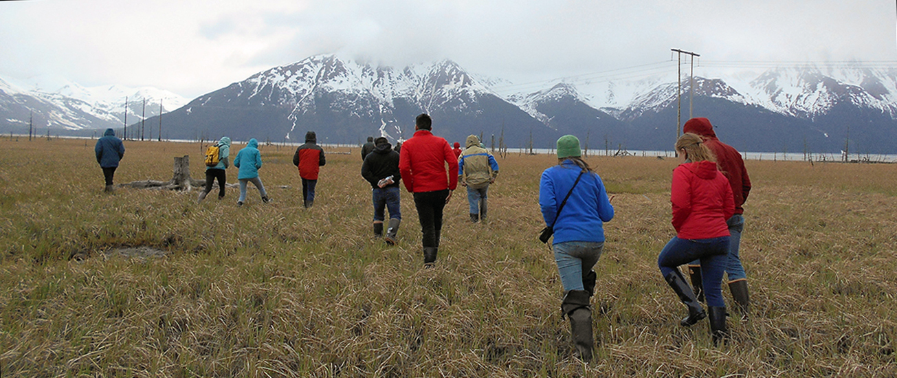
After the meeting, local EarthScope scientists led a field trip to iconic locations impacted by the 1964 Great Alaska earthquake, the second-largest magnitude quake ever recorded. Sites included the ghost forest and the rolling-hill liquefaction scarps of Turnagain Heights.
.jpg)
Image: Dead trees of the Ghost Forest (Girdwood) remind visitors that this part of Alaska sank up to three meters during the 1964 Great Alaskan earthquake.
Top image: Field trip participants of the 2017 final EarthScope National Meeting cross the wet tundra to marvel at the "ghost trees" (Girdwood).
For more information on PBO in Alaska:
https://www.earthscope.org/articles/back_to_the_mothership
https://www.earthscope.org/articles/Improving_snow_depth_forecasting
https://www.earthscope.org/articles/creeping_calamity
https://www.earthscope.org/articles/PBO_installation_alaska
For more information on the TA in Alaska:
https://www.earthscope.org/articles/Alaska_TA_Team
https://www.earthscope.org/articles/Calving_Season
https://www.earthscope.org/articles/Volcano_study_examines_relationship_between_seismic_signals


