
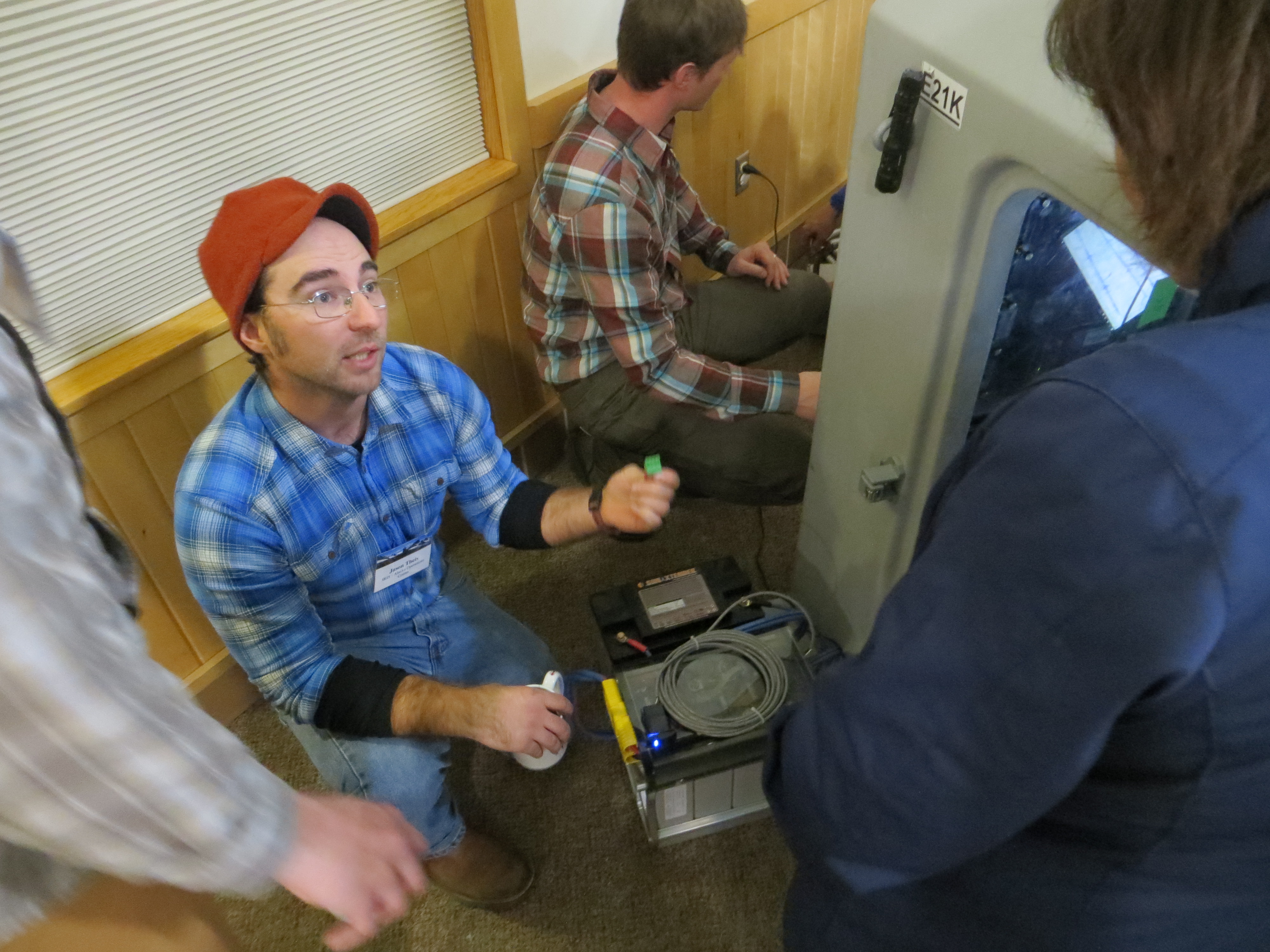
Station Specialist Jason Theis explains some of the “brains” of a Transportable Array station. (Photo by Beth Grassi)
—by Kasey Aderhold, IRIS
Now that the Alaska Transportable Array (TA) is in place, a wide variety of projects ranging from weather reports to climate change monitoring to seismic research are putting the data to work. The TA is a network of 280 high-quality, telemetered seismic stations set in a grid covering Alaska and western Canada. A number of stations also include other equipment, such as meteorological sensors, soil temperature gauges, and infrasound (sound lower than humans can hear) microphones.
Scientists and stakeholders gathered in Anchorage, Alaska, at the Campbell Creek Science Center in October 2017 to celebrate the completion of the final stations only a few weeks before and to share some of the new research.
Bob Busby, the program manager who has overseen the operations of the TA since its inception in 2004, and Maggie Benoit, the National Science Foundation program officer, introduced the network and its capabilities. Station deployment coordinator Max Enders emphasized the important role that strong teamwork, communication, and inter-agency collaboration played in the successful construction of the network. Lea Gardine, representing the Alaska Earthquake Center, described the efforts of the TA project to connect with local communities through a range of educational activities from classroom visits to teacher professional development courses, as well as news coverage and brochures with regionalized content.
The science impact of these high-quality Transportable Array stations installed across a largely unmonitored region is evident, both locally and globally. Jeff Freymueller, director of the EarthScope National Office, and Michael West, state seismologist of Alaska, were well-positioned to see the effects firsthand of new data streams in their home state. The Alaska Earthquake Center is now able to detect much smaller earthquakes and significantly more earthquakes, especially in areas of the state that previously lacked or had widely spaced seismic instruments (see figure below), providing a much better understanding of earthquakes and seismic hazard across Alaska.
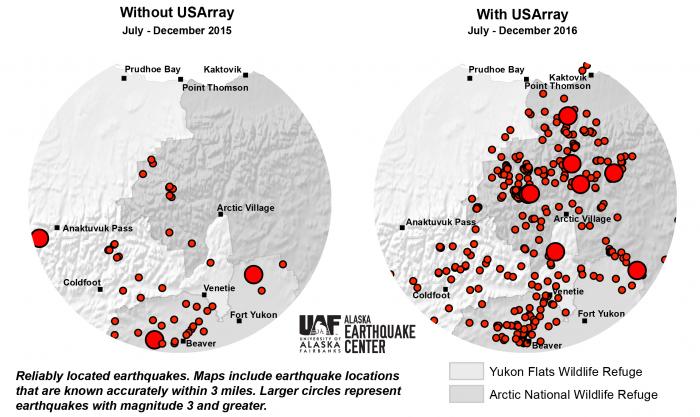
North Slope seismicity detection. (Image by Alaska Earthquake Center)
Seismic stations along the Aleutian Islands are key to the work by Paul Huang and his team at the National Tsunami Warning Center in Palmer, Alaska. The Center assesses the threat of tsunamis that could affect the coasts of the U.S. and Canada, from the Arctic to the Gulf of Mexico, as well as Puerto Rico and the Virgin Islands. When the Center detects an earthquake, the team has between three to five minutes to determine whether to broadcast a tsunami warning. The expanded coverage the TA offers for detecting earthquakes will help the Center in its vigilance.
While recording seismicity is the primary goal, the TA in Alaska reaches far beyond earthquakes. With the ongoing activity of the Bogoslof volcano in the Aleutians, Michelle Coombs of the Alaska Volcano Observatory stressed the value of the data from infrasound sensors installed on every station. The Observatory is using the data to develop a new algorithm for detecting and locating eruptions. Ash from volcanic eruptions poses significant danger to airplanes, disrupting air travel, and can also cause environmental impacts.
Collaborations with the National Aeronautics and Space Administration (NASA) and the National Oceanic and Atmospheric Administration (NOAA) provided many of the meteorological and soil temperature sensors deployed at TA sites to fill in large gaps of coverage across the state. Peter Kirchner of the National Park Service showed how those sensors support the NASA Arctic-Boreal Vulnerability Experiment (ABoVE) program mission to observe the Arctic ecosystem at multiple scales, from leaf-level to satellite.
Renee Tatusko from NOAA also spoke about how the data from 132 TA stations with meteorological sensors are being used by the National Weather Service to improve local and regional weather forecasts. Many of these TA stations are in places that have not previously had local monitoring capabilities. The more accurate forecasts possible with the new wealth of real-time, local data on wind speed and direction, temperature, humidity, precipitation intensity, and air pressure provide an invaluable tool for commercial fishermen and the many communities off the road system that rely on air travel.
All presentations are available on the workshop website.
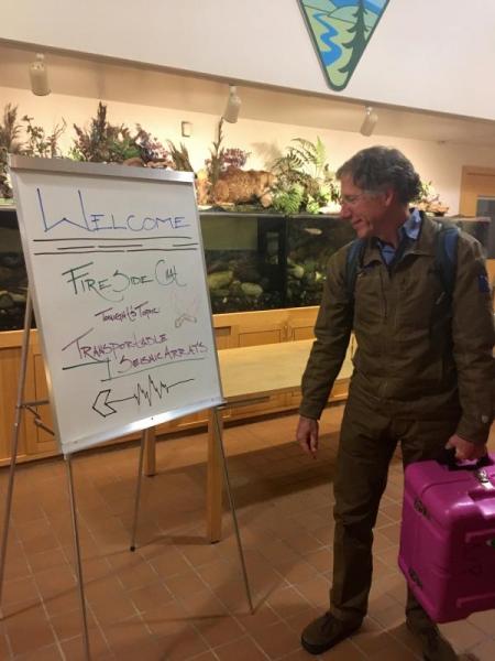
IRIS Transportable Array Manager Bob Busby carries a brightly colored case holding a gyroscopic compass into the Campbell Creek Science Center for the Fireside Chat. (Photo by Kasey Aderhold)
As the sun set on that cold, crisp evening in October, the Alaska TA field team reconvened to present a Fireside Chat as part of the monthly community speaker series organized by the Campbell Creek Science Center. Members of the public gathered to learn about detecting earthquakes and the importance of the TA project, as well as three summers of adventures by the TA field team members deploying stations in remote areas of Alaska and Canada. A full-size seismic station was on display in the front of the room. The station’s blinking LED lights and ever-scrolling recording of room vibrations drew the attention of attendees of all ages. Max Enders, along with station specialists Ryan Bierma and Jeremy Miner, explained the purpose of the project and the function of each part of the station, sometimes lifting the heavy, expensive equipment higher so the back row could see. Kasey Aderhold provided a first-hand account of how the project has affected the individuals who have been part of the TA team. The evening ended with videos showing the TA team in action and then a discussion filled with thoughtful audience questions.
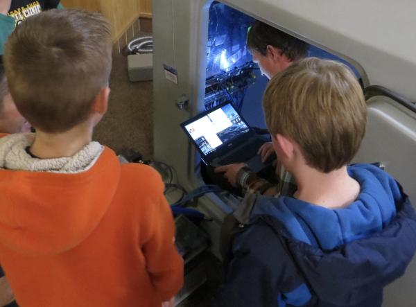
Station Specialist Ryan Bierma shows some young scientists the inner workings of a Transportable Array station. (Photo by Beth Grassi)
Learn More
See video clips and interviews from the Fireside Chat in this Anchorage TV station KTUU segment.
On January 23, 2018, a magnitude 7.9 earthquake 280km (about 180 miles) southeast of Kodiak Island shook the region. See how the quake was captured by the TA on this vertical Ground Motion Visualization of Alaska and the Lower 48 from IRIS.
Funding: NSF Seismological Facilities for the Advancement of Geosciences and EarthScope (SAGE) Award #1261681
EarthScope, funded by the National Science Foundation (NSF), is exploring the structure and evolution of the North American continent and the processes controlling earthquakes and volcanic eruptions. The Transportable Array is constructed, operated, and maintained by the Incorporated Research Institutions for Seismology (IRIS) through cooperative agreements with NSF. Staff at the IRIS Alaska Operations Center is supported by the Array Operations Facility at New Mexico Tech, the Array Network Facility at University of California San Diego, the IRIS Data Management Center, and IRIS Headquarters. Collaboration and support from the Alaska Earthquake Center has been key to the success of the Alaska component of the Transportable Array, along with cooperation with the Alaska Volcano Observatory, National Tsunami Warning Center, UNAVCO, Canadian Hazards Information Service, Yukon Geological Survey, Yukon Wildlands, and Natural Resources Canada. Data are archived at the IRIS DMC under the US-TA network code. Learn more about the Transportable Array in Alaska.


