
By Beth Bartel - Winter 2017
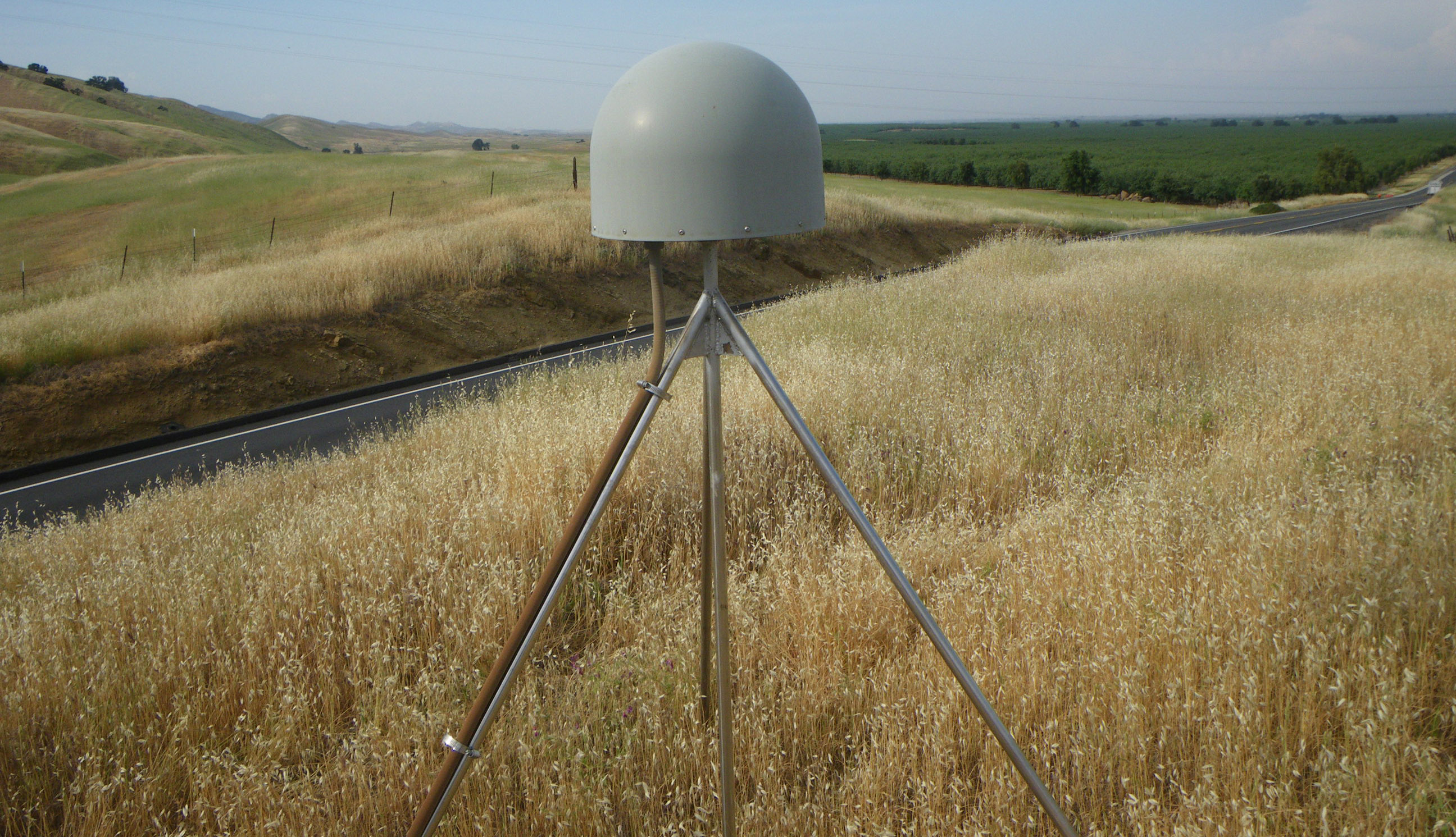
The EarthScope Plate Boundary Observatory was installed primarily to measure the motion of tectonic plates, but we’ve learned since its inception that it can measure that and a lot more. Researchers at the University of Colorado are using stations like P208 in California to measure vegetation growth. The same stations that show us how strain builds up along faults also tell us about local growing seasons. Each GPS instrument measures its position from signals received directly from satellites. These same signals bounce off the ground as well, and until recently were filtered out rather than used. Within the last 10 years, researchers discovered ways to use these reflected signals to measure snow depth, soil moisture, glacier height, sea level, and—yes—vegetation, near the antenna. The way the satellite signal bounces off the ground can tell us a lot about what's there. To measure vegetation growth, scientists look at the strength of the reflected signal. When radio waves bounce off dry, dead vegetation, that makes for strong arrivals at the antenna. When the same waves bounce off thriving vegetation with a high water content, they scatter, making for weak arrivals at the antenna. At P208, scientists looking at the GPS signals see that vegetation generally peaks in May. The height of this peak varies from year to year, and was especially low in 2007 when rainfall was well below average. Sites like P208 indicate that the Plate Boundary Observatory can serve as a remote vegetation monitor as well as tracking the slow motions of the Earth’s surface. Learn more about P208 on UNAVCO’s P208 station page or University of Colorado's educational GPS Spotlight Website.
Top image: GPS Station P208 in Salt Canyon, California. (Credit: UNAVCO)


