
By Ryan Turner and Beth Bartel - Winter 2016
Collecting continuous GPS/GNSS data throughout the Plate Boundary Observatory requires enormous investments in planning, hardware, and physical effort. Getting those data back to a central repository for distribution as quickly and reliably as possible presents even more challenges. In 2008, when the Plate Boundary Observatory was completed, the majority of stations had transfer rates of less than 15kB/s over first-generation cellular modems and Ethernet radios. Yet with an increasing demand for high-rate data to examine coseismic processes, and for real-time streams to contribute to earthquake early warning systems, the communications standards of a decade ago simply can’t keep up. Fortunately, options for transmitting data wirelessly have grown enormously and upgrading these systems with modern internet gateways and radios allows transfer rate increases up to a hundredfold. PBO engineers have employed strategies ranging from cellular modem to satellite communications, and from local internet providers to multipoint radio networks spanning hundreds of square miles and a dozen stations to improve reliability and performance as well as expand capabilities.
Radio networking, in particular, is a crucial tool for data retrieval in much of the network. Improving these networks affords more efficient, lower-cost data transfers. In Alaska, for example, 60 percent (85 of the 140 stations) are linked by 900 MHz radios to some other type of telemetry hub upstream. In the Pacific Northwest, 30 percent of all stations rely on radio telemetry. Due to poor cell coverage and expansive geography, it would not be possible to maintain 270 real-time GPS stations any other way. In some cases, as many as 12 stations operate through one internet connection, making for a highly cost-effective network. Upgrading these radio networks improves reliability as well.
Critical radio work in 2015 included upgrades of 13 instruments on the volcanoes of Unimak Island, AK, 19 stations on Mount St. Helens, WA, and five stations on the western side of Yellowstone National Park that are used to help monitor uplift and subsidence (up to 7cm/yr) of the nearby Yellowstone Caldera as well as constrain the Hebgen Lake fault and potential associated seismicity. In California, radio upgrades focused on the Channel Islands, Long Valley, and Menlo Park areas, with creation of new radio networks in the area of Hollister and the Mojave Desert. Each of these networks is critical for monitoring and understanding volcanic and seismic hazards throughout the North American plate boundary.
Field engineers employ various techniques for overcoming technical obstacles, including installing higher-gain, highly directional antennas, using different radios and frequency ranges, and using comms-only repeater stations to get signals back from the most isolated stations. While we can plan for most of these technical challenges, working in the field, often far from civilization, frequently presents less predictable obstacles as well. Field engineers might find themselves in whiteout snow conditions on the side of an active volcano, or stuck in a sandy wash in the desert. Overcoming these challenges not only enables better stability and state-of-health monitoring, but new science as well.
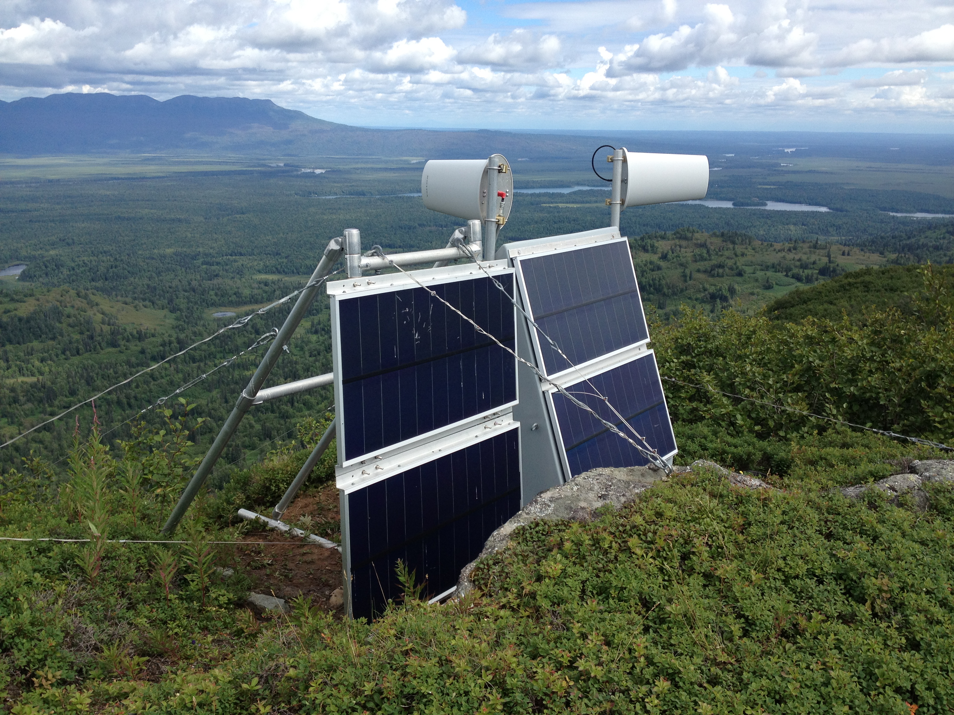
Picture: Station AC46 Skwentna lies close to the Iditarod trail in south-central Alaska. The twin radome-shielded antennas relay data from the highest elevation site on the southern edge of Denali National Park, providing important information about the ongoing uplift of the Alaska Range. Photo by Alaska Field Engineer Ellie Boyce.


