
by Beth Bartel and Diego Melgar | NSF# EAR 1261833
PBO station P472 is located less than a mile from the world's largest outdoor shake table, operated by the University of California San Diego. A shake table simulates the shaking caused by an earthquake, and most shake tables fit inside buildings, but this shake table actually sits under one. Real-life, to-scale buildings are built and tested on this large platform, which measures 40 ft x 25 ft. By constructing buildings out of different material types and fully furnishing them, researchers observe how the shaking affects real-world scenarios. This improves building engineering and makes them more resilient to earthquakes.
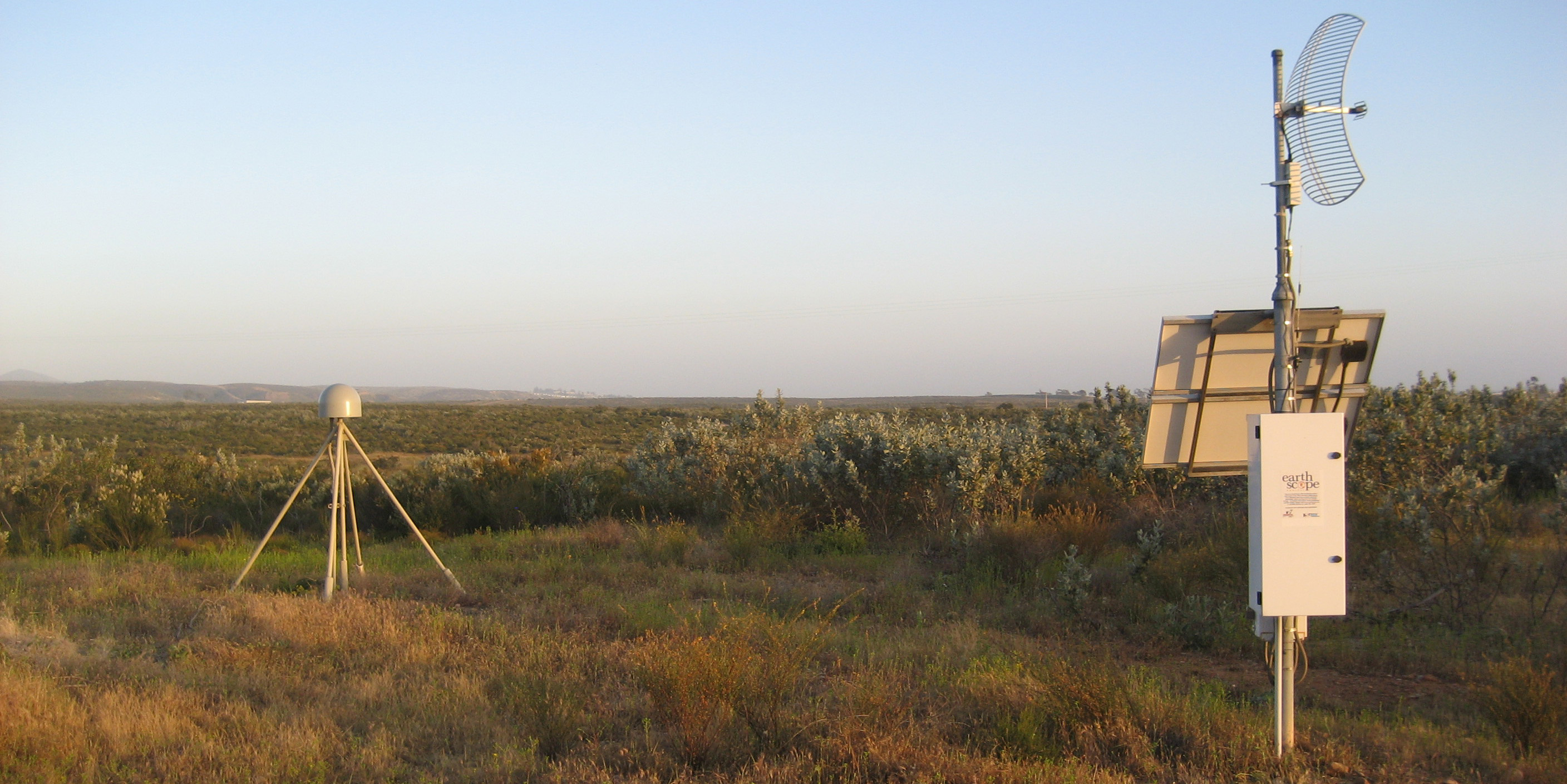
To fully understand a building’s response—by precisely measuring the shaking—high-precision GPS instruments are mounted at each corner of the building, top and bottom. For the best results, these eight stations need a “base station” away from the building, anchored in the ground, to serve as a stable reference point. This is where EarthScope Plate Boundary Observatory station P472 comes in. P472 collects data continuously, up to five times a second (5Hz). The station’s motion, which should be essentially zero on these short time scales, is then compared to the movement of the building to see how much the building actually moved during the experiment. By comparing positions, we can get higher precision measurements than with satellites alone. These precise measurements thus enable researchers to learn which building materials perform best under different conditions. Many of the tests conducted at the shake table have a direct impact on the rules and regulations regarding the way we build buildings in California, and GPS measurements on the buildings are an important part of that.
Serving as a base station for this oversized shake table isn’t P472’s only job. The station also serves to measure tectonic motion in this earthquake-prone region. P472 and its neighbors recorded the offset from Mexico’s April 4, 2010 magnitude 7.2 El Mayor–Cucapah earthquake in Baja California, just southeast of the San Diego border. You can see this movement best in the east component of the Station Position on the P472 station page.
Learn more about the shake table project through the project website and about P472 on the educational GPS Spotlight site.


