
By Justin Sweet - Winter 2016
Canada’s Yukon and Northwest Territories are not known as hospitable land. This sub-arctic region, home to the Mackenzie Mountains project, presented interesting logistical problems to the IRIS-PASSCAL Instrument Center—based at New Mexico Tech and charged with deploying 40 seismic stations along a 1,000-km-long line spanning elevations from sea level to nearly 1,500 m. The study area covers an array of climates, too, from coastal rainforest to alpine tundra, and often frigid temperatures with snowfall ranging from none to lots.
The seismic stations are being deployed in two main groups: 27 near and along the Canol Road in the Yukon Territory, and 13 in remote locations in the Northwest Territories, delivered via bush plane. A handful of pilot stations were deployed in and around Whitehorse, Yukon Territory, in summer 2015. The remaining 35 stations will be installed this summer by a team of PIs, graduate students, and local undergrads from Yukon College in Whitehorse.
Winter isn’t “down time” for PASSCAL—seasonal ice roads currently serve to transport equipment for the 13 remote stations of the upcoming summer’s deployment. From the staging point, individual stations will be deployed by air once the weather warms.
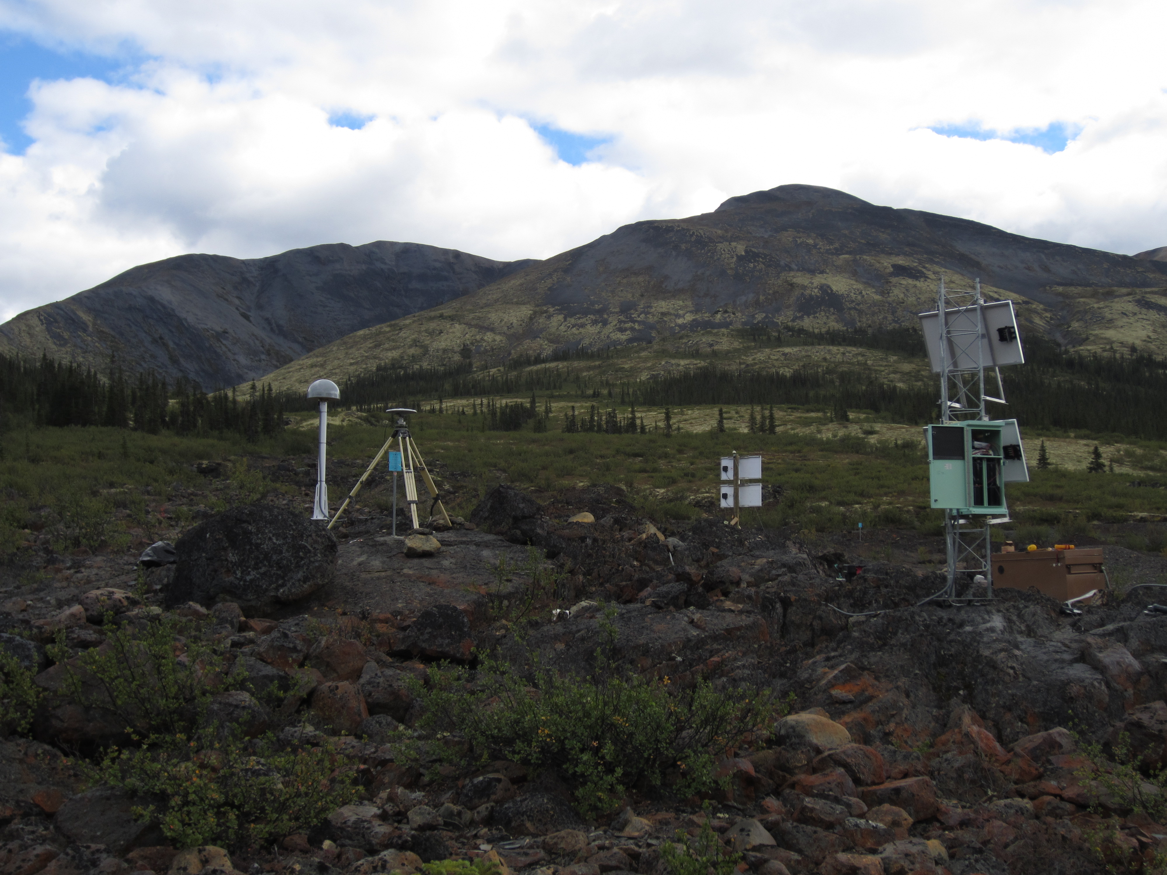
Weighing in at around 120 kilograms total, each station includes several components. There is the seismometer itself: a broadband sensor that records seismic energy across a range of frequencies. A datalogger and hard disk store the incoming data. For power, stations contain a complementary set of solar panels and lead acid and air cell batteries—solar panels reduce the number of batteries hauled to each station, and the air cells allow the stations to run throughout winter when light is low. Weatherproof housing protects the datalogger, disk, batteries, and electronics aboveground, while the seismometers are installed in temporary vaults just at the surface or down to 1.5 m deep, depending on the terrain.
The stations will run until summer 2018. Over the next couple of years, they will need periodic visits for maintenance and data collection. After the logistical hurdle of installation is cleared, a fantastic dataset will emerge, allowing scientists to fill in the blanks in this geophysical terra incognita.
Top picture: Installed seismometer and continuous GPS site, Yukon territory, Canada. Photo by Derek Shutt.


