

By Seth Stein, Carol Stein, and Eunice Blavascunas - Fall 2014
One of EarthScope’s major targets is the Midcontinent Rift (MCR), a 1.1 billion-year-old scar along which the continent started to split, just as Africa is rifting today along the East African Rift, but failed to form a new ocean. Although the rift’s volcanic rocks and sediments outcrop near Lake Superior, its arms are buried under thick sediment. Hence data from the Transportable Array and a multi-institutional flexible array survey called SPREE are being used to map structure at depth. In addition, gravity and magnetotelluric studies are being conducted.
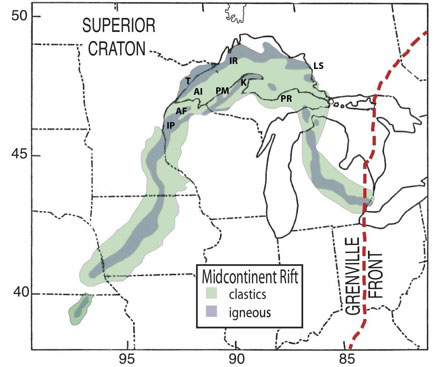
Initial results give new insight into the rift’s evolution. Although it was previously thought to have formed by midcontinent volcanism, it now seems to have formed as part of the rifting of Amazonia (Precambrian northeast South America) from Laurentia (Precambrian North America). Similarly, rifting seems to have stopped once seafloor spreading was established, rather than failing due to the Grenville orogeny, the collisions that assembled Amazonia and other continents into the supercontinent of Rodinia.
The MCR gives rise to spectacular scenery in national, state, or provincial parks near Lake Superior that provide an enormous but underutilized opportunity for park interpreters and educators. Unfortunately, many parks describe only local and sometimes only recent geology, rather than explaining how they are pieces of a huge ancient structure. Few explain that Lake Superior’s location reflects the rift. At Interstate Park, where a massive stack of volcanic flows is exposed, the visitor center explains only glacial geology. Keweenaw National Historical Park explains how copper mining shaped the area’s growth, but does not explain that the copper deposits resulted from the MCR’s volcanic rocks.
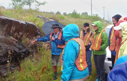
Drawing on our experiences studying the MCR and as an interpreter at Isle Royale National Park, we have developed a brief introduction to the MCR for interpreters (available at www.earth.northwestern.edu/people/seth/research/mcr. html) explaining in nontechnical terms what researchers know and are learning today. We seek to help interpreters understand and present how what one sees at a site fits into an exciting regional picture spanning much of the Midwest. This effort is part of an EarthScope program for educators that held its first workshop in August 2014.


