
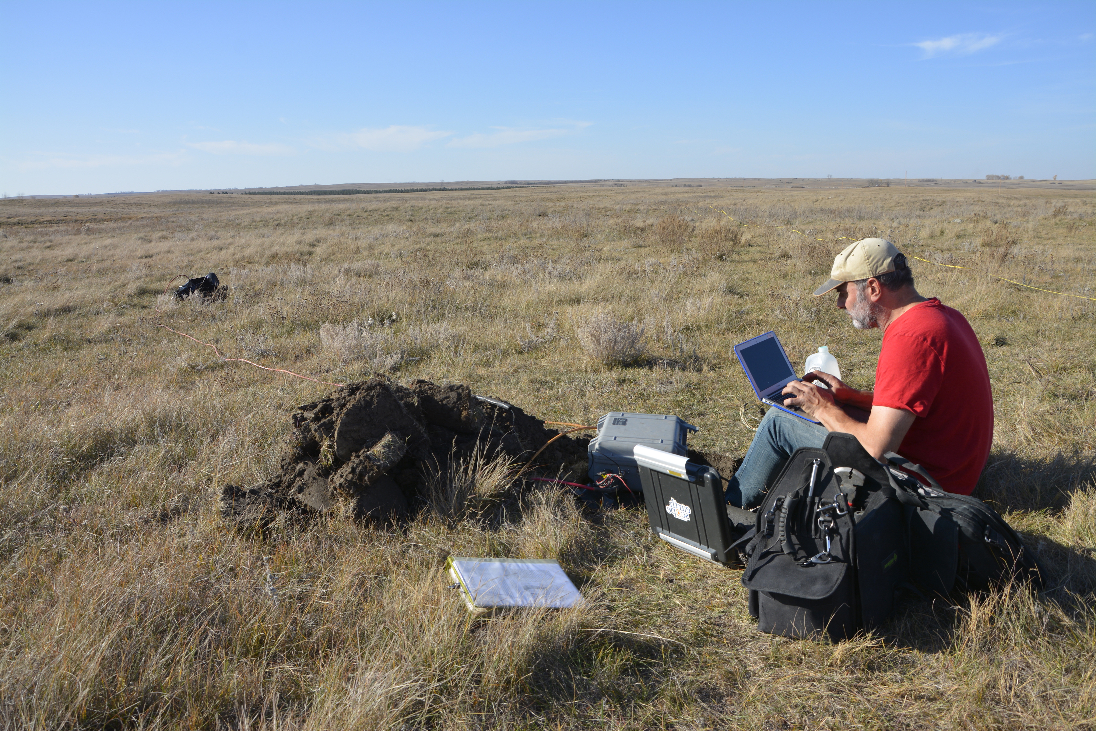
Above: Installing an MT-TA station (NDD28) near New Johns Lake, North Dakota, on October 19, 2017. (Image courtesy of Fred Anderson, North Dakota Geological Survey)
—by Andy Frassetto, IRIS
Since 2006, the EarthScope Magnetotelluric (MT) program has collected measurements of the Earth's naturally occurring electric and magnetic fields. Most of this work has been facilitated through a partnership between IRIS and Oregon State University to operate the MT-Transportable Array (MT-TA). Teams coordinated by OSU have deployed the MT-TA in discrete footprints during yearly campaigns, targeting regions in the contiguous US (Pacific Northwest, Mid-Continent Rift, and Eastern North America) chosen by the EarthScope community. The data are quality controlled and immediately distributed openly for anyone to use. Magnetotelluric observations allow researchers to determine electrical conductivity of the ground with depth. This provides a unique means to understand the movement and flow of the crust and mantle, map the distribution and circulation of fluids and volatiles, and understand the structure and evolution of the lithosphere (upper, solid mantle) and underlying asthenosphere (deeper, more fluid mantle).
As the MT-TA was deployed across the country, MT-Backbone (MT-BB) stations provided baseline observations at seven sites across the US from 2008-2013, and Flexible Array (MT-FA) experiments collected densely spaced observations on specific geologic targets in the Pacific Northwest and Mid-Atlantic regions. The National Science Foundation’s Directorate for Geosciences funded a completion of the MT-TA through New England as part of the Obama Administration’s Space Weather Action Plan, and the US Geological Survey has contributed MT observations in Florida, the Mississippi Embayment, and the Great Plains. Altogether, this has resulted in a rich dataset of observations over nearly two-thirds of the contiguous U.S. These observations have been archived at the IRIS Data Management Center, both as continuous timeseries and other data products for more direct analyses.
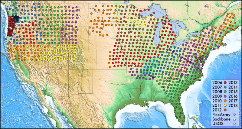
Above: Footprints of MT-TA (by year), MT-BB (now demobilized) and MT-FA (iMUSH, MOCHA onland, and MAGIC) stations. (Map by Andy Frasetto, IRIS)
In 2018, the final deployment of EarthScope MT-TA stations will join the footprints collected from the eastern and western U.S. over the previous 11 years. Like the “golden spike” that completed the first Transcontinental Railroad, this deployment of stations in the Great Plains will achieve a continuous swath of geoelectromagnetic observations from coast to coast. These measurements will contribute to a permanent legacy of EarthScope, which can be interpreted on their own or combined with other geophysical observations to enhance our understanding of the geology of North America.
In addition, MT measurements have societal benefit by helping to characterize regions where electric utilities may be vulnerable to the effects space weather. For instance, geomagnetic storms caused by solar flares are capable of producing Geomagnetically Induced Currents (GICs). In regions where the lithosphere has particularly resistive electrical properties (it slows electrical current), GICs may travel through electric transmission lines and pipelines, accelerating the wear and tear on this infrastructure and causing power outages. In March 1989 the effects of GICs caused a blackout in eastern Canada that affected 6 million people for 9 hours. Ongoing dialog with stakeholders in the power industry may support the completion of the MT-TA in the southern tier of the states in future years. For more information, visit the USArray website.


