
This issue focuses on two videos available to the public through the UNAVCO and IRIS websites.
Alaska: Tectonics and Earthquakes
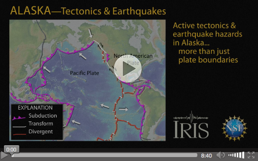 Watch concepts like strike-slip faults, shallow and deep earthquake distributions, megathrust earthquakes, and the accretion of geologic terranes come alive through narrated illustrations. This animation uses the basic geologic concepts and terminology that you have taught your students to introduce them to the range of tectonic activities across the Alaskan subduction zone. Students gain a better understanding of how shallow subduction beneath southern Alaska drives uplift and earthquakes in the Alaska interior, and how subduction of an oceanic plateau triggered the Great Alaska earthquake of 1964. As this plateau—the Yakutat terrane—continues to move, it acts as a “geologic snowplow” that shoves immense blocks of crust counterclockwise and continues to drive the Alaska and the Chugach–St. Elias Ranges upward. (Video length: 8.40 min)
Measuring Drought with GPS
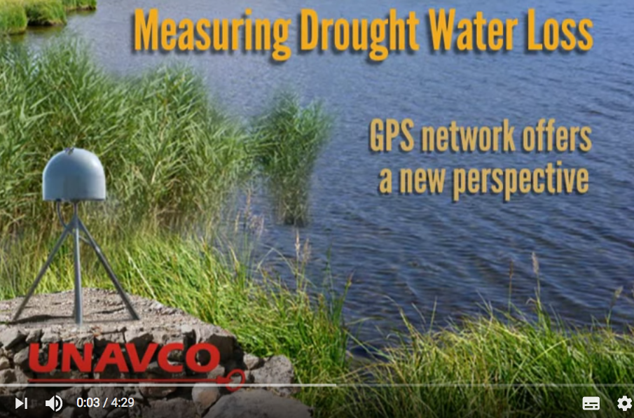 The recent drought across the western U.S. caused land levels to shift over the past few years. How do GPS instruments record these changes? In this visualization, students learn how a GPS network, composed largely of EarthScope’s Plate Boundary Observatory operated by UNAVCO, captures seasonal and long-term changes in water levels and snowpack. During the drought, peaks of the Sierra Nevada rose because they weren’t weighed down with snow. The opposite happened in neighboring valleys, where land sank because water was sucked out of the ground for farming. Using GPS instruments, scientists figured that a whole year’s worth of rainfall was lost. (Video length: 4.29 min.)


