
By Kerry Klein - Winter 2016
At first blush, the Mackenzie Mountains in northern Canada could be the Rocky Mountains’ long lost sibling. They appear just as angular and majestic as the more southerly range, but they’re 1400 meters shorter and roughly 25 million years older. Gaze up at their bald peaks and you’re likely to spot more caribou, too.
What really sets the Mackenzies apart, though, is their unlikely tectonic history. Stretching as far as 1000 km from the nearest plate boundary, straddling the border between the Yukon and Northwest Territories, they’re practically in the middle of the continent. And while the Rockies, similarly far from a plate boundary, stopped growing around 50 million years ago, the Mackenzies are still active today. “It seems like they uplifted before the Rockies uplifted, then that stopped,” says seismologist Derek Schutt of Colorado State University in Fort Collins—and then, sometime in the last few million years, they reactivated. “They’re still uplifting now and popping off earthquakes.”
What’s happening underneath these mountains is the focus of an ambitious new EarthScope project with Schutt at the helm. Over the next five years, he and colleagues from Colorado State, University of Alaska Fairbanks and Yukon College in Whitehorse will collect and analyze seismic and GPS data from the region—the most comprehensive subsurface data collected there to date. The team hopes their analyses will paint a picture under the mountains as deep as the mantle and help provide geological context for the entire northwestern corner of North America. “We’re not refining existing results; we’re looking at unexplored territory,” says Schutt. “It’s a wonderful opportunity.”
Schutt first heard about the Mackenzie Mountains from a colleague at a 2009 EarthScope meeting. Pascal Audet, a geophysicist from the University of Ottawa who set up some of the few seismometers already near the Mackenzies, lamented the scarcity of seismic data and research infrastructure in the area.
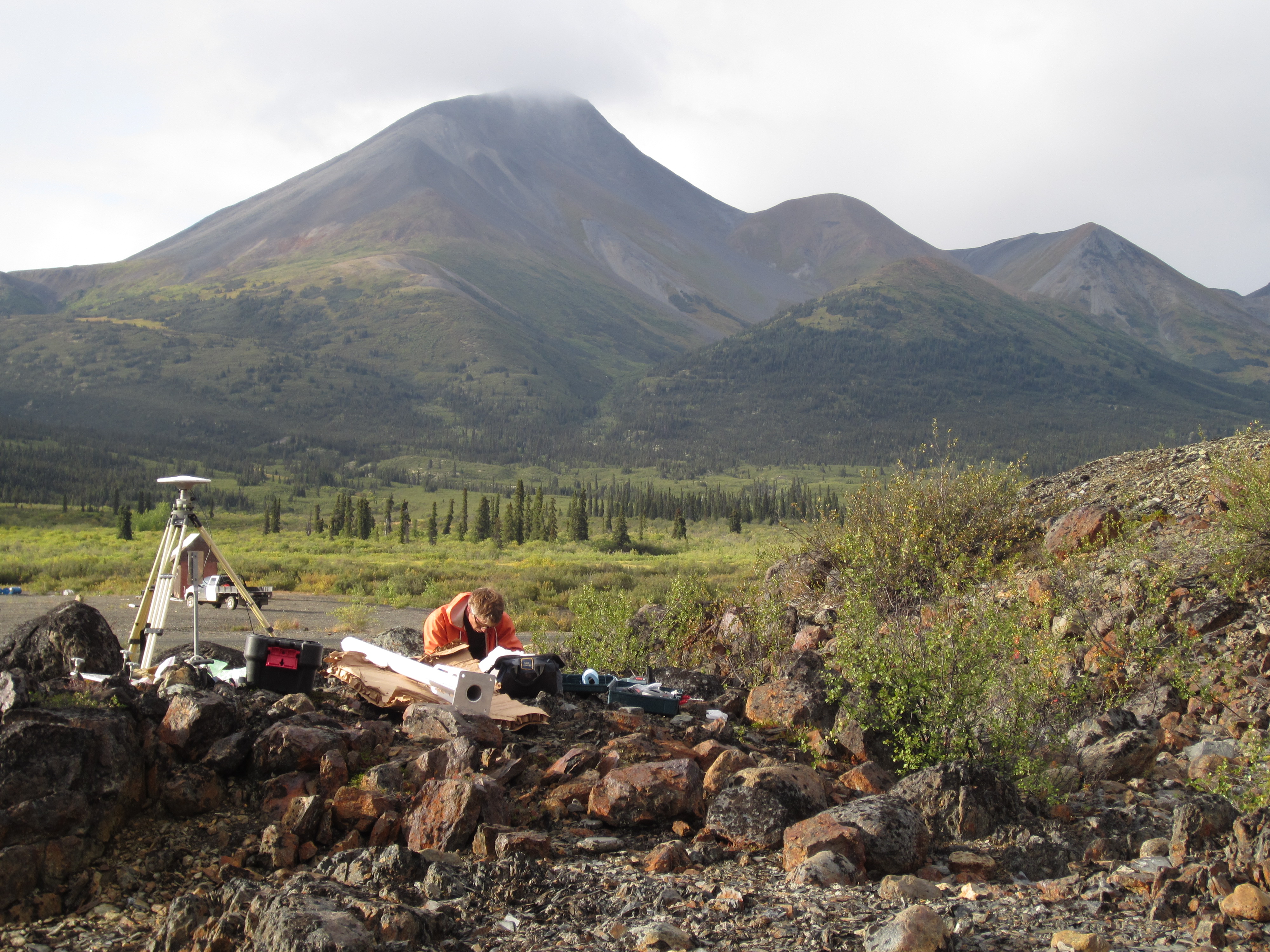
The conversation drove Schutt to create the Mackenzie Mountain EarthScope Project. Now in its second field season, the project is slated to install 40 seismometers and a handful of GPS units along a 1000-kilometer-long transect across the mountains. It will connect the Transportable Array’s easternmost seismometers in Alaska and the Yukon to the highly studied North American Craton in the Northwest Territories. The units will be deployed for two years, designed to survive 8-month winters and the curiosity of bears and musk ox.
Schutt and his team will come away with high-resolution tomographic images and seismic velocity maps extending hundreds of kilometers into the mantle. They hope a clearer idea of the thickness of the crust and the temperature and strength of the mantle will illuminate the processes that both created the Mackenzie Mountains and kicked them back into motion.
“People used to think all the action was in the crust,” says Rick Aster, head of Colorado State’s geosciences department and a seismologist on the project. “But we’ve learned that there’s lots of structures in the mantle that influence the high topography of the Earth.”
Based on models developed by others, the team posits that the Mackenzies are fundamentally connected to the Yakutat terrane, an unusually thick chunk of oceanic crust that’s colliding with Alaska between Juneau and Anchorage. If the base of the crust in the Yukon Territory is mostly hot and weak, stress from the collision could be shifting the upper part of the crust towards the northeast. Eventually, the slab bucks up against thicker, stronger lithosphere beneath the mountains and the Canadian Shield and pushes the crust along with it. “The Mackenzie Mountains are just kind of rolling up against the Canadian Craton,” posits Schutt; “kind of like you were pushing a rug against the wall.”
This crumpling motion is shortening the mountains by a few millimeters per year, says geophysicist Jeff Freymueller of the University of Alaska Fairbanks. Also causing this motion, he says, is isostatic rebound from the last glacial period. He hopes that two years of observation will be long enough to disentangle these two forces. “One concern will be whether we can get enough data,” he says. “You have to wait for the earth to move before you can really measure the signal.”
Joel Cubley, a geologist at Yukon College, helps coordinate local logistics for the project and looks forward to getting his undergraduates involved as field assistants. Yukon College is a two-year technical school, and he says that few students get the opportunity to learn outside the classroom. “Our hope is it shows them the possibilities and potential out there for geoscience,” he says, “and might get them invested enough to keep going.”
Northwest of Whitehorse, geophysicist Michael Schmidt, science coordinator for the Kluane Lake Research Station, is excited for these seismometers to join the Transportable Array in northwestern Canada. “It will hugely compliment that and give us a really nice profile across the mountains,” he says. “It’ll just be pretty exciting to see what comes out of here.”
When Schutt looks up at the Mackenzie Mountains, he doesn’t see a mountain range dwarfed by the peaks in his backyard in Colorado; he sees new horizons. “Anytime we put instruments out, we learn something new,” he says. “It’s just like going to Pluto with a space probe.”
Photo: Max Kaufman, Research Assistant with University of Alaska Fairbanks, gets ready to install a continuous GPS station at Macmillan Pass, near the Yukon Territory-Northwest Territories border. Photo by Derek Schutt.


