
by Beth Bartel and Elisabeth Nadin - Fall 2016
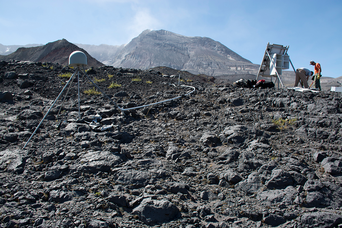
Mount St. Helens was studded with thousands of instruments for the relatively short-term objectives of the iMUSH project, but her restless nature requires long-term monitoring as well. The iMUSH team also incorporated a four-station borehole geophysics network that is part of EarthScope’s Plate Boundary Observatory (PBO). Borehole seismometers and strainmeters record many small earthquakes and are poised to record any sudden movements related to magma migration. The iMUSH team used data from the seismometers, which often yield the cleanest, quietest, clearest seismic signals because they are installed in holes around 750 ft deep.
Along with the eight tiltmeters and 17 continuous GPS stations on and around the volcano that are also part of PBO, the borehole instruments monitor volcano deformation that is likely linked to eruptions. Maintaining continuous data for these instruments is challenging, yet critical for researchers as well as for partners at the U.S. Geological Survey charged with monitoring the volcano's activity. The GPS stations, for example, have recorded the slow inflation of the volcano since the end of its 2004–2008 eruption.
PBO instruments plug away through the snowy winters, facing snowpacks and snowdrifts that sometimes reach a crushing thickness of 30 ft. Heavy rime ice can distort GPS signals. They collect data year-round thanks to large battery banks and well-anchored fiberglass huts designed to resist snow damage.
For more on how UNAVCO keeps PBO stations running on Mount St. Helens, check out this short video:
Top image: Instruments near the summit of Mount St. Helens capture its every move. (photo credit: Beth Bartel, UNAVCO)


