Summer 2016
Over the years, an array of tools, modules, and activities applying EarthScope scientific data have been developed for a wide variety of users. K–12 and university educators, or informal programs like museums, can benefit from these freely available resources. inSights will feature two examples in each issue. Find more links to resources on our website.
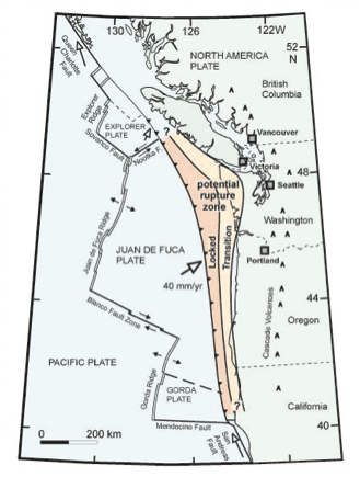 Investigating Episodic Tremor and Slip: Mysterious motions along the California Coast
This one-hour activity, designed for high-school and early undergraduate students, teaches about Episodic Tremor and Slip (ETS) and how it differs from the traditional earthquake cycle. In small groups, students consider local tectonic boundaries, investigate earthquake history using the IRIS Earthquake Browser, and analyze GPS displacement and seismic data from the Cape Mendocino, CA region
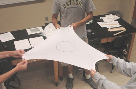
Infinitesimal Strain Analysis Using GPS Data: Module for structural geology or geophysics
Through analysis of GPS displacement velocity data from the Plate Boundary Observatory (PBO), undergraduate structural geology students investigate ongoing (infinitesimal) strain. Optional short lab exercises introduce the idea of strain and how to find location and velocity data for PBO GPS stations. Students consider GPS data from three stations arrayed in a triangle, assess how the ellipse inscribed within this triangle deforms, and relate the deformation to regional geology, tectonics, and ongoing hazards. This module was designed for structural geology but could be applied to geophysics, tectonics, or physics courses. Elements from the module can be used as a single lab activity or extended over several weeks.