
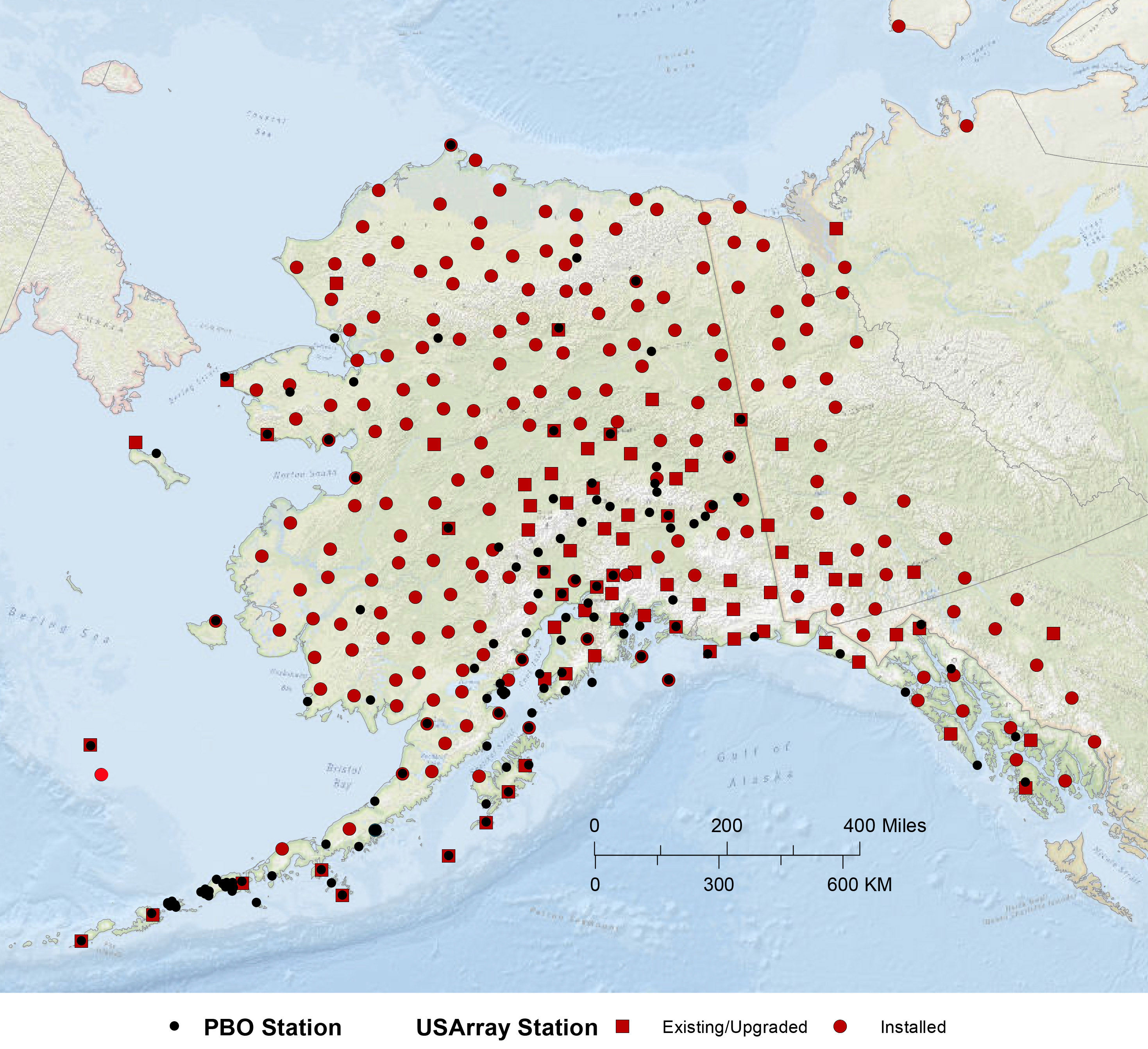
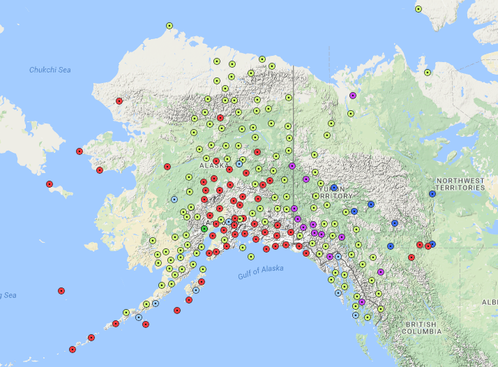
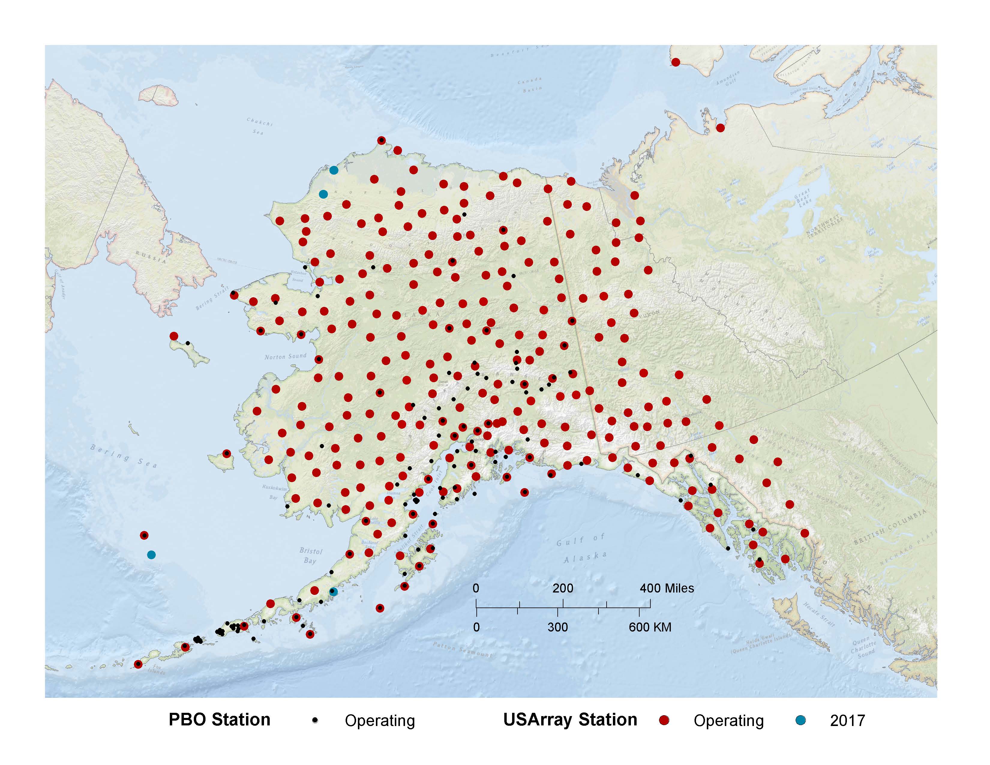
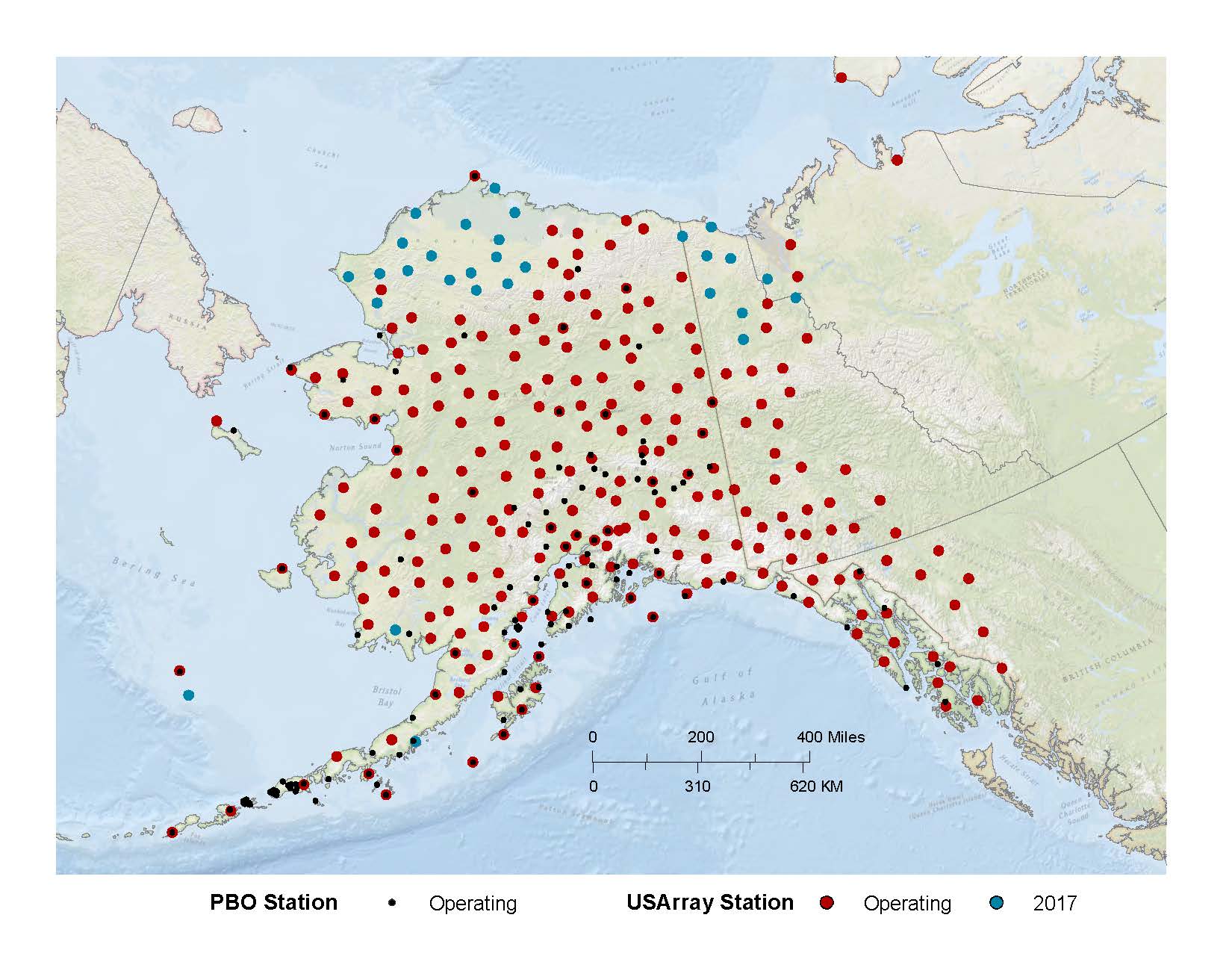
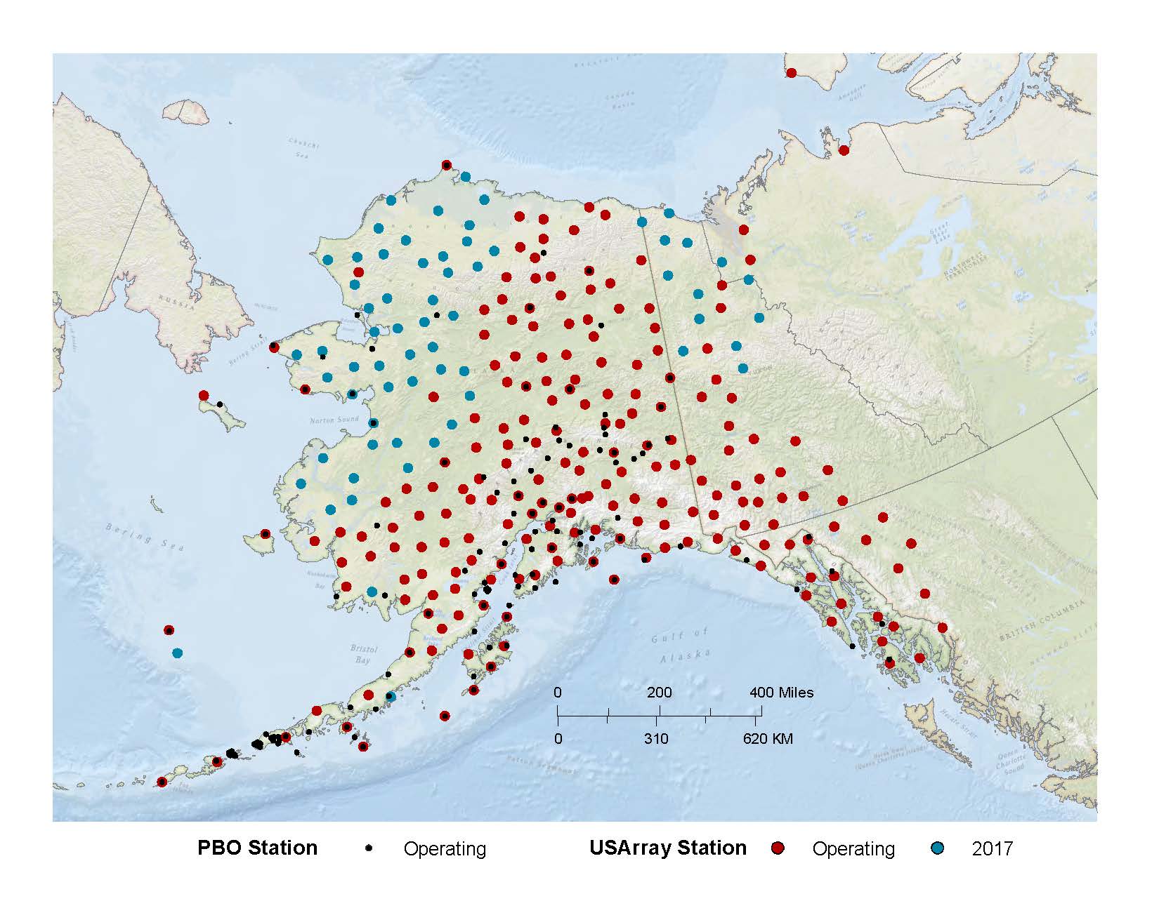
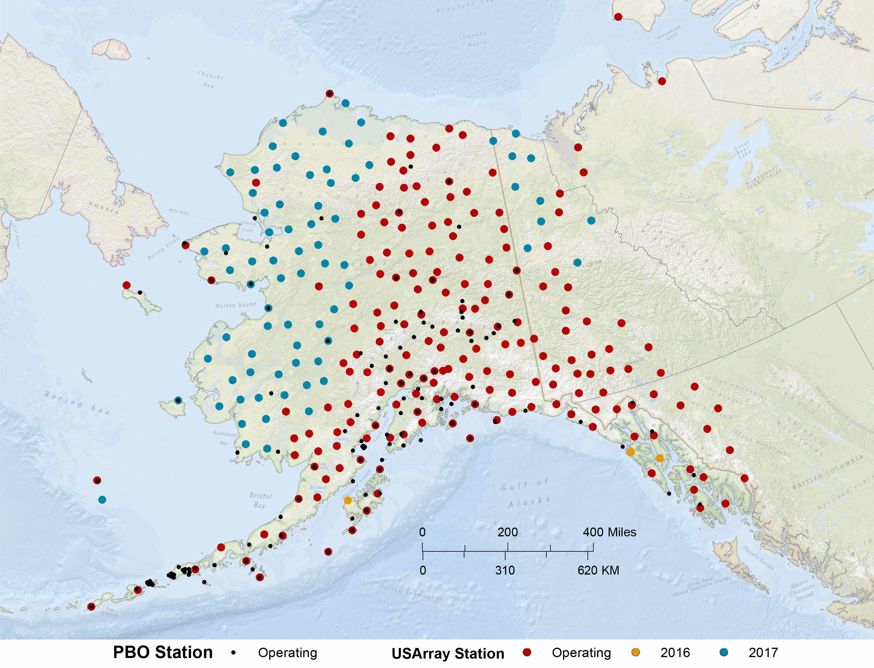
Overall EarthScope Network in Alaska (April 2019)
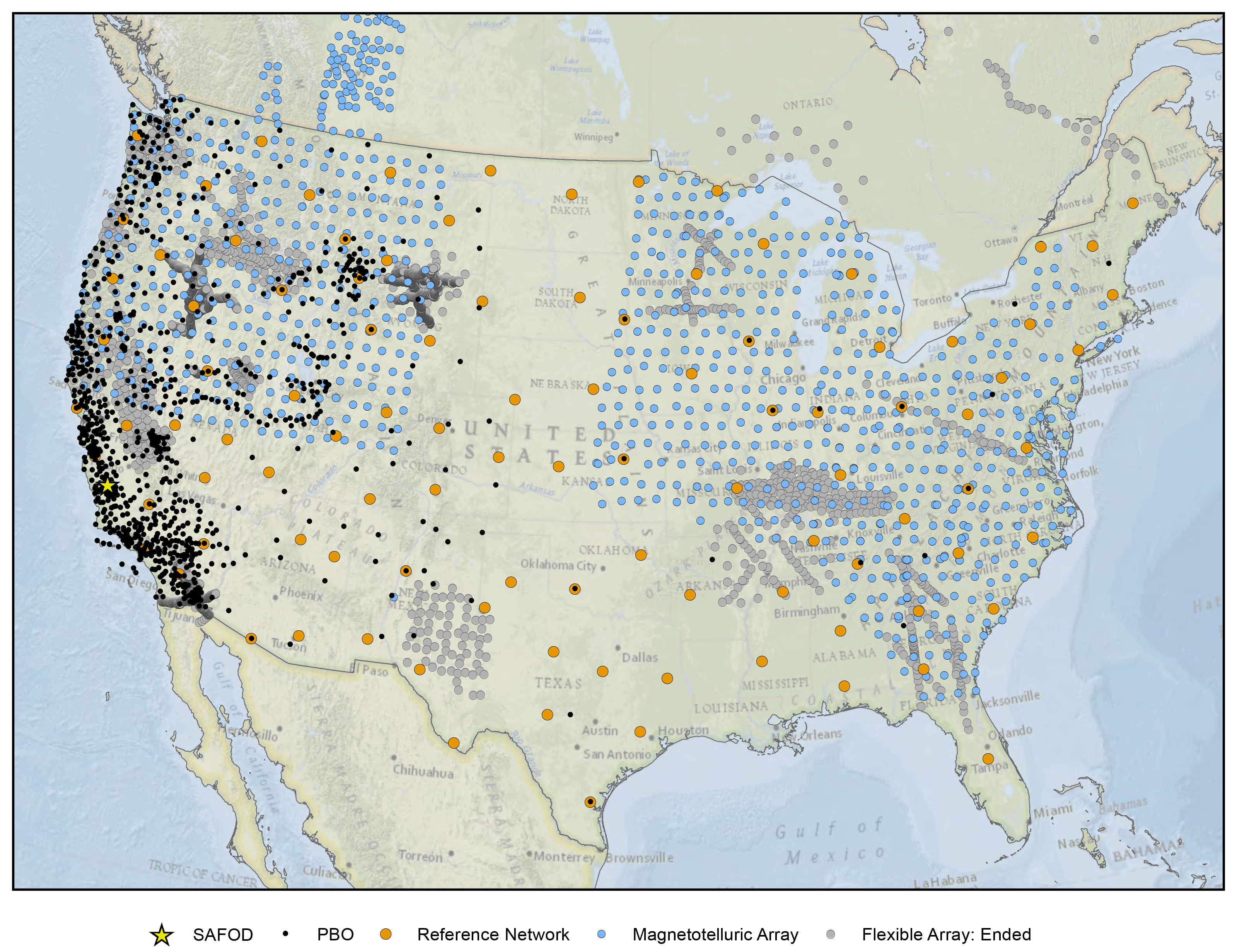
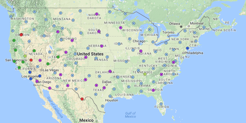
EarthScope overall map in Continental US (September 2017)
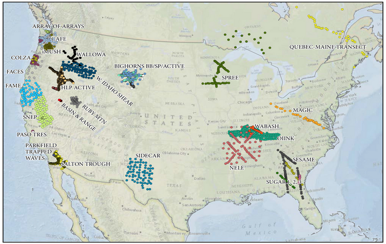
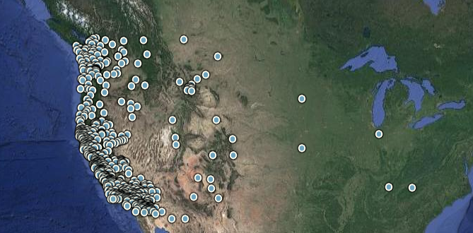
USArray Flexible Array maps
Click here to see Interactive PDF map with links to individual projects
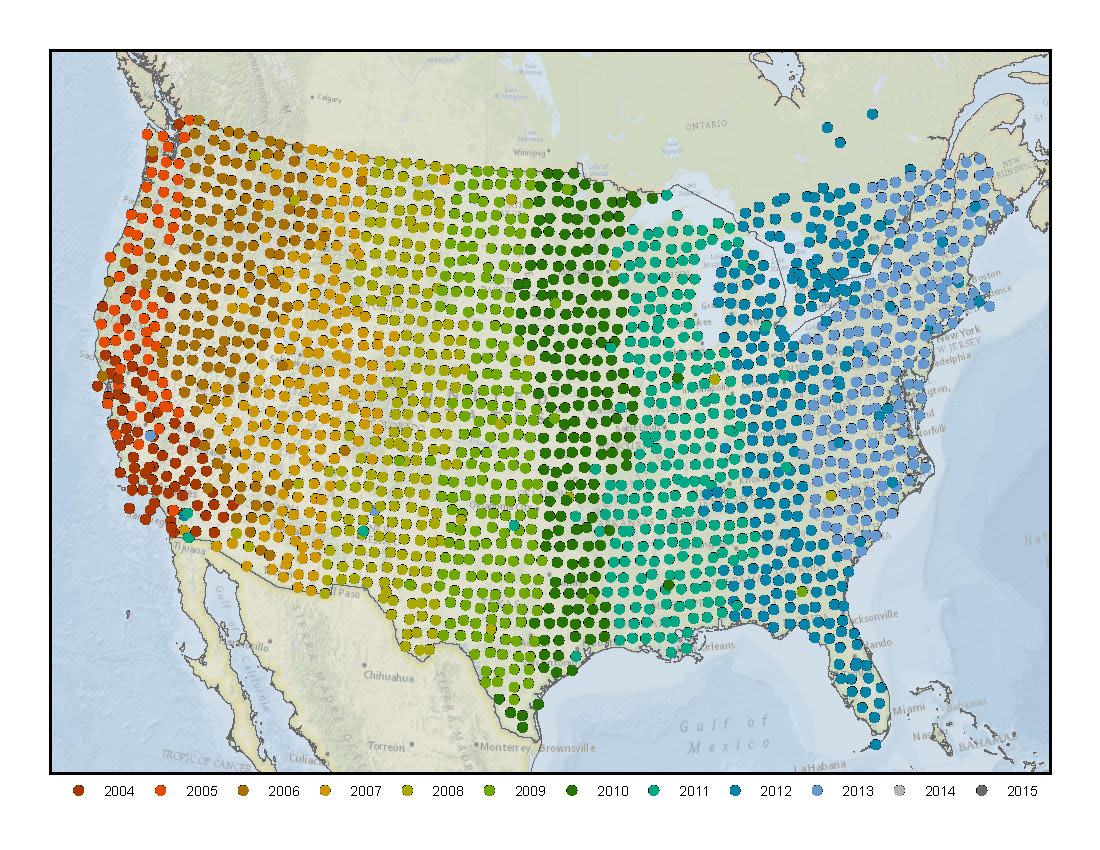
EarthScope USArray Installation Over Time in Continental US
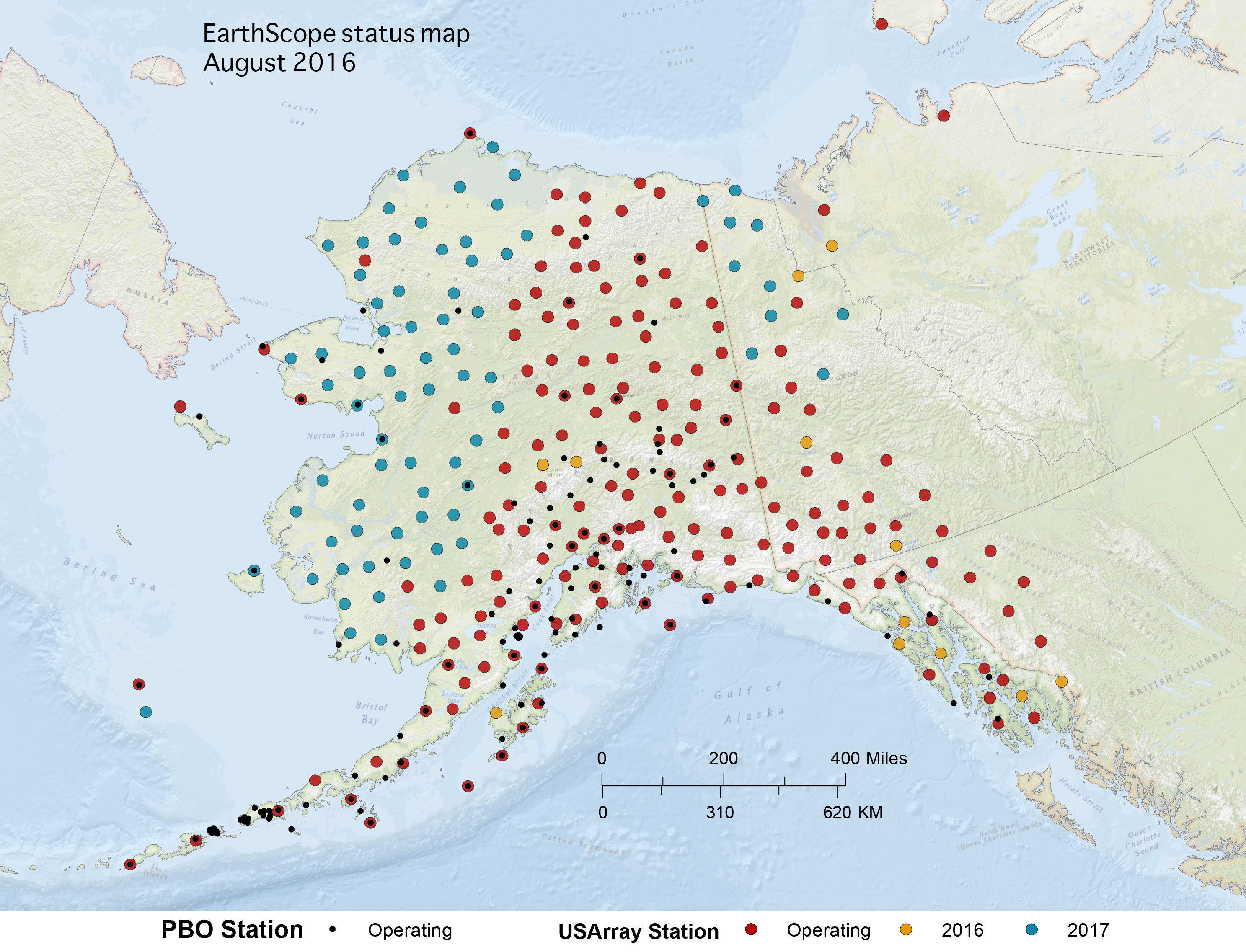
A variety of EarthScope-related maps are hosted by EarthScope and by our partners.
Unless specified, all USArray maps presented here are from IRIS (USArray webpage), and PBO maps from UNAVCO (PBO webpage). Click open the drop down menus below to see overall maps, USArray maps or PBO maps. Contact our office if you are looking for something specific.
| Year | JPG | |
|---|---|---|
| June 2015 | JPG | |
| May 2015 | JPG | |
| April 2015 | JPG | |
|
February 2015 |
JPG | |
|
December 2014 |
JPG | |
|
September 2014 |
JPG | |
|
July 2014 |
JPG | |
|
May 2014 |
JPG | |
|
April 2014 |
JPG | |
|
February 2014 |
JPG | |
|
January 2014 |
JPG | |
|
November 2013 |
JPG | |
|
October 2013 |
JPG | |
|
September 2013 |
JPG | |
|
August 2013 |
JPG | |
|
July 2013 |
JPG | |
|
June 2013 |
JPG | |
|
April 2013 |
JPG | |
|
January 2013 |
JPG |
TA stations (IRIS)
The Transportable Array is a set of 400 broadband stations that will, over the 10 year course of the project, traverse the conterminous United States. The DMC receives 40 and 1 samples/second seismic data streams from each site in addition to related state-of-health data in real-time. Since mid-2010, atmospheric sensors have been installed at the TA stations. Information about these sensors is available at usarray.org Atmospheric.
| Map Data | Description |
|---|---|
| Operating Stations Google Map | Operating TA stations as a web-viewable Google Map |
| Operating Stations KML | Operating TA stations as a KML NetworkLink (e.g. for Google Earth) |
| Operating Stations Map GIF | Operating TA Network stations as a GIF image file, conterminous US only |
| Operating Alaska Stations Map GIF | Operating TA Network stations as a GIF image file, Alaska region only |
| All Stations Google Map | All TA stations (past and present) as a web-viewable Google Map |
| All Stations KML | All TA stations as a KML NetworkLink (e.g. for Google Earth) |
| All Stations Map GIF |
All TA stations as a GIF image file, conterminous US only |
Reference Network stations, conterminous US only (IRIS)
The Reference Network is composed of permanent stations at a roughly 300 km spacing across the United States and includes the 39 EarthScope-funded Permanent Array stations. The DMC receives 40 and 1 samples/second seismic data streams from most sites.
| Map Data | Description |
|---|---|
| Stations Google Map | Permanent Array stations as web-viewable Google Map |
| Station KML | Reference Network stations as a KML file (e.g. for Google Earth) |
| Stations Map GIF | Reference Network stations as a GIF image file, conterminous US only |
| Alaska Stations Map GIF | Reference Network stations as a GIF image file, Alaska region only |
The Flexible Array is a set of broadband and active-source oriented instruments deployed on a temporary basis according to individual proposal (the PASSCAL model). Data rates and availability from Flexible Array deployments depend on the individual proposals. Find this map above & more information on Flexible Array Projects here.
| Map Data | Description |
|---|---|
| Operating Stations Google Map | Operating FA stations as a web-viewable Google Map |
| Operating Stations KML | Operating FA stations as a KML file (e.g. for Google Earth) |
| Operating Station Map GIF | Operating FA Network stations as a GIF image file, conterminous US only |
| All Stations Google Map | All FA stations (past and present) as web-viewable Google Map |
| All Stations KML | All FA stations as a KML NetworkLink (e.g. for Google Earth) |
| All Stations Map GIF | All FA stations as a GIF image file, conterminous US only |
| Interactive Flexible Array Map | Map provided by EarthScope National Office |
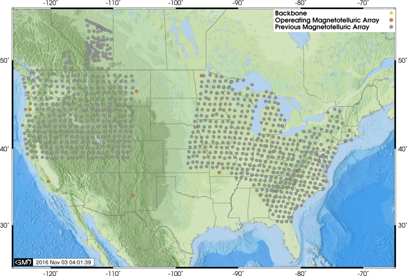
The magnetotelluric (MT) component of USArray consists of 7 permanent MT stations and a mobile array of 20 MT stations that will each be deployed for a period of about one month in regions of identified interest with a spacing of approximately 70 km.
| Map Data | Description |
|---|---|
| Operating Stations Google Map | Operating MT stations as web-viewable Google Map |
| Operating Stations KML | Operating MT stations as a KML file (e.g. for Google Earth) |
| Operating Stations Map GIF | Operating MT Network stations as a GIF image file, conterminous US only |
| All Stations Google Map | All MT stations (past and present) as web-viewable Google Map |
| All Stations KML | Magnetotelluric stations as a KML NetworkLink (e.g. for Google Earth) |
| All Stations Map GIF | All MT stations as a GIF image file, conterminous US only |
PBO Network (UNAVCO)
PBO's network of 1324 permanent continually-operating stations spans the rapidly-deforming Pacific/North-American plate boundary in the western United States and Alaska, with additional stations on the stable continental interior. PBO maps from UNAVCO (PBO webpage).
| PBO Station Locator Google Map | All PBO stations as a web-viewable Google Map |
| PBO Real Time Google Map | Subset of PBO stations-viewable Google Map |
| PBO Velocity Poster Map | Velocities of Global Positioning System (GPS) stations on posters |
PBO only static map (Archived, from ESNO)
| Year | JPG |
|---|---|
| April 2015 | JPG |
| April 2014 | JPG |
| April 2013 | JPG |


![EarthScope Footprint Continental US [JPG]](../sites/default/files/2017-10/2017_09_15_All%20Arrays_01_sm-2.jpg)
![USarray over time (Continental US) [PDF]](../sites/default/files/2016-11/2016_08_17_Lower%2048%20Map.jpg)
![EarthScope in Alaska (overall) [JPG]](../sites/default/files/2017-10/2017_10_06_PBO%20and%20USArray%20Monthly%20Map_color.jpg)