
Researching, testing and better understanding all the movements and complexity below our feet, allows us to know our planet better, share this information and better prepare for natural disasters.
Discover EarthScope TOP 10 Discoveries here
Locating Earthquakes
 The earth’s crust is filled with fractures beneath our feet. These fractures are called faults by geologists. When enough stress concentrates near these cracks in the earth, they rapidly slip, causing earthquakes. A famous fault is the San Andreas fault in California. Earthquakes occur all over the US continent with a concentration in the west, where the Pacific plate slides under the North American plate. The United States experiences thousands of earthquakes every single year, with more than 40,000 recorded in 2014 in Alaska alone! California has long been the second-most seismically active state, and has the highest risk of loss of life from earthquakes because of its large population and densely built environment. Elsewhere in the United States, where the chances of a powerful earthquake are not as high, smaller earthquakes can still cause a lot of damages as infrastructure is not built to resist seismic events.
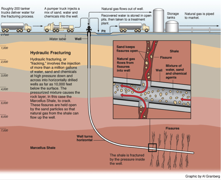
Recently, this has become a serious issue in some parts of the central and eastern United States due to earthquakes that likely are being triggered by human activities. Over the last 15 years, for example, the rate of earthquakes in Oklahoma has increased by more than 400%, with 890 magnitude 3 or larger earthquakes recorded in 2015. EarthScope seismometers have helped locate earthquakes in the central US more accurately, which allow scientists to identify the likely cause of most of them: wastewater injection that resulted from oil and gas hydraulic fracturing, or fracking. Learn more about it here.
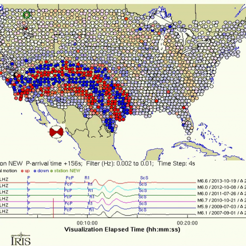
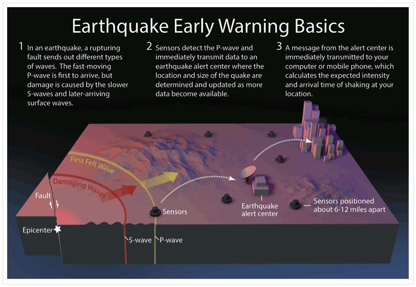
Earthquake Wave Animation
Watch Now!
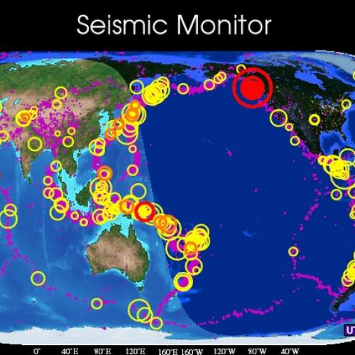
IRIS Earthquake Monitor
Click here!
What is your Birthquake?
Click here!
Understanding earthquakes and knowing what to do in case of one is important and can save your life!
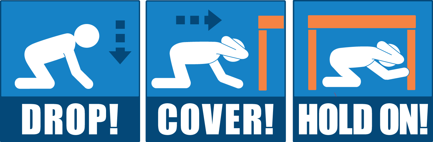
Learn more about earthquakes in the US and how to keep informed and safe:
USGS / 7 Steps to Earthquake Savety / Alaska Earthquake Center
ShakeMaps / National Earthquake Information Center
Tsunami Warnings
 Tsunamis are sea waves that are caused by sudden displacements of the sea floor due to earthquakes, landslides or volcanic eruptions. While some of these waves can be small, large tsunamis can cross wide ocean basins and put thousands of lives in danger while also causing millions of dollars in damages. Scientists discovered that EarthScope PBO network (GPS instruments) could be used for tsunami early warning system in two ways: by measuring how much the Earth moves during an earthquake and by tracking the water waves as it compresses the atmosphere above it.
Learn more about Tsunamis and how to keep informed and safe by clicking on these buttons:
NOAA / Getting prepared for tsunamis
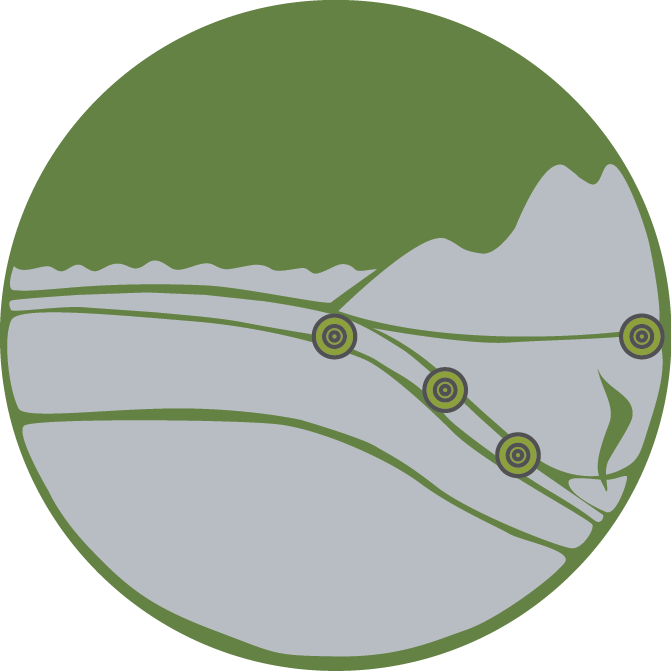
Monitoring Volcanoes
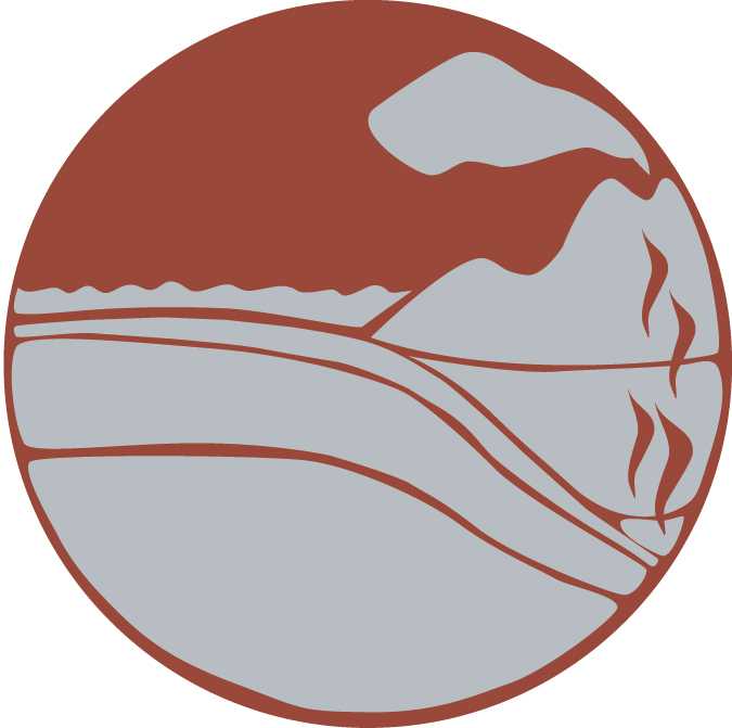 There are 169 geologically young volcanic systems in the United States. Most of those are located in Cascadia and Alaska, which alone hosts 52 volcanoes that have erupted within the past 200 years. Volcanic eruptions pose serious hazards to local and global populations and infrastructure. Explosive eruptions produce volcanic ash, a mixture of finely pulverized glass, rock, and small pieces of mineral. This volcanic ash is destructive to aircraft, forcing airplanes to stay on the ground; it damages buildings and other infrastructure. Volcanic mudflows, called lahars, can sweep down river and stream channels, threatening lives and property downstream. Fine particles can also create health issue. Better understanding how active volcanoes work is one of many applications of EarthScope-based research. Instruments used by scientists for research also helps monitoring Volcanoes which can save lives and money.
Earthquakes near and beneath volcanoes alert scientists that magma and volcanic gases may be on the move. This animation represents generalized patterns of seismic and geological activity at some, but not all, long dormant stratovolcanoes worldwide during the months to hours leading up to an eruption.
Learn more about Volcanoes and how to keep informed and safe by clicking on these buttons:
US & Global Volcano Hazards & Information Programs:
Hazards & information about Alaska Volcanoes and Hazards :
AVO / AEC / Alaska Science Center

You have questions about earthquakes, tsunamis, and volcanoes? A science communicator from IRIS, UNAVCO, SCEC and USGS might have already answered it during this Reddit AMA! Click here to check it out!


