
Understanding Continental Structure and Evolution
EarthScope is helping us observe the North American continent on an unprecedented scale. These observations are needed to develop a new, physics-based description of the dynamics of the whole Earth.
EarthScope data provide a comprehensive image of the deformation field and material properties of North America and the way it changes and evolves through time. These data reveal details of active plate boundaries, complex patterns of rock deformation, mountain building and the variations in physical and chemical properties that result from billions of years of continental evolution.
Researchers are asking questions such as how is the continental lithosphere formed, and what makes some parts stable over hundreds of millions of years while others are actively deforming? What relates continental structure to deformation? How has the North American continent been assembled and modified over time?
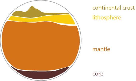
Looking Deep into Earth’s Structure
A better understanding of the deep earth, the mantle below the crust, and how the deformation or stability of the continental lithosphere is related to upper mantle processes is a primary goal of EarthScope. The scientific questions that can be addressed within the framework of EarthScope fall into two broad classes. The first concerns the connection between the deep mantle and relatively shallow structures immediately beneath the North American continent. The second concerns the structure and composition of the lower mantle and core.
Scientists want to know how and where are forces generated in the upper mantle? How are these forces transferred to the crust?
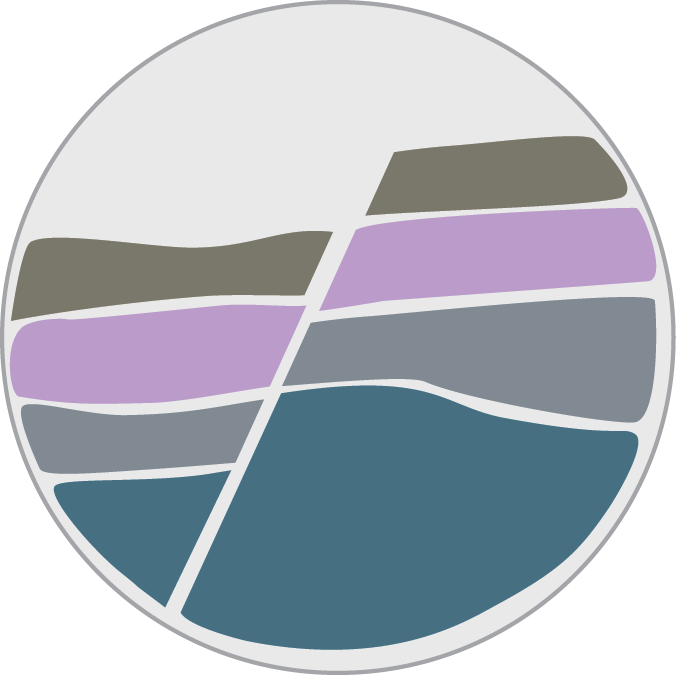
Understanding Earth’s Deformation - Crustal Strain
 Geologists use the terms stress and strain, commonly thought of as synonyms in everyday life, to describe how and why rocks deform. Stress is the force that acts on the rock while strain describes how the rock responds to that force.
The Pacific/North American plate boundary zone provides us with an actively deforming natural laboratory to study how stress builds up over time due to tectonic motions; motions which eventually result in earthquakes. We term this the “earthquake cycle”, and it depends on processes that occur over a wide range of time scales, from seconds to millions of years.
How the solid Earth responds to deformational forces depends on rock type, temperature and pressure, deformation history, and the presence or absence of fluids. The details of these relationships still have considerable uncertainty, which prevents us from accurately predicting the impacts of stress changes caused by, for example, earthquakes or the melting of ice sheets.
Scientists are asking questions such as how the crust and mantle respond to stress and strain varies with rock type and depth? How does proximity to a fault zone change lithospheric response to stress and strain? How is stress distributed in the lithosphere?
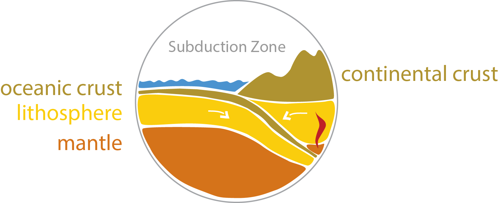
Where Tectonic Plates Collide - Convergent Margins
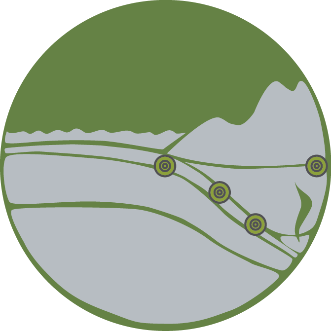 Convergent boundaries between tectonic plates, where two plates collide and one is subducted under the other, are some of the most dynamic geological environments on Earth. The largest earthquakes and majority of volcanic eruptions take place here. Every subduction zone has several distinct zones of earthquakes associated with it. Very large earthquakes occur on the main thrust zone, where the oceanic plate pushes down beneath the continent. Studies show complex geologic behavior during these events that we still do not fully understand.
The two sides of the main thrust interface slip past each other at a variable rate, producing not only earthquakes but also slow slip events that can have as much fault motion as large earthquakes but produce only a weak seismic tremor signal instead of strong ground shaking. Researchers are trying to discover why this happens and how the slow fault motions are related to characteristics of large and potentially damaging earthquakes.
Researchers are able to use EarthScope’s data to ask questions such as: What is the deep slab and upper mantle structure? How does this relate to the earthquakes in the slab, or to deformation of the overriding continent? How do these processes aid the growth of the continent as time marches on?
Unlocking the Secrets of Faults and Earthquakes
EarthScope is enabling us to observe the processes and properties of faults that underlie the earthquake cycle. EarthScope data provide critical new information ranging from the rupture process of a large earthquake to the effect of millions of years of fault and plate boundary evolution. These data show us how the Northern American continent has changed over time, and understanding these processes can help us unravel how continents in general evolve over time.
Scientists are using EarthScope instruments and data to delve deeper into the nature of earthquakes than ever before. They want to know how do earthquakes start, rupture and stop? What structural factors give rise to the seismicity of intraplate regions? How does strain accumulate and release at plate boundaries?
Imaging the Pathways of Fluids and Magma within the Earth
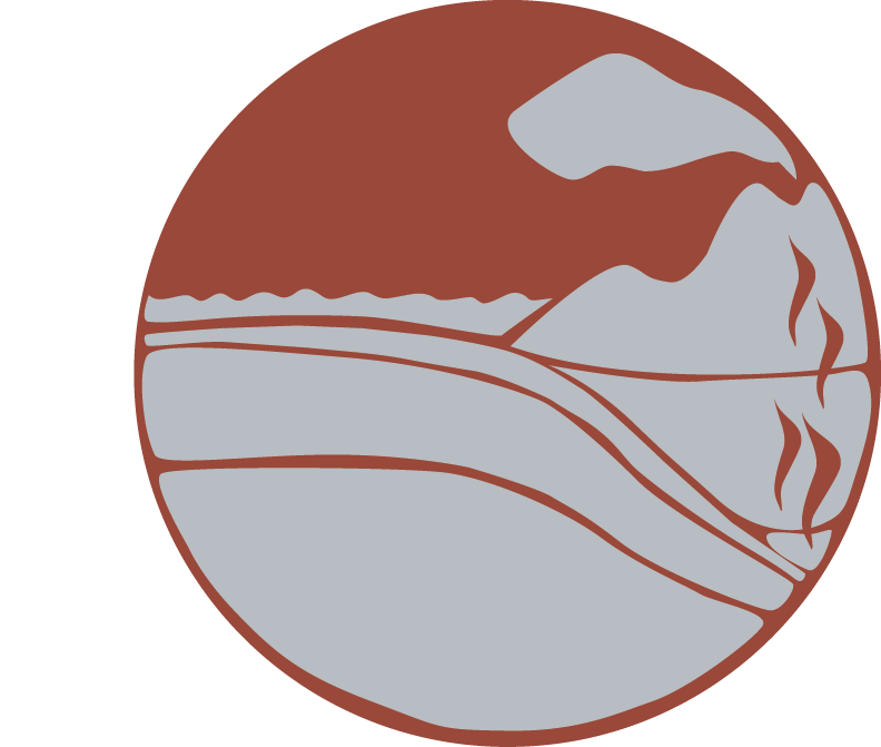
North America hosts a diverse array of active magmatic systems including the continental and oceanic convergent margin volcanoes of Cascadia and Alaska, the large volume and widespread eruptions associated with extension in the Basin and Range, and the Yellowstone volcanic system. Eastern North America contains ancient volcanic systems that can tell us about the long-term dynamical evolution of the eastern continental margin.
EarthScope's scientists are researching these volcanic systems using a diverse set of tools. Their goal is to get a clearer picture of how magmas are generated in different tectonic regions in North America and answer some of these questions: how melting occurs in the lithosphere? What are the physical and chemical controls on magma migration? What are the key factors that govern the timescales of eruptive activity?


