
Enjoy these excellent Earth Science educational animations, video lectures, and other electronic resources for Earth science educators.
You are doing place-base education and are looking for more regional content? Our regional workshop page might have information and activities for you and find some interesting EarthScope science project highlights in our interactive map.
"Connect with Scientists" : watch videos from our EarthScope Youtube Channel
I use EarthScope Data playlist: EarthScope National Office asked scientists using EarthScope data to describe their project in less than a minute.
EarthScope Chronicle Series playlist: Watch these short videos to learn about different aspects of EarthScope science and get inspire by EarthScope scientists
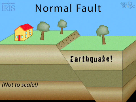
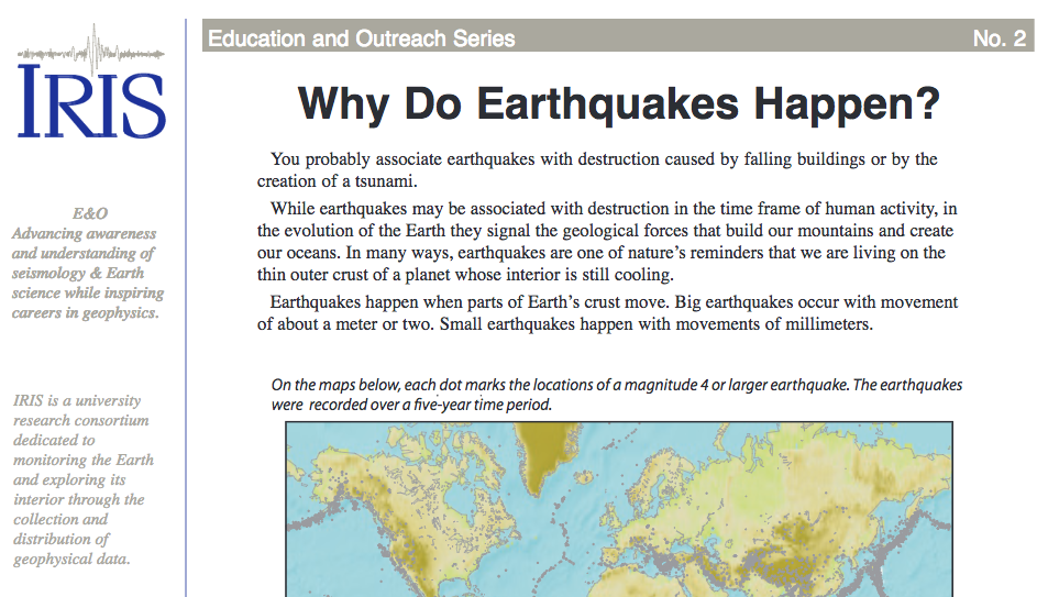
Earth Science Animations (from IRIS) contain text, graphics, animations, and videos to help teach Earth Science fundamentals. Topics include hazards, plate tectonics, Earth structure, earthquakes and volcanoes.
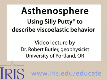
Earthquake Video Lectures (from IRIS) - are short-segment video lectures to give rudimentary background information on the Earth and plate tectonics to teach how earthquakes happen and how they are studied.
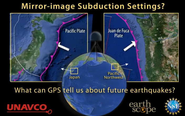
Animations and videos (from UNAVCO) on topics such as GPS & earthquakes, earthquake early warning, measuring glacial ice loss
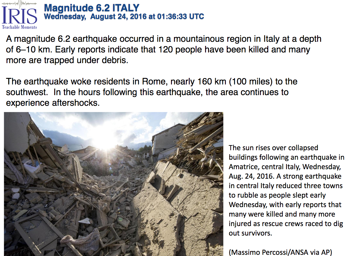
Teachable Moments (from IRIS) – are power point presentations following a newsworthy earthquake to capture that unplanned opportunity to bring knowledge, insight, and critical thinking to the classroom.
Handouts on Earthquakes and Seismology –these one-page handouts are related to seismology for use in the classroom or public information forums and provide additional resources for earthquake lessons.
IRIS Earthquake Browser - is an interactive map service for viewing Earthquake
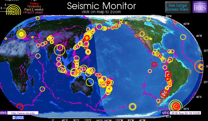
Seismic Monitor from IRIS – This is a real-time monitor of earthquakes around the globe.
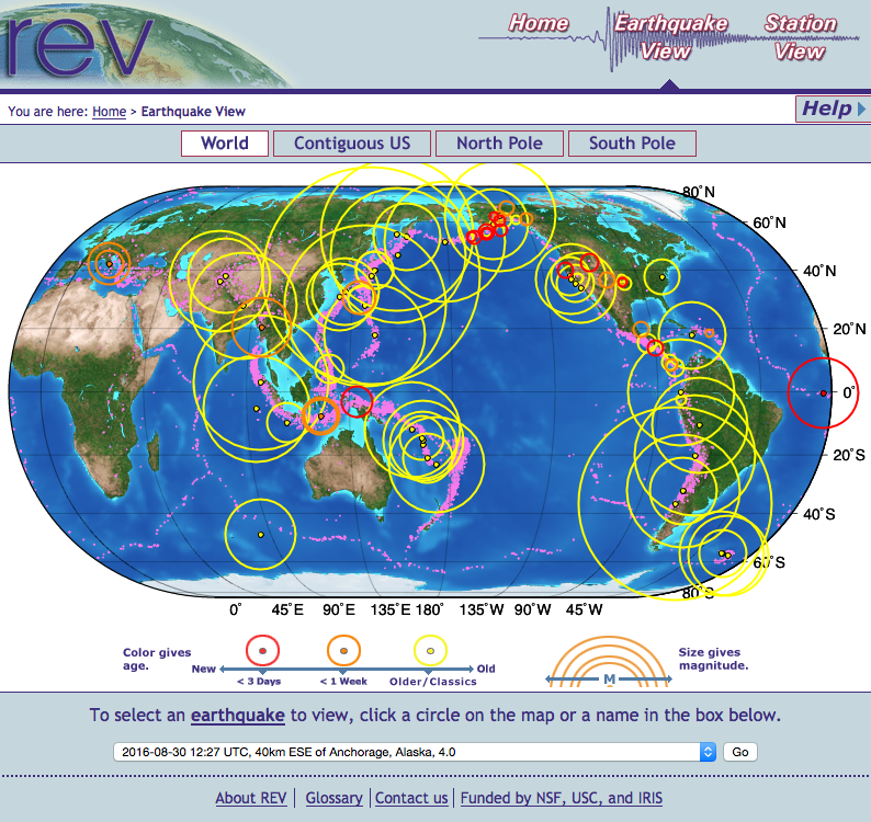
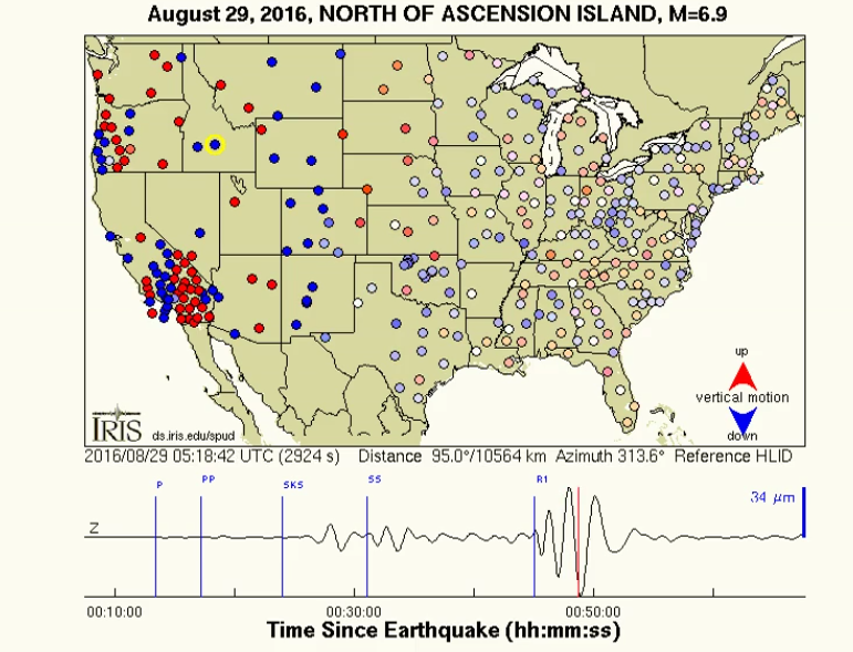
REV (Rapid Earthquake Viewer) – This gives you access to data from seismograph stations around the world. REV provides seismograms from global seismograph stations for every notable earthquake. Find seismograph stations in your area to track earthquakes.
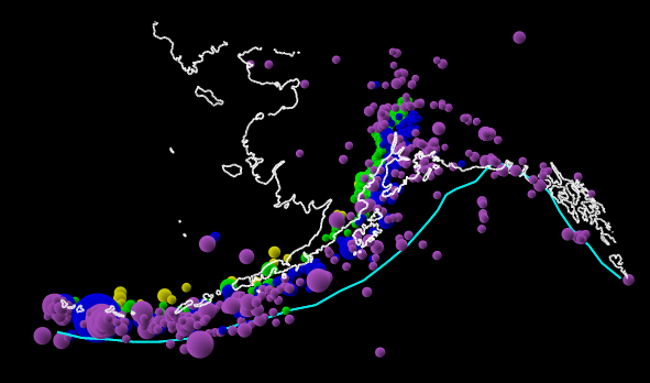
Wave Visualizations - Animated ground movement of seismic waves. The visualizations show how the ground moves as seismic waves sweep across about 400 earthquake recording stations in EarthScope’s Transportable Array
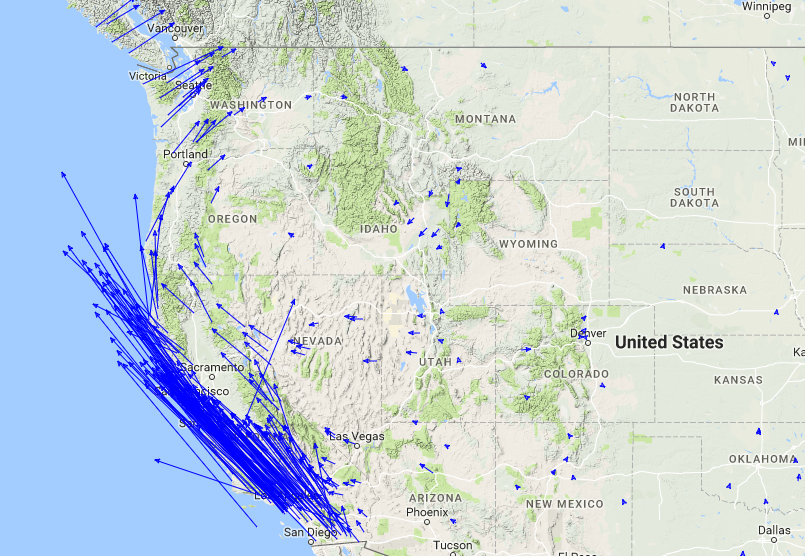
GPS Velocities Map from UNAVCO- This Google-Maps based viewer shows the motions of Earth's crust as GPS geodesy station velocities overlaid on maps of the Earth's tectonic plates, USA active faults, earthquake locations, and volcanoes.
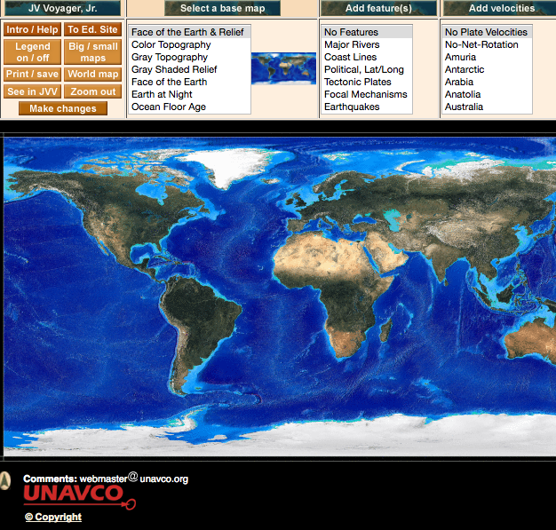
Jules Verne Voyager, Jr. and EarthScope Voyager, Jr. - Jules Verne Voyager, Jr. (world focus) and EarthScope Voyager, Jr. (United States, EarthScope focus) are interactive map tools that enables students and scientists to better understand the relationships between geophysical and geological processes, plate motions as measured with high-precision GPS data., and other geological data.
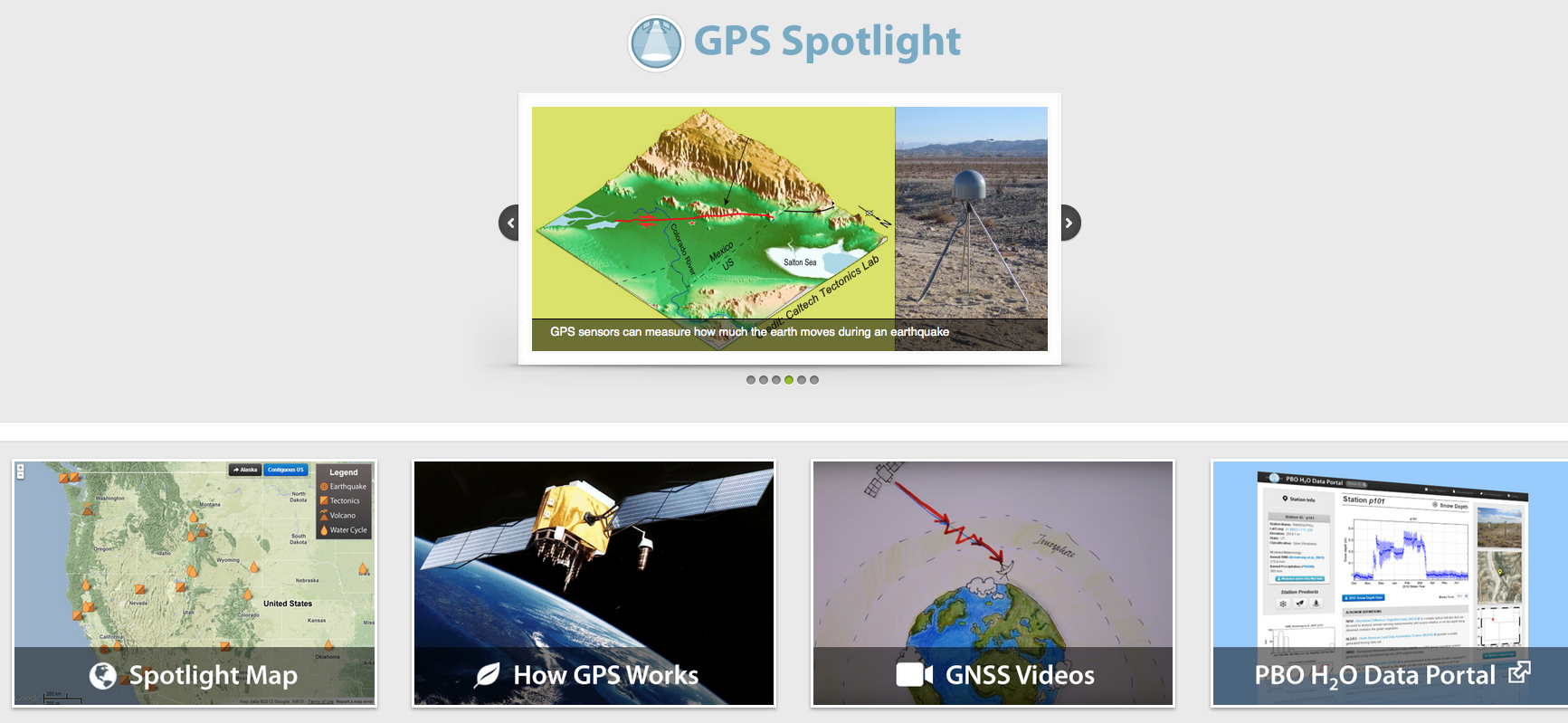
GPS Spotlight - This site provides an overview on how GPS works, focusing on how GPS is used in the geosciences to explain how GPS is used to study faults, earthquakes, volcanoes, the atmosphere, and environmental signals. The Spotlight map provides real-world examples of GPS being used for geoscience research.
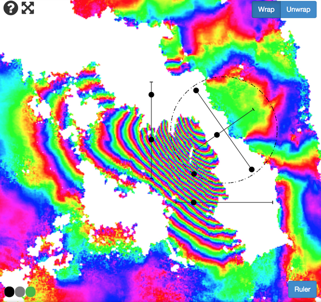
Visible Earthquakes - A learning tool to model earthquakes with InSAR. This tool allows you to model real earthquakes that are measured through InSAR data. The whole process is interactive and the deformation models update in real-time.
About Earthquakes and Plate Tectonics:
Teaching modules and Resources – Lessons and resources from IRIS for standalone and integrated instruction, and other educational activities.
About Geodesy and Plate Tectonics:
Teaching modules and Resources -Lessons and resources from UNAVCO for standalone and integrated instruction, and other educational activities.
Science Lab: Using GPS to Monitor Tectonic Plate Motions This activity designed by Sally McGill at CSUSB teaches students about tectonic plate motions using GPS data. Students will be able to: graph and analyze the position of a survey benchmark over time, interpret the rate and direction of motion of the underlying tectonic plate, determine the magnitude and velocity of the resultant horizontal velocity vector from its north and east components, and analyze the pattern of motion across the San Andreas fault as measured by GPS. Vector Lab
GEodesy Tools for Societal Issues (GETSI) Education Resources shows the teaching resouces being developed for engaging undergraduate students in addressing societally important Earth science questions through the use of geodetic data.
The SERC website (Science Education Resource Center) offers a variety of science resources for teachers, including many EarthScope-related activities and lessons:EarthScope Chronicles; Integrating Geophysics and EarthScope into Structural Geology Courses; Where is that chunk of crust going?; Analyzing Plate motion using EarthScope GPS data, Tomography: How do we know what is below our feet?,
Cascadia EarthScope Earthquake and Tsunami Education Program (CEETEP) This award winning program aims to foster community engagement in earthquake-tsunami science and preparedness and to encourage collaboration and exchange between formal and informal coastal educators.
About Disaster Prevention:
Southern California Earthquake Center (SCEC) provides earthquake public education and preparedness and teacher resources.
Great Shake Out earthquake drills – participate in this earthquake drill held yearly! Everyone, everywhere, should know how to protect themselves in an earthquake. Even if earthquakes are rare where you live, they may happen where you or your family travel.
Smithonian Disaster detector game:Disaster Detector teaches players how to analyze and interpret data on natural hazards to forecast future catastrophic events and how to implement tools to mitigate the effects of those disasters. (grade 6, 7, 8)
IRIS: Incorporated Research Institutions for Seismology
UNAVCO: University-Governed Consortium that Facilitiates Geoscience Research and Education using Geodesy.
NAGT: National Association of Geoscience Teachers
NSTA: National Science Teachers Association
NESTA: National Earth Science Teacher Association
DLESE: Digital Library for Earth System Education
RESESS: Research Experience in Solid Earth Science for Students
GLOBE: Global Learning and Observations to Benefit the Environment
SERC: Science Education Resource Center
SOARS: Significant Opportunities in Atmospheric Research and Science
TOTLE: Teachers on the Leading Edge
SCEC: Southern California Earthquake Center
University of Kansas: Online Learning: Resources for Science Classes


