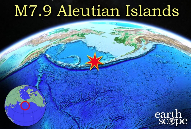
A 7.9 magnitude earthquake in Alaska's Aleutian Islands led the National Tsunami Warning Center to issue a tsunami warning on Monday, June 23, 2014. The Aleutian Islands are between Eastern Russia and the Alaska mainland. The epicenter of the earthquake is reported to be closer to Russia than to Anchorage, approximately 13 miles from Little Sitkin Island, but no reports of major damage have surfaced since the incident. According to the U.S. Geological Survey, the earthquake is the largest to hit the northwest United States in more than 10 years. Residents of some small communities in immediate proximity of the epicenter and tsunami danger zone were evacuated, but the following tsunami was relatively small, and caused no damage to towns or residents. A tsunami of approximately 7 inches was reported 200 miles west at Amchitka Island. Several strong aftershocks rocked the region, ranging from 3.5 to 6.9 in magnitude, followed the 7.9 earthquake, and shaking felt in coastal villages, including Adak, Shemya, and other communities along the Aleutian Island chain.
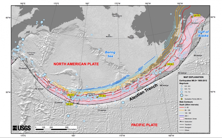
Alaska sits on the Ring of Fire, a region in which violent tectonic activity causes volcanism, crustal deformation and earthquakes along western North and South America, and eastern Asia. This is caused by the subduction of the Pacific Plate beneath the North American Plate.The majority of deaths that occur as a result of earthquakes are actually caused by the post-quake tsunami, or disasters such as structure collapse, fire, and flooding in towns and cities. The 7.9 magnitude quake and resulting tsunami did not pose a threat to Hawaii, west coast states, or Japan, all of which suffered damages during the Aleutian Island earthquake in 1946. The 1946 earthquake caused a tsunami and killed 96 people in Hawaii, leading to the establishment of the Pacific Tsunami Warning Center. Western U.S. was particularly affected in the 1964 9.2 magnitude earthquake near Anchorage, killing over 100 people in the western United States alone. Earthscope's Plate Boundary Observatory (PBO) measures plate motion across North America, particularly in Alaska and the northwest coast. This helps scientists to monitor all activity resulting from the movement of plates, including volcanism, seismic activity, faulting, and other processes. PBO is run by Incorporated Research Institutions for Seismology (IRIS). For more information on this and other seismic and geologic events, visit IRIS Teachable Moments.