
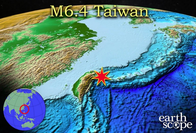
A 6.4 magnitude earthquake occurred April 20, 2015 off the coast of Taiwan near Yonaguni Island, Japan. One person was killed in a house fire caused by the earthquake, but no significant casualties or damages were reported following the main event. A low-level tsunami warning was issued for southern Japan, but no waves were reported. The earthquake was a result of interaction between the Yangtze Subplate (part of the Eurasian Plate), the Okinawa Plate, the Philippine Plate, and the Sunda Plate. Taiwan is a particularly interesting location because it marks a location where the direction of subduction is changing, creating a complex region of volcanic activity and tectonic collision with numerous island arcs and a wide variety of volcanic rocks and systems.
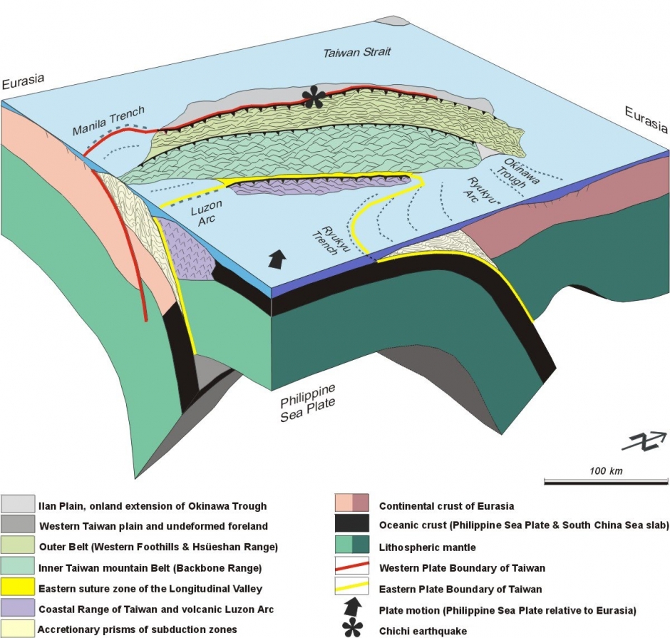
The image above is a cross section of the convergent boundaries that formed the Taiwan Orogeny.
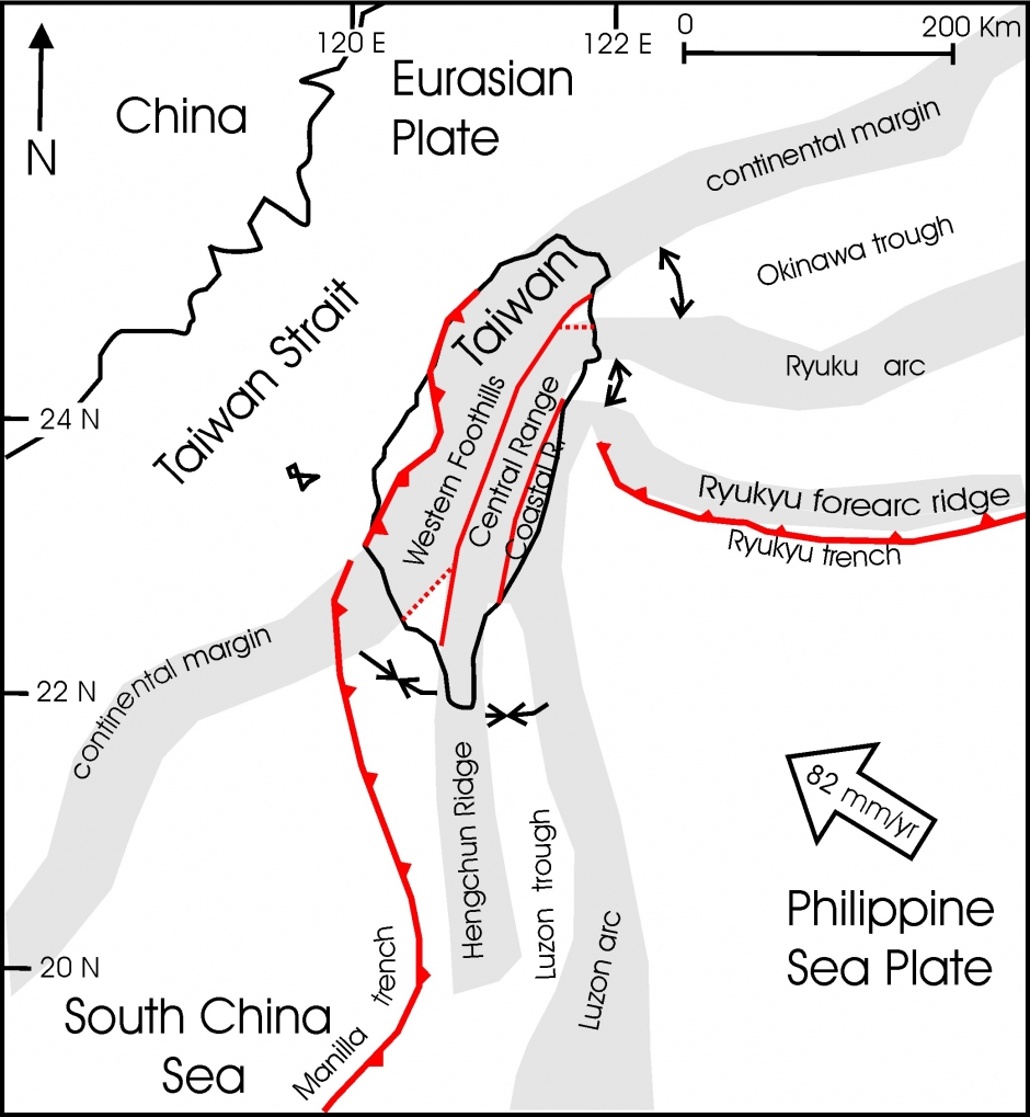
Tectonic activity is very complex near Taiwan and the Taiwan Strait.
The Tsunami Warning System (TWS) is a method used internationally to report and predict the magnitude of tsunamis generated by earthquakes. Numerous sensors have been placed along coastlines and tsunami-prone regions around the world. The sensors pick up any unusual activity that might be associated with an oncoming tsunami and reports the activity back to scientific stations on islands or the mainland where personnel can judge the size of the tsunami and decide whether action needs to be taken to prevent any damages or deaths on coastlines.
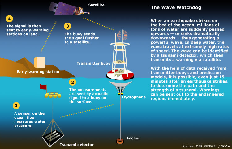
The diagram above (courtesy of the NOAA) shows how the TWS works to alert people on the coast of oncoming earthquakes
The second part of the TWS involved widespread communication to warn governments and residents of the oncoming tsunami and to start evacuating affected areas. The system is not entirely without flaws – the tsunami sensors frequently issue false warnings. One way to better predict tsunamis is by earthquake magnitude. Depending on the location, a large magnitude earthquake can cause a deadly tsunami or none at all, if no vertical displacement of the oceanic plate occurs. Seismic data is incredibly important in detecting tsunami risk, though no system can completely protect against a sudden tsunami risk.
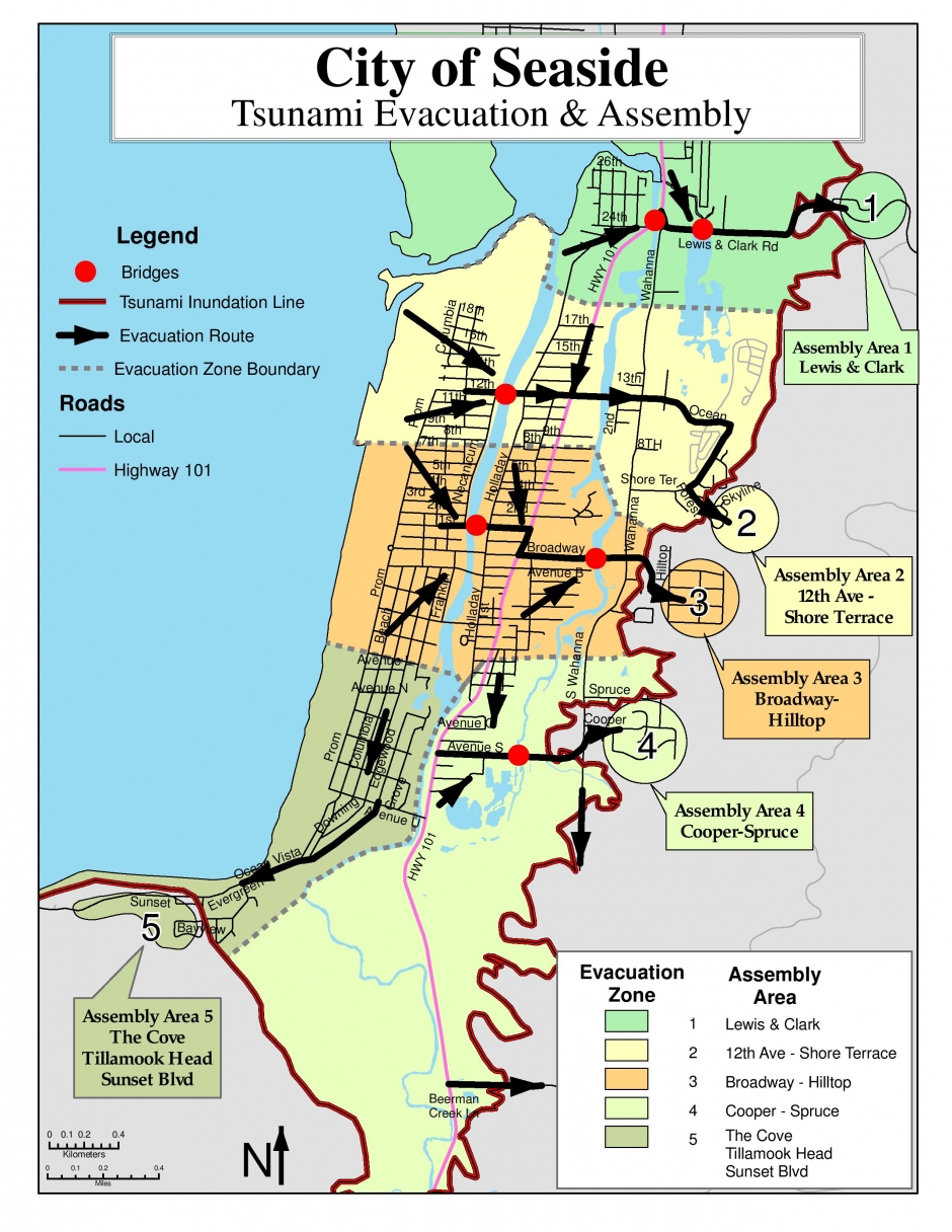
The tsunami evacuation map for Seaside, Oregon.
Warning systems can be effected if implemented immediately after an earthquake. While tsunamis can travel up to 4 kilometers per second in open water, the distance of a coast in the path of the tsunami from the epicenter of the generating earthquake can be a significant factor in predicting damages. For example, if a high magnitude (M9.0+) earthquake were to occur off of the North American Coast near the Cascadia Subduction Zone, it might take up to 12 hours before the resultant tsunami reached the coastline of Japan. This allows for evacuation of the inhabited coastal regions before the tsunami reaches the coast.
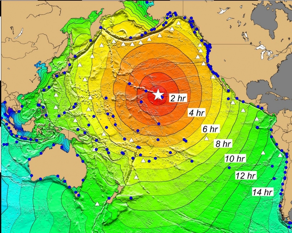
The map above demonstrates the amount of time it takes a tsunami to hit Hawaii from the various subduction zones around the Pacific Ring of Fire.
Convergent plate boundaries are a driving force for orogenic processes, seismic activity, magmatism (volcanic activity) and continental accretion of ocean island arcs. These processes are what build the continents and environments around the world, though they can result in death, destruction, and general mayhem in major human population centers. The 6.4 magnitude Taiwan earthquake demonstrates the results of these powerful processes, and further research by scientists and organizations around the world will shed more light on the driving forces and frequency of these events. EarthScope, UNAVCO, and IRIS help observe and interpret tectonic plate movement and geologic events. EarthScope monitors many plate boundaries with the Plate Boundary Observatory (PBO) system. The movement of the plates, seismic activity, volcanic activity, and other geologic events are observed and analyzed by researchers around the country. The Plate Boundary Observatory is maturing to a decade old, so many of the GPS time series tell compelling stories. Sites in the Pacific Northwest show the signature of subduction including episodic tremor and slip, sites in California shear along the San Andreas fault, sites on Yellowstone and other volcanoes move up and down as magma moves and erupts, and sites throughout the network have captured earthquakes. This information will help scientists to determine and predict the exact causes of seismic activity and volcanic activity, as well as the geology and inner-earth movements that contribute to plate tectonics. (Information courtesy of UNAVCO and EarthScope).

Taipei, Taiwan (above)


