
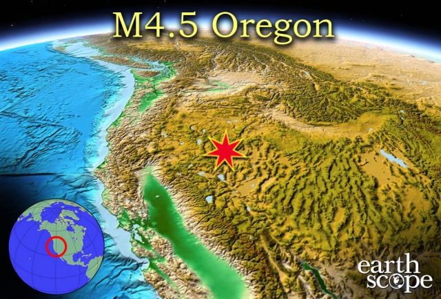
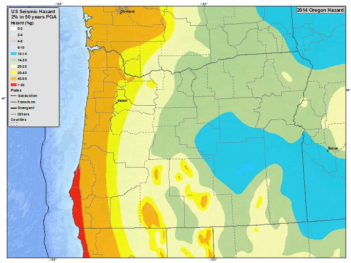
Eight earthquakes were recorded near Oregon’s southern border on January 21-22, 2015. The earthquakes ranged in magnitude from 2.5 to 4.5, and were based in Nevada approximately 50 miles southeast of Lakeview, Oregon. The series of earthquakes were not felt by many, and resulted in no casualties or notable damage in population centers. More than 1700 earthquakes have been reported in this region since early December 2015. Oregon and Nevada are both topographically part of the Cascade Mountain Range, an active tectonic zone that causes a significant amount of volcanism and seismic activity across the western United States. The image below is a seismic hazard map of the Pacific Northwest/Cascade Range, retrieved from U.S. Geological Survey.
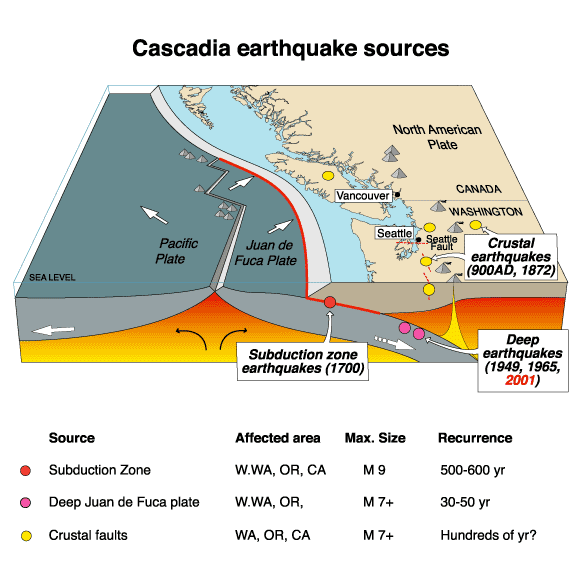
The Cascade Range stretches from southern British Columbia through Washington, Oregon, to northern California. The range is comprised of a number of volcanoes formed due to the subduction along the Cascadia subduction zone. This convergent plate boundary was formed by the subduction of the relatively small Juan de Fuca plate beneath the North American plate, and the volcanoes and seismic activity throughout the Cascade Range makes the region one of the most dangerous in the world. The Cascadia subduction zone has the capability to produce incredibly large earthquakes (called megathrust earthquakes) with a magnitude of 9.0 and greater, and scientists have predicted that the zone will produce a megathrust earthquake within the next 50 years. The images below provide further information on the Cascade Range and the Cascadia Subduction Zone in the Pacific Northwest.
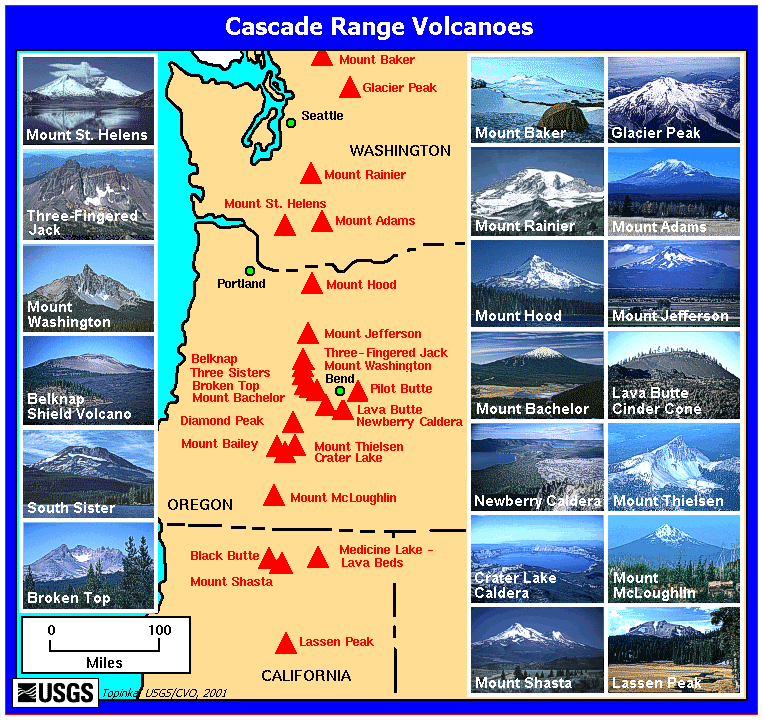
The Cascadia subduction zone is also widely known for the volcanic activity that forms most of the Cascade Range. A series of Quaternary stratavolcanoes were formed over a thick layer of Miocene volcanoes and glacial remains. The Cascade Volcanic Arc is approximately 100 kilometers inland from the main subduction zone trench, and the more famous peaks include Lassen Peak and Mt. Shasta in California, Crater Lake (Mazama volcano), Three Sisters, Mt. Jefferson, and Mt. Hood in Oregon, Mt. Adams, Mt. Saint Helens, Mt. Rainier, Glacial Peak, and Mt. Baker in Washington, and Mt. Garibaldi and Mt. Meager in British Columbia. Mt. Saint Helens erupted catastrophically in 1980, but Mt. Baker, Lassen Peak, and Mt Hood have also erupted relatively recently. The volcanoes are all stratavolcanoes with a high silica content and volatile content. As a result, eruptions are highly explosive, and the magma chambers are composed of andesite, dacite, and rhyolite. The image below depicts the range of volcanoes that are a part of the Cascadia subduction zone volcanic arc.
EarthScope monitors many plate boundaries with the Plate Boundary Observatory (PBO) system. The movement of the plates, seismic activity, volcanic activity, and other geologic events are observed and analyzed by researchers around the country. The Plate Boundary Observatory is maturing to a decade old, so many of the GPS time series tell compelling stories. Sites in the Pacific Northwest show the signature of subduction including episodic tremor and slip, sites in California shear along the San Andreas fault, sites on Yellowstone and other volcanoes move up and down as magma moves and erupts, and sites throughout the network have captured earthquakes. This information will help scientists to determine and predict the exact causes of seismic activity and volcanic activity, as well as the geology and inner-earth movements that contribute to plate tectonics. (Information courtesy of UNAVCO and EarthScope). More images of the Cascade Range and subduction zone can be seen below.
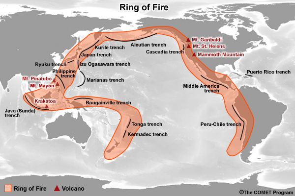
The Cascadia Subduction Zone is on the Ring of Fire.
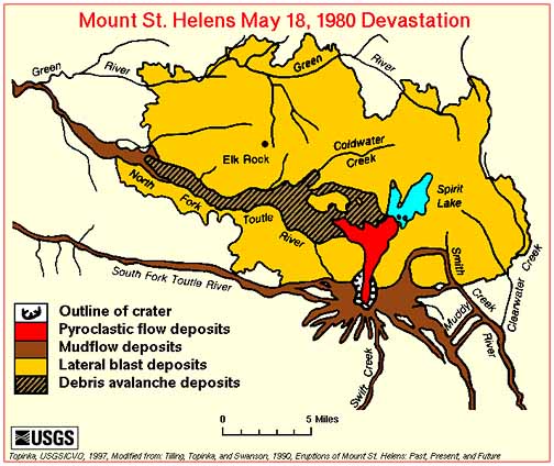
The Mt. Saint Helens eruption of 1980 caused significan damage in the surrounding region.


