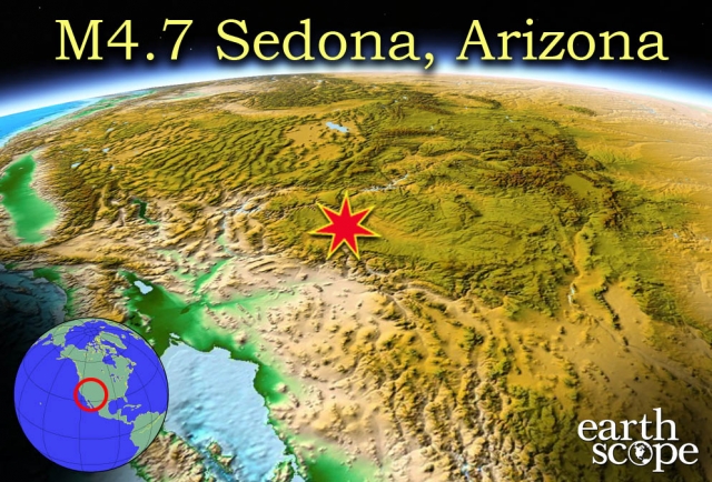
A 4.7 magnitude earthquake was reported 7 miles (12 km) north of Sedona, Arizona on November 30, 2014 at 11:00 PM. Shaking was felt as far as Flagstaff, Arizona, 16 miles (25 km) north of Sedona. No damage or injuries were caused by the quake, but the event is a good reminder that earthquakes can happen unexpectedly at any geologically active location, not just near plate boundaries and hotspots. Dr. Ramon Arrowsmith of Arizona State University was quoted by AZ Central’s The Arizona Republic. ‘”The 4.7 trembler is not the biggest in recent memory, but it’s big enough for people to remember,” said Ramon Arrowsmith, ASU professor at the School of Earth and Space Exploration. “In Arizona, in recent memory, it’s a bigger one.”’ (Retrieved from AZ Central). The photograph below depicts a scenic view of Sedona, Arizona, the location of the quake.

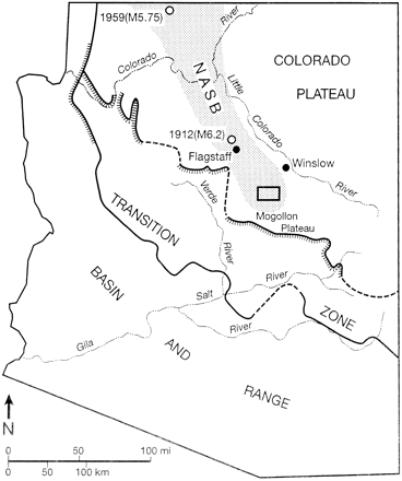
For some, this may bring to memory the 5.2 magnitude earthquake earlier this year (June 29, 2014), on the New Mexico – Arizona border. Dr. Brumbaugh of Northern Arizona University stated that the M4.7 quake “was a large enough earthquake to be felt, but not quite large enough to really get too concerned about.” See the GeoEvents posted in June 2014 for more information on this occurrence and the geology behind it. Check out Dr. Ramon Arrowsmith’s Active Tectonics blog here for more professional insight into the event. Sedona lies in the Transition Zone, a region that is literally the transition zone from the Basin and Range provinces of southern and southwestern Arizona, and the Colorado Plateau, a large uplifted region in the north to northeastern region of the state. A significant amount of geologic activity has occured througout this region, and the Transition Zone is scattered with faults and evidence of geologic deformation. The Colorado Plateau was uplifted relatively recently, so many of the faults in the region are still active today. One or more of these faults may have been the cause, or contributed to the 4.7 magnitude quake in Sedona.
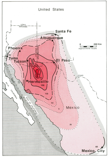
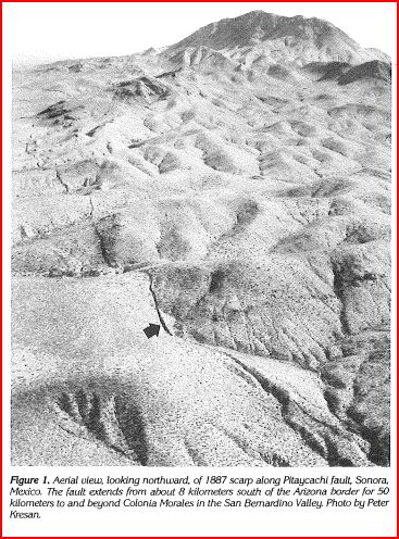
Mountain areas throughout California, Nevada, and Arizona, are prone to earthquakes, though the two latter states are less likely to experience large-scale seismicity than California. According to Rich Briggs of the USGS in Colorado, Arizona does have the potential for large, damage-inducing quakes. Bruce Presgrave, a geophysicist with USGS, stated that many of the more volatile, higher magnitude earthquakes in Arizona (especially the southern regions) have epicenters in Sonora, Mexico. According to accounts of the ~7.4 magnitude Sonora earthquake on May 3, 1887, the towns of Bisbee, Tombstone, and Fort Huachuca were all damaged, and “entire mountainsides in the Santa Catalina Mountains [gave way] and caused clouds of dust visible for days.” The epicenter of this event was near Bavispe, Mexico, ~190 miles southeast of Tucson, Arizona. The bottom left image depicts a projected intensity map of the 1887 Sonora earthquake.
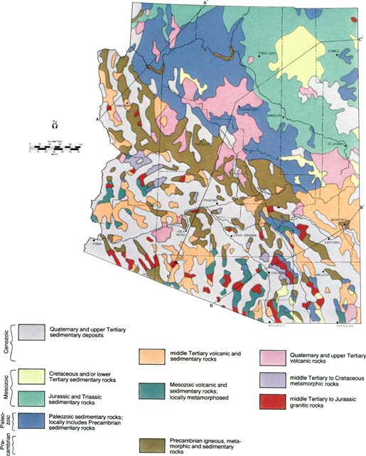
Dr. Arrowsmith commented that one major contribution to Arizona’s susceptibility to earthquakes is the abrupt elevation change from the Basin and Range province in southern Arizona (~1000 ft), to the Transition Zone (~3000 – 5000 ft) to the Colorado Plateau (~7000 ft). Significant faulting throughout the region contribute to the seismic activity in the region in some cases, but also decrease the likelihood that a large-magnitude quake will travel far across the state (in other words, the faults disrupt the wave path). The seismic activity across the western USA is a result of the tectonic plate interaction and faulting in the lithosphere of the North American tectonic plate, resulting in the slow deformation of the west coast. In this case, the stress put on the crust is extensional, caused by the subduction zone between the North American plate and the Pacific Plate. This means that Arizona and California are slowly stretching away from central America, in a westward direction, and are elongated in the process (California is deformed much faster than Arizona). EarthScope measures present-day deformation of North America with Plate Boundary Observatories (PBOs), a complex network of seimometers, gravitational sensors, translational arrays, and GPS systems. The 4.7 magnitude earthquake in Sedona was monitored by a Plate Boundary Observatory to the north, and though no major damage resulted from the event, the observation and data from such a rare event will help scientists understand the complex deformation of the regional geology, particulary in the southwestern United States. The image below (retrieved from Arizona Geological Survey) depicts some of the complex geology found in Arizona.