
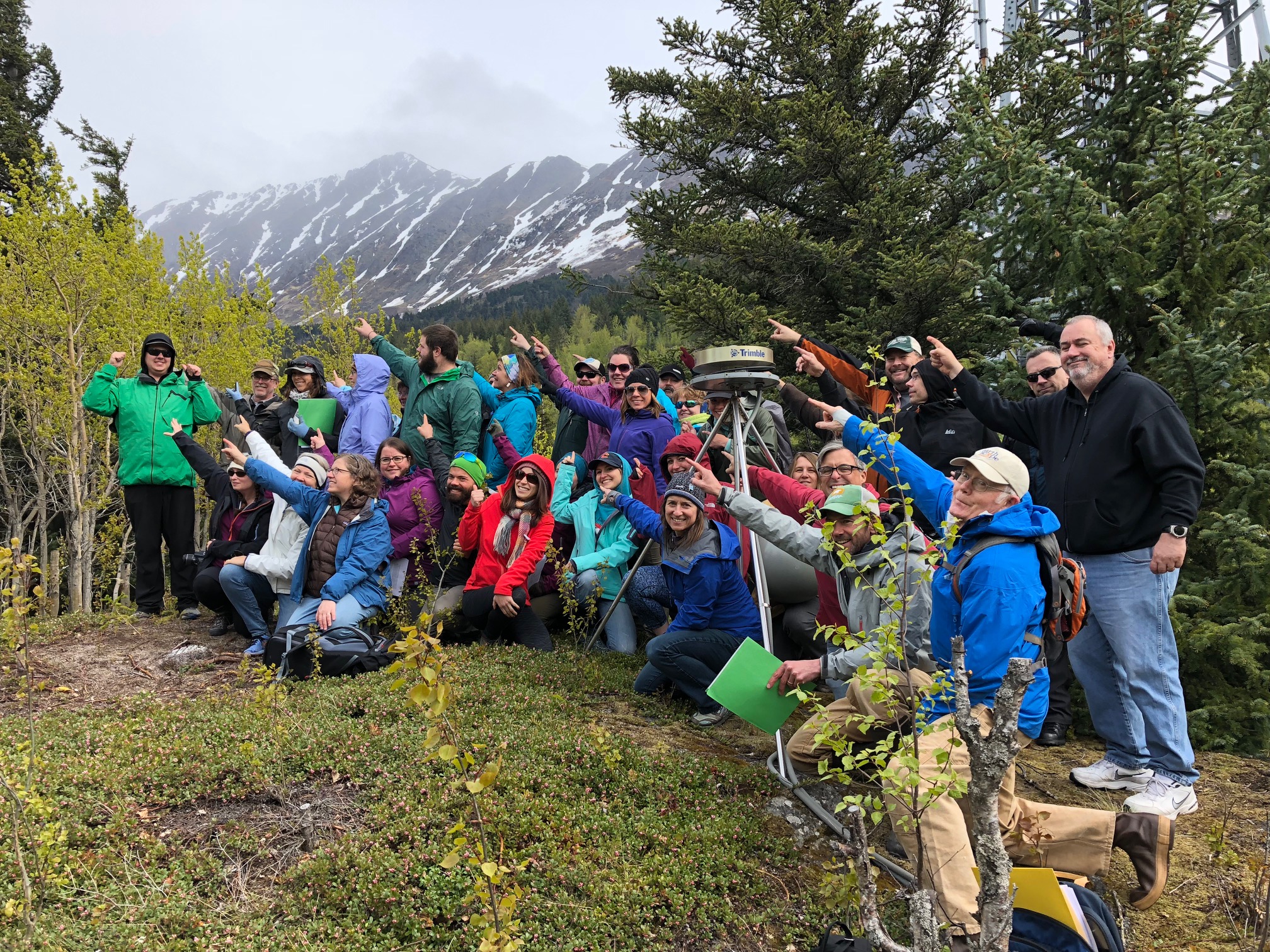
ANGLE workshop participants show the direction of plate movement during a visit to Plate Boundary Observatory GPS Station AC20 at Bird Point State Wayside. Photo by Beth Pratt-Sitaula.
Hands-on Training for Alaska Educators
Alaska is one of the most geologically active places on the continent, making it a fantastic geosciences natural laboratory. That also means hazards. Thousands of Alaskans live in places that can experience earthquakes, tsunamis, and volcanic eruptions. Late last May, 32 educators from Anchorage, Seward, Homer, Nikiski, and Soldotna attended the 2018 EarthScope Alaska Native Geoscience Learning Experience (ANGLE) Educator Workshop in Anchorage. The workshop helped educators discover more about Alaska geology and geohazards through hands-on activities and a field trip, and also focused on new ways to help learners improve disaster preparedness in their communities. Participants included K–12 teachers, natural history interpreters, environmental educators, and emergency-management educators.
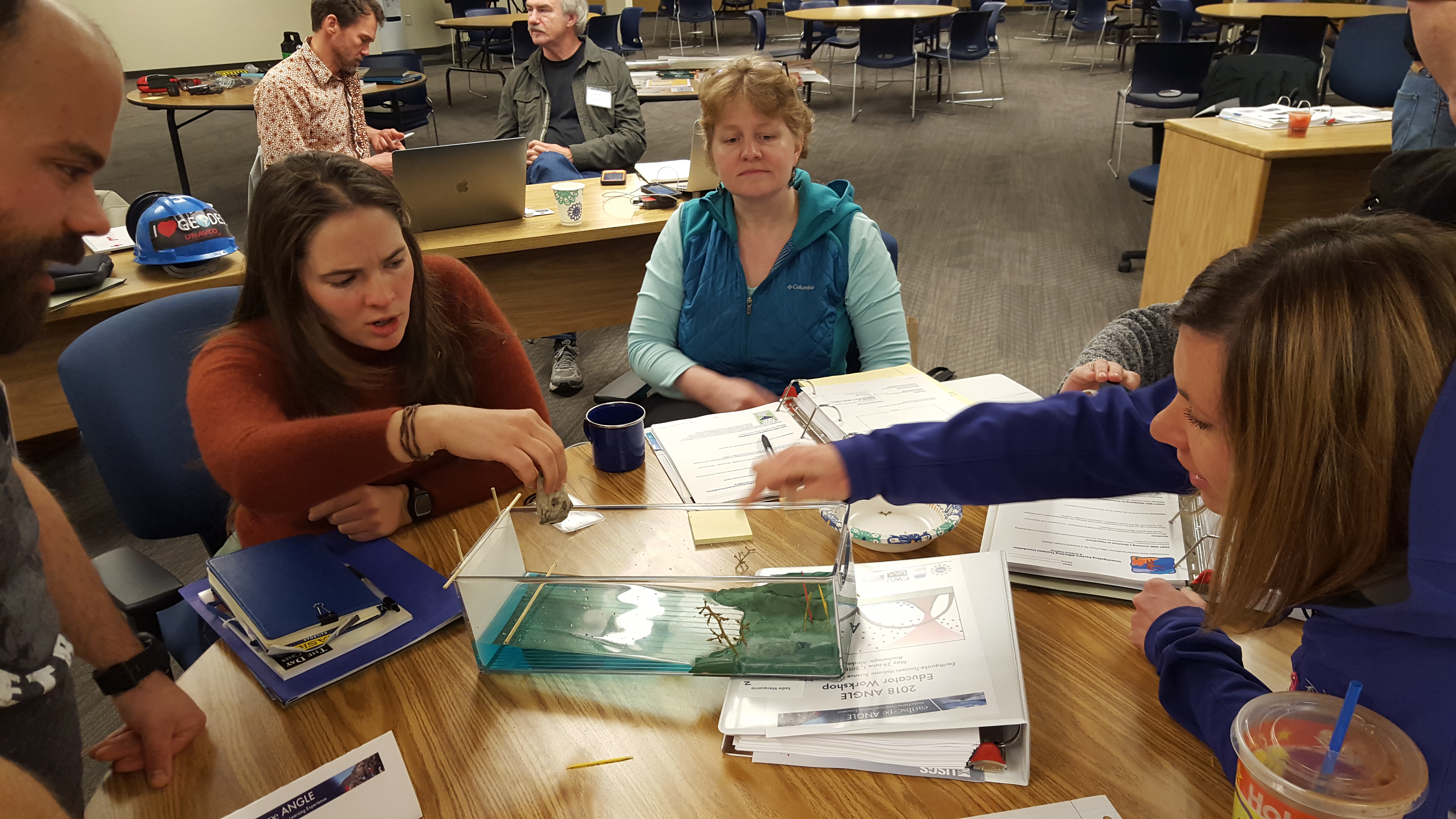
Participants experiment with a model tsunami activity. Photo by Maite Agopian.
Through an EarthScope grant, ANGLE offers educators professional development workshops, and helps teach geoscience for the University of Alaska Anchorage Alaska Native Science and Engineering Program’s (ANSEP) Middle School Academies. Three collaborating institutions participate in this NSF grant: Alaska Pacific University (APU), University of Alaska Anchorage (UAA), and Central Washington University.
“The overarching goal of EarthScope ANGLE is to help Alaskan communities be more resilient to geologic hazards through education and the development of an action-oriented statewide learning community. The most at risk are small, rural, coastal communities,” said Jennifer Witter, Science Curriculum Coordinator for the Anchorage School District, Affiliate Faculty at APU, and Project Director of EarthScope ANGLE. “The science curriculum in our K–12 schools should be authentic, and place-based. We need to look at what’s happening in our communities, and the challenges they face, as a training ground for the youth that will be tasked with overcoming these challenges.”
The second day of the workshop featured a field trip to sites in the Alaskan communities of Anchorage, Girdwood, and Whittier. The focus of the trip was to understand the science and societal impacts of the 1964 Alaska magnitude 9.2 earthquake, as well as ongoing EarthScope research on geohazards to help better plan for future events. Participants also practiced a tsunami evacuation walk as a way to foster discussion of preparedness actions and challenges.
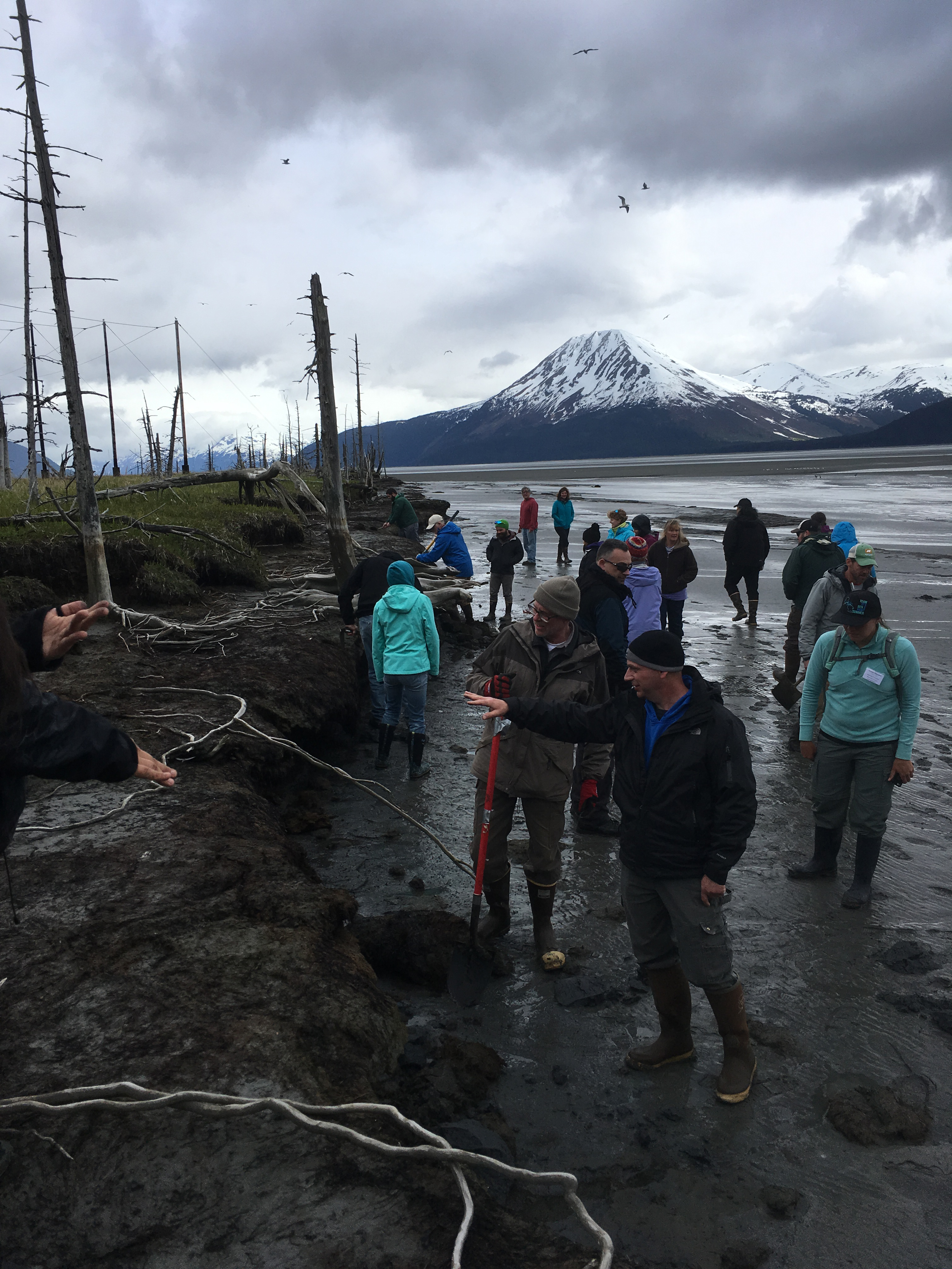
Photo on left: On the field trip, ANGLE participants see evidence near Girdwood of the 1964 magnitude 9.2 Alaska earthquake. The area subsided by approximately 1.5 meters, dropping this once-forested area below the tideline. Salt water killed the trees, many of which remain standing today in the “Girdwood Ghost Forest." Photo by Jennifer Witter.
“ANGLE is offering educators the opportunity to learn about teaching the Alaska version of plate tectonic, tsunami, and volcano science and community preparedness,” said Beth Pratt-Sitaula, one of the workshop coordinators and instructors. Pratt-Sitaula is a Research Associate at Central Washington University. She was Co-director of the EarthScope-funded projects Teachers on the Leading Edge (TOTLE) and Cascadia EarthScope Earthquake and Tsunami Education Program (CEETEP). Pratt-Sitaula spent five summers in Alaska as a natural history guide.
Participants received an educator kit containing high-quality physical and digital resources to support teaching activities in their classrooms or other learning venues. They tested out some of the activities at the workshop, such as these human-chain demonstrations of how P wave and S wave seismic waves travel. Participants will present their progress on action plans at a follow-up Share-a-thon on February 2, 2019.
A series of ANGLE educator and student workshops over the next three years focuses on Alaska communities in the most tectonically active coastal regions, from the Aleutian Islands to Southeast Alaska. Educators have the option of receiving two UAA credits for the workshop. This first educator workshop was primarily for educators from Anchorage, Kenai Peninsula, and Kodiak. In the next few years, the EarthScope ANGLE project will broaden out to include participants of other coastal areas of Alaska and possibly interested educators anywhere in the state.
Some of the educators from the summer workshops will go on to co-teach ANSEP middle school student academies with ANGLE director Jennifer Witter. Over the next three years, ANGLE will help reach out about geohazards and geoscience careers at ANSEP academies. During that time, the curriculum will be fully integrated into the ANSEP program, to be potentially used for years to come. Participants in the educator workshops and ANSEP student academies will have the opportunity to join the international Quake Catcher Network (QCN) and have a seismometer installed at their educational or public institution, or even their own house. (QCN has thousands of members around the world collecting earthquake data.) Educators will also receive advice from ANGLE instructors regarding classroom activities, as well as interpretive programming, exhibits, and signage development.
RESOURCES
2018 EarthScope ANGLE Workshop Information
2018 EarthScope ANGLE Educator Workshop Agenda (includes presentations and activity guides)


